Hazleton / Hasedene / Haselton / Hasleton / Hazledon
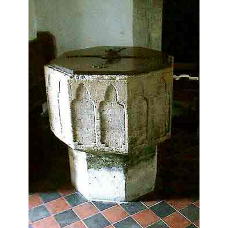
Image copyright © John Wilkes, 2007
Standing permission
Results: 5 records
view of font and cover
Copyright Statement: Image copyright © John Wilkes, 2007
Image Source: digital photograph by John Wilkes [www.allthecotswolds.com]
Copyright Instructions: Standing permission
view of font and cover
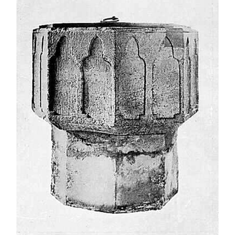
Copyright Statement: Image copyright © [in the public domain]
Image Source: digital image of an illustration in Daubeny (1921)
Copyright Instructions: PD
design element - architectural - arcade - blind - trefoiled arches - 16 arches
Scene Description: two per side of the octagonal basin
Copyright Statement: Image copyright © John Wilkes, 2007
Image Source: digital photograph by John Wilkes [www.allthecotswolds.com]
Copyright Instructions: Standing permission
view of church exterior - northwest view
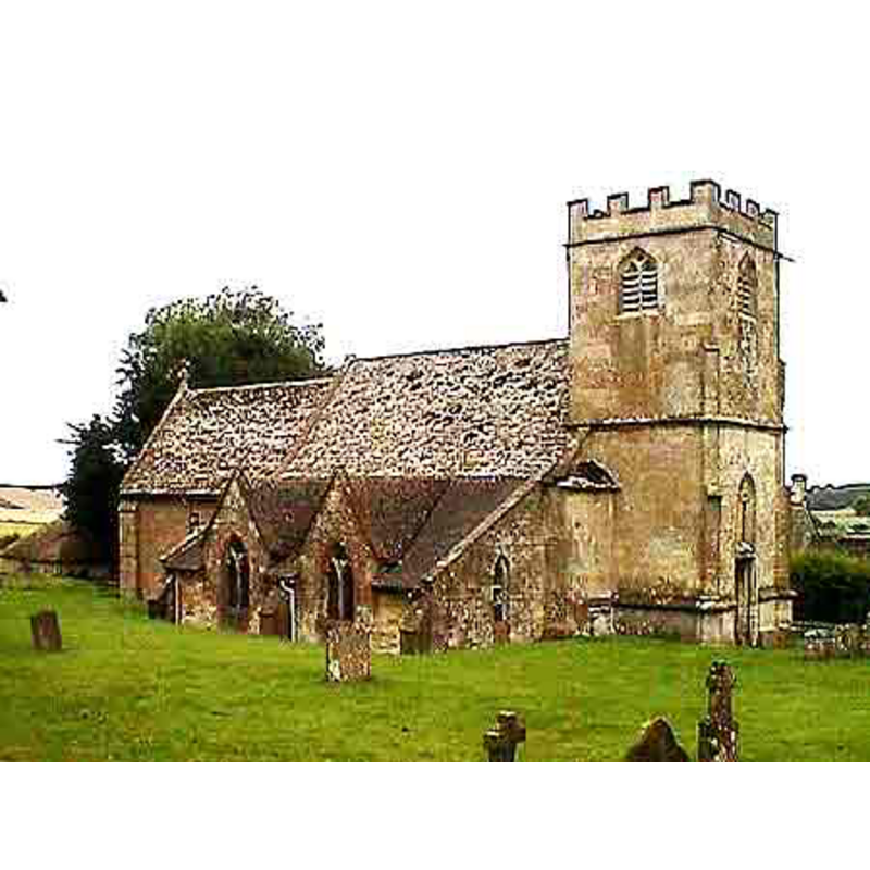
Copyright Statement: Image copyright © John Wilkes, 2007
Image Source: digital photograph by John Wilkes [www.allthecotswolds.com]
Copyright Instructions: Standing permission
view of church interior - looking east
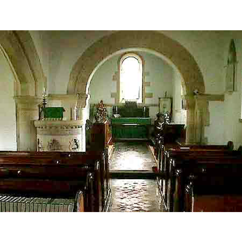
Copyright Statement: Image copyright © John Wilkes, 2007
Image Source: digital photograph by John Wilkes [www.allthecotswolds.com]
Copyright Instructions: Standing permission
INFORMATION
Font ID: 10227HAZ
Object Type: Baptismal Font1
Font Century and Period/Style: 13th century, Early English
Church / Chapel Name: Parish Church of St. Andrew
Font Location in Church: Inside the church
Church Patron Saint(s): St. Andrew
Church Address: Hazleton, Gloucestershire GL54 4DZ
Site Location: Gloucestershire, South West, England, United Kingdom
Directions to Site: Located off (N) the A40, 5 km NW of Northleach, 15 km ESE of Cheltenham, 19 N of Cirencester
Ecclesiastic Region: Diocese of Gloucester
Historical Region: Hundred of Bradley
Additional Comments: disappeared font? (the one from the original Domesday-time church here)
Font Notes:
Click to view
There is an entry for Hazleton [variant spelling] in the Domesday survey [https://opendomesday.org/place/SP0718/hazleton/] [acccessed 7 February 2019]; it mentions a preiest in it, but not a church, though there probably was one there. A font here is illustrated in Daubeny (1921). Noted in Verey & Brooks (1999-2002): "Font. Good octagonal C13 bowl, each face with paired trefoil-headed panels." The entry for this parish in the Victoria County History (Gloucester, vol. 9, 2001) notes: "Hazleton had a priest in 1086 [...] and the fabric of the parish church dates from the 12th century. [...] Among the older fittings retained is a large 13th-century octagonal font with blind arcading." Baptismal font of the Early English period; the octagonal basin has vertical sides, each ornamented with a pair of low-relief trefoil windows or arches; a repair shows on the upper rim, a place consistent with the damage caused by the forceful removal of the metal staples of the old font cover; narrow chamfered underbowl; plain pedestal base, octagonal. Flat wooden cover with ring handle, modern.
Credit and Acknowledgements: We are grateful to John Wilkes, of www.allthecotswolds.com, for his photographs of church and font.
COORDINATES
UTM: 30U 576663 5746312
Latitude & Longitude (Decimal): 51.862328, -1.886685
Latitude & Longitude (DMS): 51° 51′ 44.38″ N, 1° 53′ 12.07″ W
MEDIUM AND MEASUREMENTS
Material: stone
Number of Pieces: two?
Font Shape: octagonal, mounted
Basin Interior Shape: round
Basin Exterior Shape: octagonal
LID INFORMATION
Date: modern
Material: wood
Apparatus: no
Notes: [cf. FontNotes]
REFERENCES
- Victoria County History [online], University of London, 1993-. URL: https://www.british-history.ac.uk.
- Daubeny, Ulric, Ancient Cotswold Churches, Cheltenham: J. Burrow, 1921
- Verey, David, Gloucestershire, London: Penguin Books, 1999-2002, vol. 1: 412