Blackland
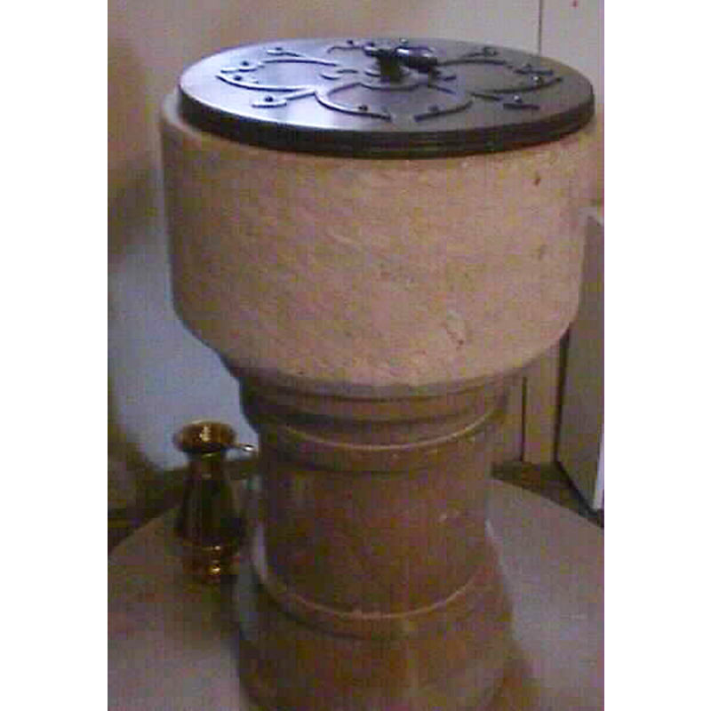
Image copyright © John Wilkes, 2004
Standing permission
Results: 2 records
view of font and cover
Copyright Statement: Image copyright © John Wilkes, 2004
Image Source: John Wilkes [www.allthecotswolds.com]
Copyright Instructions: Standing permission
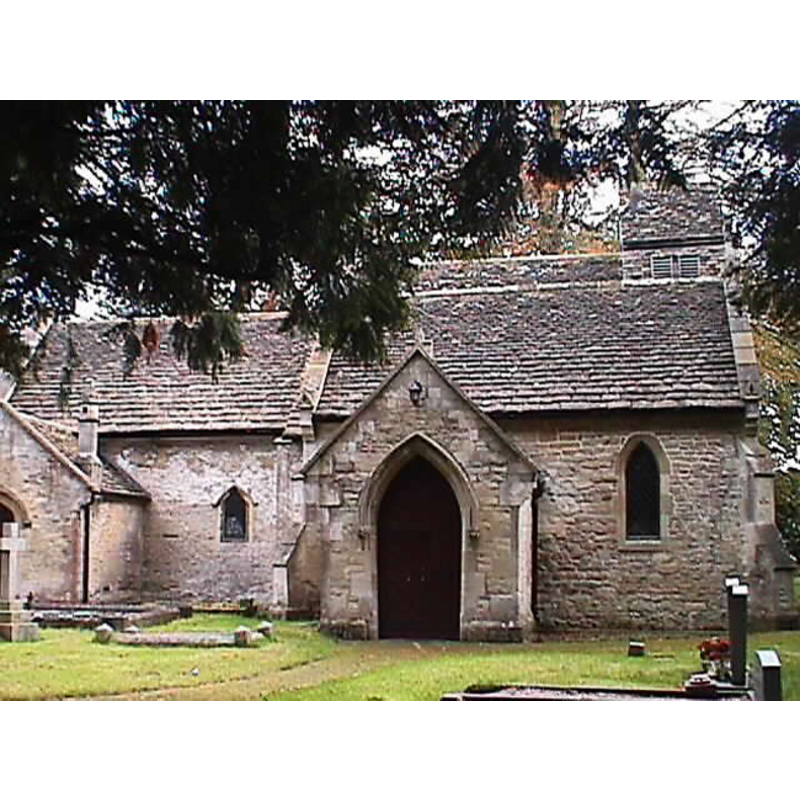
view of church exterior - north portal
Copyright Statement: Image copyright © John Wilkes, 2004
Image Source: John Wilkes [www.allthecotswolds.com]
Copyright Instructions: Standing permission
INFORMATION
Font ID: 10205BLA
Object Type: Baptismal Font1
Font Century and Period/Style: 13th century [basin only] [composite font], Medieval [composite]
Church / Chapel Name: Parish Church of St. Peter [formerly St. Nicholas']
Font Location in Church: Inside the church, W side, just inside the N entrance
Church Patron Saint(s): St. Peter [formerly dedicated to St. Nicholas]
Church Notes: "church of ST. PETER, so called in 1851 (fn. 52) and formerly St. Nicholas'" [cf. VCH entry in bib.]
Church Address: [cf. directions to site]
Site Location: Wiltshire, South West, England, United Kingdom
Directions to Site: Located 2 km SSE of Calne (left turn off the A4 at Quemerford, just after, when entering Calne, the turning to Devizes, Calne, Wiltshire, SN11 8UX)
Ecclesiastic Region: Diocese of Salisbuy
Historical Region: Hundred of Calne
Font Notes:
Click to view
The Victoria County History (Wiltshire, vol. 17, 2002) notes: "Blackland church was standing in the late 12th century. It was probably built as a chapel dependent on Calne church, it was called a chapel in 1194 [...] and until 1316 [...] or later[...] It was probably built in the 12th century, the likely date of the west end of the chancel, and there is a chipcarved panel, possibly part of a 12th-century tympanum, built into the inner face of the west gable wall of the nave. [...] Registers of baptisms survive from 1761"; there is no mention of a font in the VCH entry for this parish." The present baptismal font consists of a plain cylindrical basin with a narrow chamfer at the underbowl, raised on a moulded round pedestal base, of a later date, perhaps 19th-century; difficult to suggest a date for such a plain bowl, but it could be 13th-century, the date of the church itself. Wooden lid with metal handle, modern.
Credit and Acknowledgements: We are grateful to John Wilkes, of www.allthecotswolds.com, for the photograph of font and church.
COORDINATES
UTM: 30U 570641 5697463
Latitude & Longitude (Decimal): 51.423969, -1.983987
Latitude & Longitude (DMS): 51° 25′ 26.29″ N, 1° 59′ 2.35″ W
MEDIUM AND MEASUREMENTS
Material: stone
Number of Pieces: two?
Font Shape: cylindrical, mounted
Basin Interior Shape: round
Basin Exterior Shape: round
LID INFORMATION
Date: modern
Material: wood
Apparatus: no
REFERENCES
- Victoria County History [online], University of London, 1993-. URL: https://www.british-history.ac.uk.