Great Coxwell / Cocheswelle / Cokeswell / Cokeswylle / Cokyswell / Coxwell / Great Cokewell
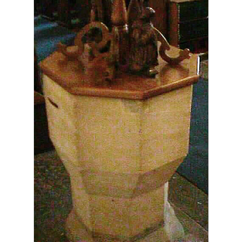
Image copyright © John Wilkes, 2004
Standing permission
Results: 4 records
view of font and cover
Copyright Statement: Image copyright © John Wilkes, 2004
Image Source: John Wilkes [www.allthecotswolds.com]
Copyright Instructions: Standing permission
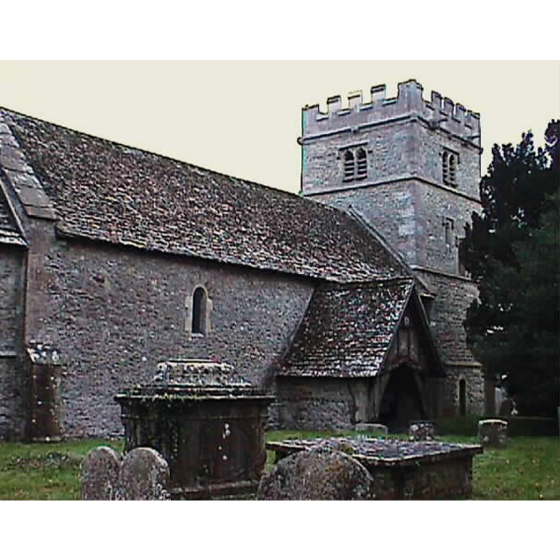
view of church exterior - north portal
Copyright Statement: Image copyright © John Wilkes, 2004
Image Source: John Wilkes [www.allthecotswolds.com]
Copyright Instructions: Standing permission
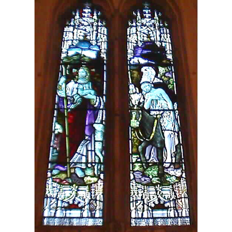
view of church interior - window
Copyright Statement: Image copyright © John Wilkes, 2004
Image Source: John Wilkes [www.allthecotswolds.com]
Copyright Instructions: Standing permission
view of church interior - ceiling
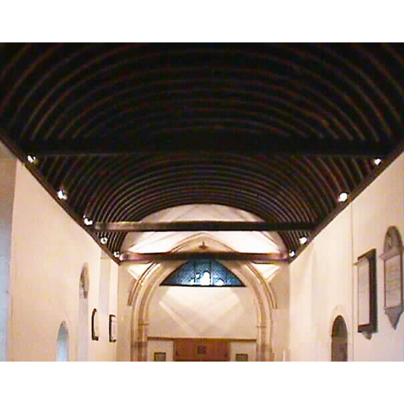
Scene Description: Looking east
Copyright Statement: Image copyright © John Wilkes, 2004
Image Source: John Wilkes [www.allthecotswolds.com]
Copyright Instructions: Standing permission
INFORMATION
Font ID: 10200COX
Object Type: Baptismal Font1
Font Century and Period/Style: 13th - 15th century, Medieval
Church / Chapel Name: Parish Church of St. Giles
Font Location in Church: Inside the church, E end of the nave
Church Patron Saint(s): St. Giles [aka Aegidus, Egidus, Gilles]
Church Address: The Hollow Road, Great Coxwell, Oxfordshire, SN7 7NG
Site Location: Oxfordshire, South East, England, United Kingdom
Directions to Site: Located off the A420, 3 km SW of Faringdon, 15-20 km NE of Swindon
Ecclesiastic Region: Diocese of Oxford
Historical Region: Hundred of Wyfold [in Domesday] -- formerly in Berkshire -- Hundred of Faringdon
Additional Comments: disappeared font? (the one from the Domesday-time church here)
Font Notes:
Click to view
There is an entry for [Great] Coxwell [variant spelling] in the Domesday survey [http://opendomesday.org/place/SU2693/great-coxwell/] [accessed 8 June 2015]; it mentions a church, and half-a-hide in church lands in it. The Victoria County History (Berkshire, vol. 4, 1924): "The church at Great Coxwell in 1086 was endowed with half a hide of land [...] In 1204, however, it is described as a chapel [...] The nave was apparently built about 1200, and the north wall of the chancel is perhaps of about the same date. [...] The ancient octagonal font is plain and of doubtful date". Baptismal font probably of the medieval period consisting of a basin with tall chamfered underbowl, pedestal base and lower base, all octagonal and plain. Octagonal wooden font cover of the rib-around-a-pivot design, with a kneeling figure between to the ribs; appears modern. [NB: we have no information on the font from the 11th-century church here].
Credit and Acknowledgements: We are grateful to John Wilkes, of www.allthecotswolds.com, for the photograph of font and church.
COORDINATES
UTM: 30U 596062 5721794
Latitude & Longitude (Decimal): 51.638943, -1.611821
Latitude & Longitude (DMS): 51° 38′ 20.2″ N, 1° 36′ 42.56″ W
MEDIUM AND MEASUREMENTS
Material: stone
Font Shape: octagonal, mounted
Basin Interior Shape: round
Basin Exterior Shape: octagonal
LID INFORMATION
Date: modern?
Material: wood
Apparatus: no
REFERENCES
- Victoria County History [online], University of London, 1993-. URL: https://www.british-history.ac.uk.