Wolford / Great Wolford / Ulwarda / Ulware / Uolwarde / Uolwarde] / Wolford Magna / Worwarde
![Main image for Wolford / Great Wolford / Ulwarda / Ulware / Uolwarde / Uolwarde] / Wolford Magna / Worwarde](/static-50478a99ec6f36a15d6234548c59f63da52304e5/compressed/0041014019_compressed.png)
Image copyright © John Wilkes, 2004
Standing permission
Results: 3 records
view of font and cover
Scene Description: the modern font and cover
Copyright Statement: Image copyright © John Wilkes, 2004
Image Source: John Wilkes [www.allthecotswolds.com]
Copyright Instructions: Standing permission
view of church exterior - south view
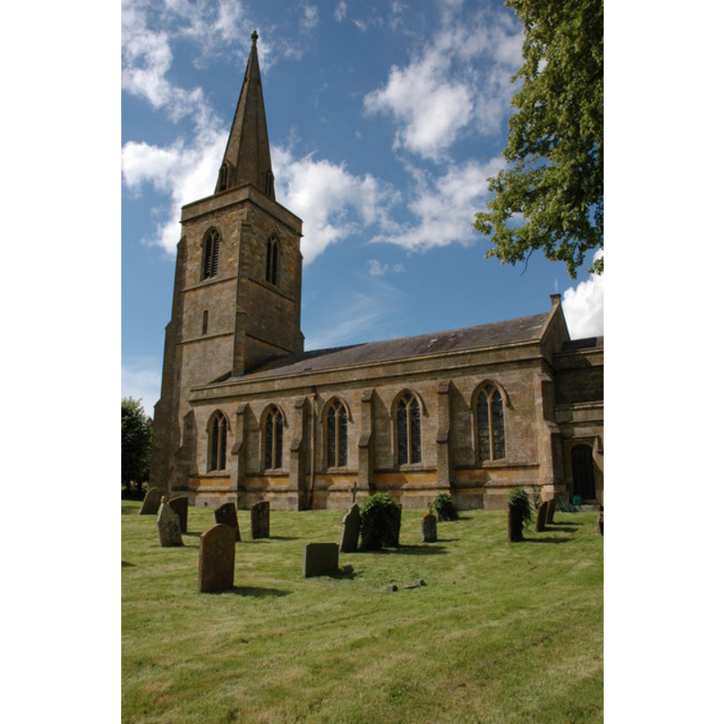
Copyright Statement: Image copyright © Philip Halling, 2007
Image Source: digital photograph taken 28 July 2007 by Philip Halling [www.geograph.org.uk/photo/512007] [acccessed 19 January 2015]
Copyright Instructions: CC-BY-SA-2.0
view of church exterior in context
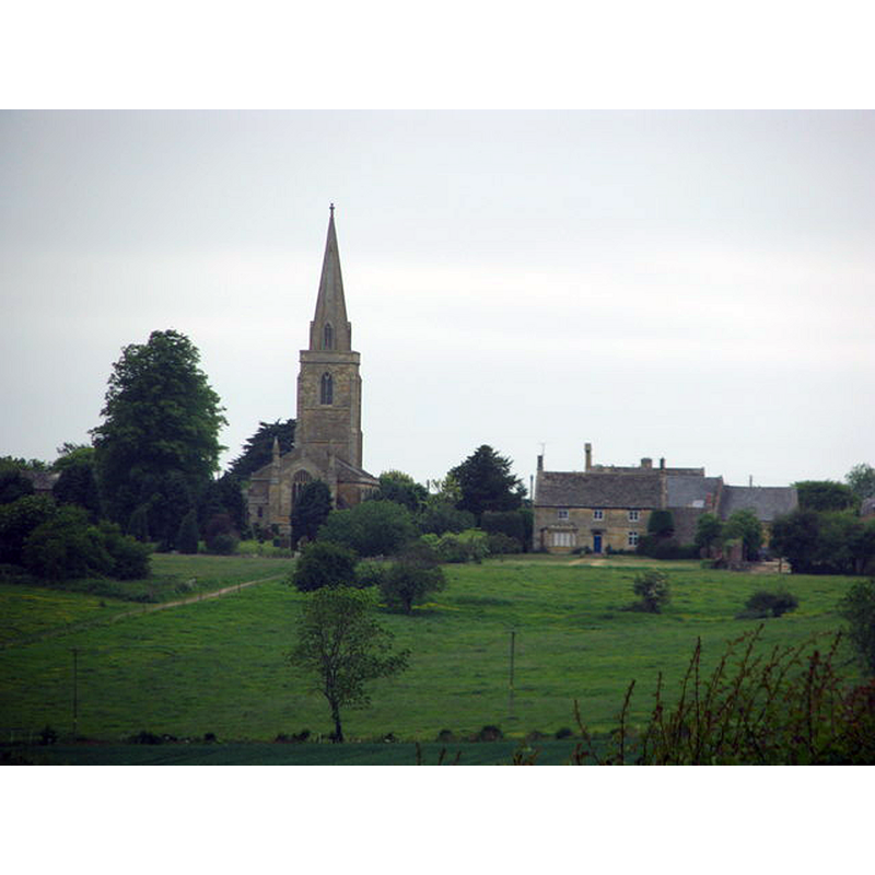
Copyright Statement: Image copyright © Sarah Charlesworth, 2011
Image Source: digital photograph taken 13 May 2011 by Sarah Charlesworth [www.geograph.org.uk/photo/2451489] [accessed 19 January 2015]
Copyright Instructions: CC-BY-SA-2.0
INFORMATION
Font ID: 10196WOL
Object Type: Baptismal Font1?
Font Century and Period/Style: 11th century, Pre-Conquest? / Norman
Church / Chapel Name: Parish Church of St. Michael and All Angels
Church Patron Saint(s): St. Michael & All Angels
Church Address: The Green, Great Wolford, Warwickshire CV36 5NQ
Site Location: Warwickshire, West Midlands, England, United Kingdom
Directions to Site: Located on the A3400, near Burmington, about 20 km W of Banbury
Ecclesiastic Region: Diocese of Coventry
Historical Region: Hundred of Barcheston [in Domesday] -- Hundred of Kington
Additional Comments: disappeared font? (the one from the Domesday-time church here)
Font Notes:
Click to view
There are five entries for Wolford and [Little] Wolford [variant spelling] in the Domesday survey [http://domesdaymap.co.uk/place/XX0000/wolford-and-little-wolford/] [accessed 19 January 2015], one of which, the part in the lordship of Robert of Stafford, mentions a priest, but not a church in it, though there probably was one there. The Victoria County History (Warwick, vol. 5, 1949) notes: "The church of Wolford was given to Kenilworth Priory by Maud widow of Nicholas de Stafford with the consent of her son Robert de Stafford, and was among the properties confirmed to the priory by Henry II in 1177. [...] The church was entirely rebuilt in 1833 and restored in 1885. Not a vestige of ancient architecture has been preserved. The spire had to be repaired in 1910 after being struck by lightning. [...] All the furniture is modern". English Heritage [Listing NGR: SP2502734586] (1987) reports a "C19 polygonal stone font with carved panels", in this completely re-built church. The present modern font is of Perpendicular design; it consists of an octagonal basin with a chamfered upper rim above the vertical sides decorated with deeply-carved large quatrefoil windows around floral motifs; the chamfered octagonal underbowl alternates floral and blank-shield motifs on the sides; the plian stem of the base and the moulded lower base are also octagonal. Wooden font cover of the rib-around-a-pivot design; also modern. [NB: we have no information on the font of the original church here.
Credit and Acknowledgements: We are grateful to John Wilkes, of www.allthecotswolds.com, for the photograph of the modern font here
COORDINATES
UTM: 30U 593607 5762917
Latitude & Longitude (Decimal): 52.009001, -1.636165
Latitude & Longitude (DMS): 52° 0′ 32.41″ N, 1° 38′ 10.19″ W
REFERENCES
- Victoria County History [online], University of London, 1993-. URL: https://www.british-history.ac.uk.