Todenham / Teodeham / Toteham [Domesday]
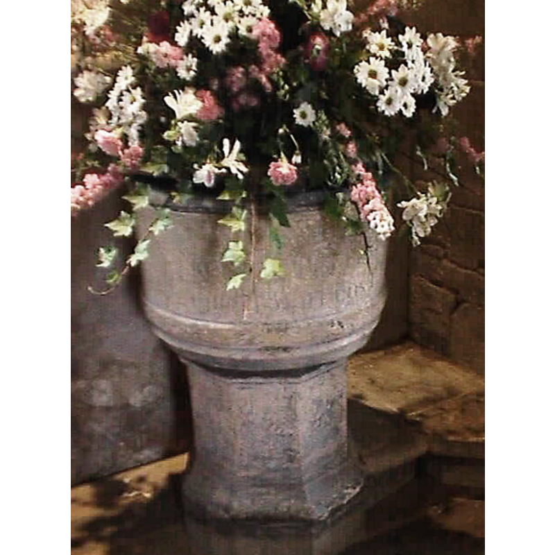
![Main image for Todenham / Teodeham / Toteham [Domesday]](/static-50478a99ec6f36a15d6234548c59f63da52304e5/compressed/1181220012_compressed.png)
Image copyright © Aidan McRae Thompson, 2018
Standing permission
Results: 5 records
view of font and cover
Scene Description: there appears to be another round wooden cover behind the font, against the wall
Copyright Statement: Image copyright © Aidan McRae Thompson, 2018
Image Source: digital photograph taken by Aidan McRae Thompson [https://farm6.static.flickr.com/5667/20512298780_152f347483_b.jpg] [accessed 19 December 2018]
Copyright Instructions: Standing permission
view of font and cover
Copyright Statement: Image copyright © John Wilkes, 2004
Image Source: John Wilkes [www.allthecotswolds.com]
Copyright Instructions: Standing permission
inscription
Scene Description: self-accolade by the 1773 church wardens; or, did they pay for the restoration from their own pockets? [cf. FontNotes and InscriptionArea fields]
Copyright Statement: Image copyright © Aidan McRae Thompson, 2018
Image Source: digital photograph taken by Aidan McRae Thompson [https://farm6.static.flickr.com/5667/20512298780_152f347483_b.jpg] [accessed 19 December 2018]
Copyright Instructions: Standing permission
view of church exterior - southeast view
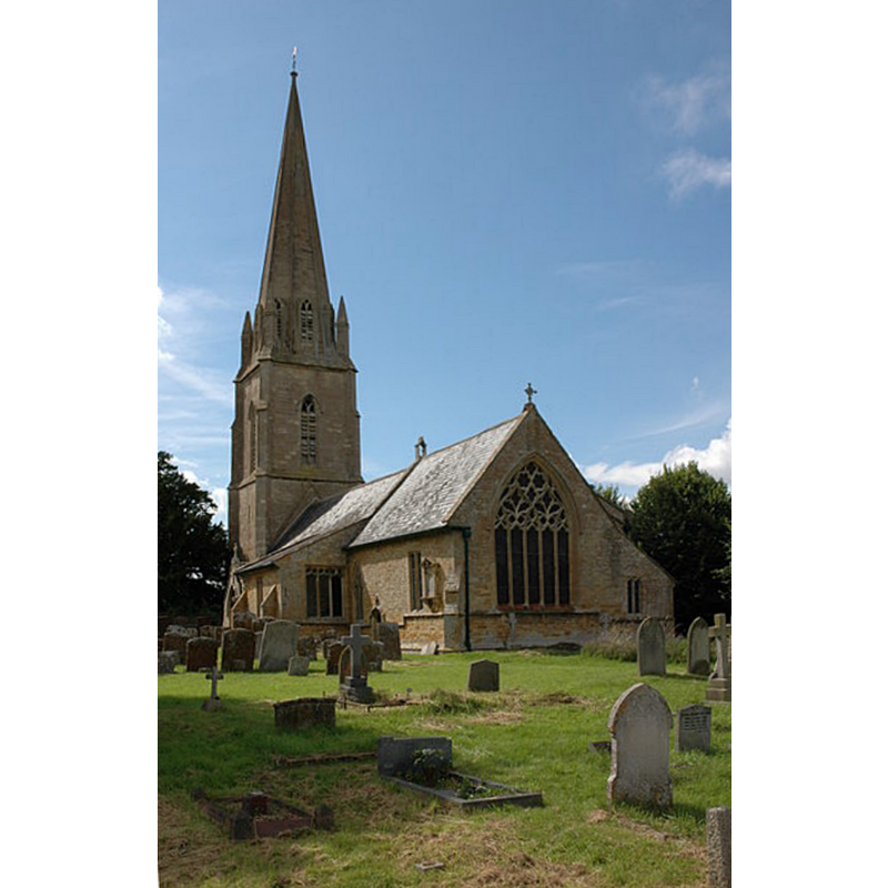
Scene Description: Source caption: "Todenham church is dedicated to St. Thomas a Becket and was rebuilt in the early 14th century."
Copyright Statement: Image copyright © Philip Halling, 2007
Image Source: digital photograph taken 28 July 2007 by Philip Halling [www.geograph.org.uk/photo/510976] [accessed 19 December 2018]
Copyright Instructions: CC-BY-SA-2.0
view of church interior - nave - looking east
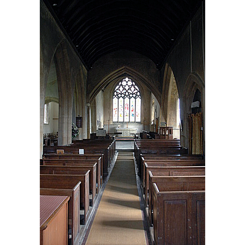
Copyright Statement: Image copyright © Philip Halling, 2007
Image Source: digital photograph taken 28 July 2007 by Philip Halling [www.geograph.org.uk/photo/511094] [accessed 19 December 2018]
Copyright Instructions: CC-BY-SA-2.0
INFORMATION
Font ID: 10194TOD
Object Type: Baptismal Font1
Font Century and Period/Style: 13th century [basin only?] -- 15th century [restored] [composite font?], Medieval [composite]
Church / Chapel Name: Parish Church of St. Thomas of Canterbury
Font Location in Church: Inside the church, in the SW corner of the nave
Church Patron Saint(s): St. Thomas of Canterbury [aka St. Thomas à Becket]
Church Address: 5 Becket Close, Todenham, Gloucestershire, GL56 9PL
Site Location: Gloucestershire, South West, England, United Kingdom
Directions to Site: Located 6 km NE of Moreton-in-Marsh, near the county border with Warwks.
Ecclesiastic Region: Diocese of Gloucester
Historical Region: Hundred of Deerhurst [in Domesday] -- Hundred of Westminster
Additional Comments: composite font? Altered font? Restored font? (the 13thC one was restored in 1773 and the names of the churchwardens added then) [cf. FontNotes] -- disappeared font? (the one from the 12thC church here)
Font Notes:
Click to view
There is an entry for Todenham [variant spelling] in the Domesday survey [http://opendomesday.org/place/SP2436/todenham/] [accessed 189 December 2018] but it mentions neither cleric nor church in it. The entry for this parish in the Victoria County History (Gloucester, vol. 6, 1965) notes: "The earliest known documentary evidence for Todenham church is a papal confirmation of the church to Westminster Abbey in 1157. [...] The church of St. Thomas of Canterbury was apparently so named before the Reformation, [...] and was known by this name from the early 18th century. [...] The 13th-century font has a plain circular bowl and octagonal pedestal. It was removed from the church at one time, and the names of the churchwardens who restored it to use in 1773 are carved on the bowl." In Verey & Brook (1999-2002) : "The font in the church is 13th Century and consists of a circular bowl with a roll moulding at the top and a roll with a holow chamfer at the bottom. The pedestal is an octagonal stem, probably 15th Century."] Baptismal font of a composite nature consisting of a cylindrical basin with a moulding at the upper rim and another at the lower; rounded underbowl; raised on an octagonal pedestal base with splaying lower base. Much-weathered inscription on the sides of the basin [cf. VCH supra]. A recent photograph of this font by Oxford Church Illustrations in Flickr [http://flickr.com/photos/oxfordshire_church_photos/216696548/] [accessed 9 September 2007].
Credit and Acknowledgements: We are grateful to John Wilkes, of The Gloucestershire Photo Library, for his photographs of church and font.
COORDINATES
UTM: 30U 592903 5764658
Latitude & Longitude (Decimal): 52.024764, -1.645948
Latitude & Longitude (DMS): 52° 1′ 29.15″ N, 1° 38′ 45.41″ W
MEDIUM AND MEASUREMENTS
Material: stone
Number of Pieces: two?
Font Shape: cylindrical, mounted
Basin Interior Shape: round
Basin Exterior Shape: round
INSCRIPTION
Inscription Language: English
Inscription Location: on the sides of the basin
Inscription Text: "[?] GRIMLS / [?] POWERS / [?] Wardens 1773"
Inscription Notes: much weathered -- only partially legible in the source
LID INFORMATION
Date: unknown
Material: wood
Apparatus: no
REFERENCES
- Victoria County History [online], University of London, 1993-. URL: https://www.british-history.ac.uk.
- Verey, David, Gloucestershire, London: Penguin Books, 1999-2002