Stretton-on-Fosse / Stratone / Stretton under Fosse
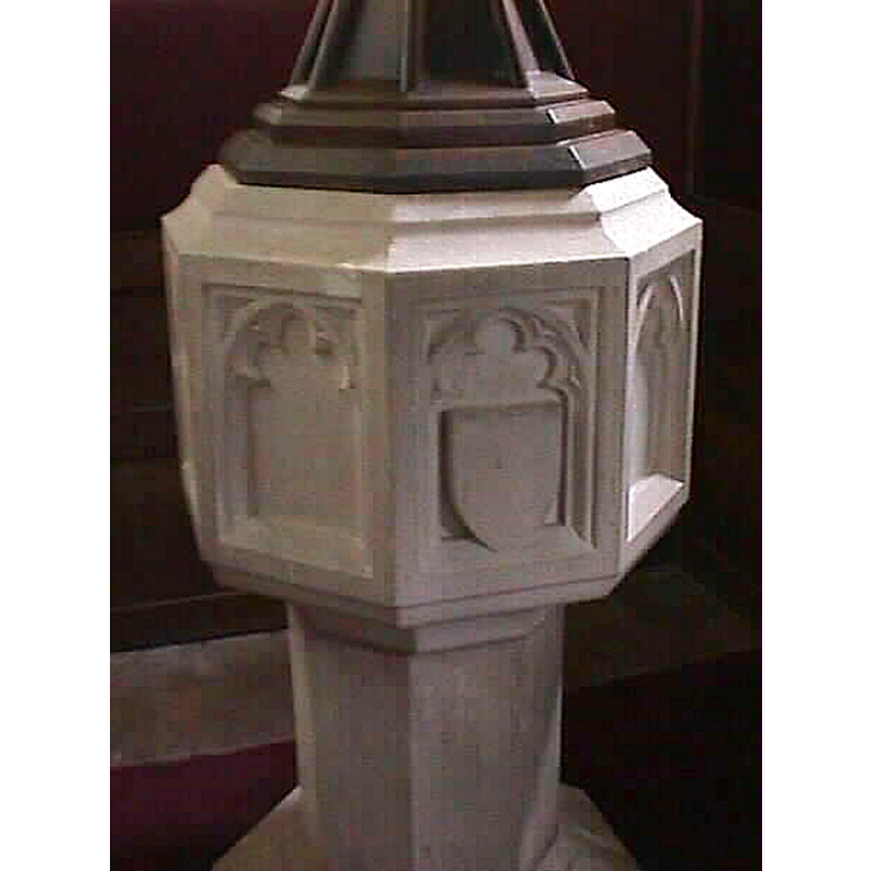
Image copyright © John Wilkes, 2004
Standing permission
Results: 2 records
view of font and cover
Copyright Statement: Image copyright © John Wilkes, 2004
Image Source: John Wilkes [www.allthecotswolds.com]
Copyright Instructions: Standing permission
view of church exterior - north view
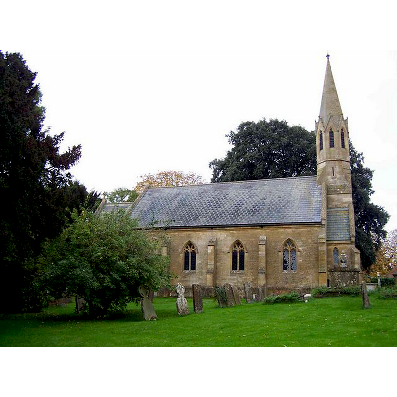
Copyright Statement: Image copyright © Geoff Pick, 2006
Image Source: digital photograph taken 28 October 2006 by Geoff Pick [www.geograph.org.uk/photo/268464] [accessed 13 January 2015]
Copyright Instructions: CC-BY-SA-2.0
INFORMATION
Font ID: 10193STR
Object Type: Baptismal Font1
Font Century and Period/Style: 11th century, Pre-Conquest? / Norman
Church / Chapel Name: Parish Church of St. Peter
Church Patron Saint(s): St. Peter
Church Address: Old Tree Cottages, Stretton-on-Fosse, Warwickshire GL56 9SJ
Site Location: Warwickshire, West Midlands, England, United Kingdom
Directions to Site: Located near Ilmington. on the fringe of the Cotswold Hills, near the county border with Gloucs.
Ecclesiastic Region: Diocese of Coventry
Historical Region: Hundred of Barcheston [in Domesday] -- Hundred of Kington
Additional Comments: disappeared font? (the one from the Domesday-time church here)
Font Notes:
Click to view
There are two entries for Stretton[-on-Fosse] [variant spelling] in the Domesday survey [http://domesdaymap.co.uk/place/SP2238/stretton-on-fosse/] [accessed 13 January 2015], one of which, in the lordship of Walter, mentions a priest, but not a church in it, though there probably was one there. The Victoria County History (Warwick, vol. 5, 1949) notes: "About the end of the 12th century Ralph le Breton presented to the church of Stretton [...] The church of Stretton-on-Fosse was originally a chapel of Blockley in Worcestershire [...] In 1291 it was called a chapel [...] enlarged in 1841 [...] No ancient architectural features remain. [...] All the fittings and furniture are modern. The registers begin in 1538." Baptismal font probably of the 19th century, consisting of an octagonal basin of vertical sides decorate with cinquefoil arches, at least one of which contains a blank shield in it; the upper and lower rim of the basin have a graded chamfer cut; raised on a plain octagonal pedestal base and lower base. Wooden pyramidal font cover, also eight-sided; modern. [NB: the church was renovated in the 19th century, from which time this font originates, but we have no information on the font of the original church here].
Credit and Acknowledgements: We are grateful to John Wilkes, of www.allthecotswolds.com, for the photograph of this modern font.
COORDINATES
UTM: 30U 590786 5766609
Latitude & Longitude (Decimal): 52.042653, -1.676279
Latitude & Longitude (DMS): 52° 2′ 33.55″ N, 1° 40′ 34.6″ W
LID INFORMATION
Date: modern
Material: wood
Apparatus: no
REFERENCES
- Victoria County History [online], University of London, 1993-. URL: https://www.british-history.ac.uk.