Lower Lemington / Limenstone / Limentone
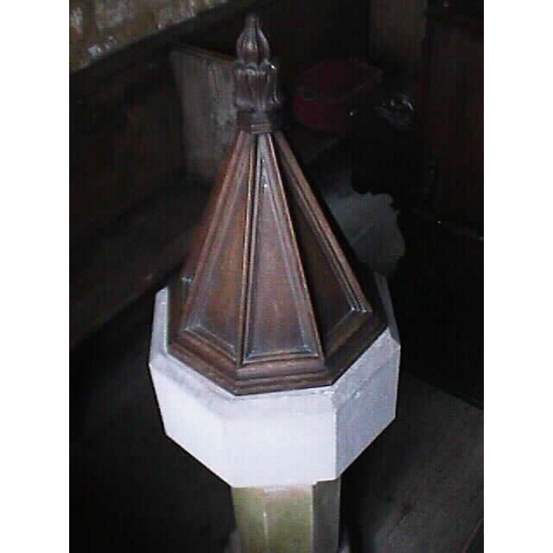
Image copyright © John Wilkes, 2004
Standing permission
Results: 6 records
view of font and cover
Copyright Statement: Image copyright © John Wilkes, 2004
Image Source: digital photograph by John Wilkes [www.allthecotswolds.com]
Copyright Instructions: Standing permission
view of church exterior - north view
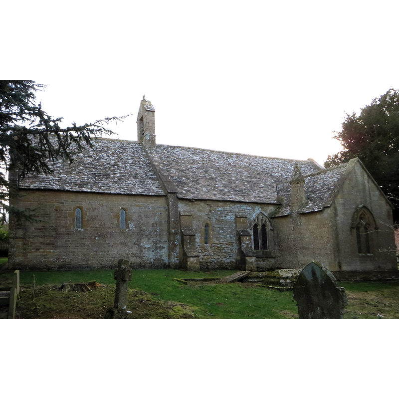
Copyright Statement: Image copyright © Philip Jeffrey, 2017
Image Source: digital photograph taken 23 Fedbruary 2017 by Philip Jeffrey [www.geograph.org.uk/photo/5291933] [accessed 18 December 2018]
Copyright Instructions: CC-BY-SA-2.0
view of church exterior - south view - detail
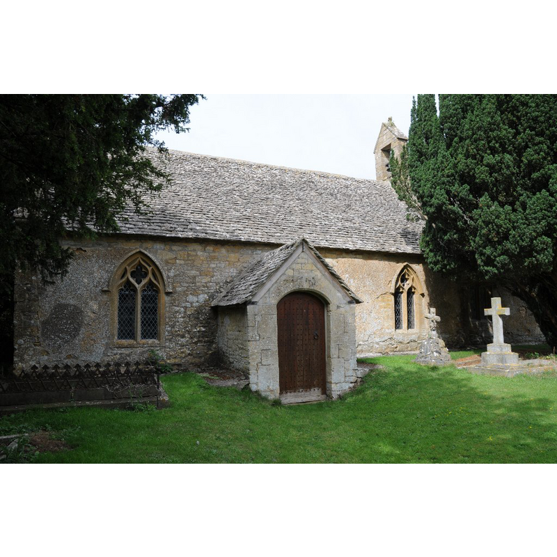
Scene Description: Source caption: "Lower Lemington church is dedicated to St Leonard, this small church is still in use even though there appears to be no village as such."
Copyright Statement: Image copyright © Philip Halling, 2015
Image Source: digital photograph taken 29 August 2015 by Philip Halling [www.geograph.org.uk/photo/4649318] [accessed 18 December 2018]
Copyright Instructions: CC-BY-SA-2.0
view of church exterior in context
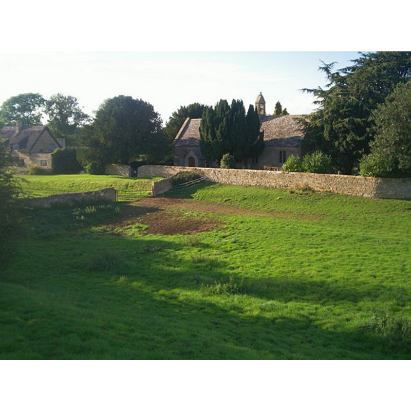
Copyright Statement: Image copyright © Jennifer Luther Thomas, 2006
Image Source: digital photograph taken 23 September 2006 by Jennifer Luther Thomas [www.geograph.org.uk/photo/247205] [accessed 17 July 2012]
Copyright Instructions: CC-BY-SA-2.0
view of font
!["Font. Early Norman, tub-shaped. It lies disused in the chancel" [Verey & Brooks (1999-2002)]](/static-50478a99ec6f36a15d6234548c59f63da52304e5/others/permission_not_available.jpg)
Scene Description: "Font. Early Norman, tub-shaped. It lies disused in the chancel" [Verey & Brooks (1999-2002)]
Copyright Statement: Image copyright © Guy Thornton, 2016
Image Source: edited detail of a digital photograph taken 31 January 2016 by Guy Thornton [www.flickr.com/photos/bwthornton/24423115579/in/photostream/] [accessed 18 December 2018]
Copyright Instructions: PERMISSION NOT AVAILABLE -- IMAGE NOT FOR PUBLIC USE
view of church interior - chancel arch and east side
Scene Description: Source caption: "The early Norman chancel arch is only 4ft wide and has small squints on either side. The Norman font which can be seen in the chancel [bottom-left corner of the image] was replaced by a very small Victorian font."
Copyright Statement: Image copyright © Guy Thornton, 2016
Image Source: digital photograph taken 31 January 2016 by Guy Thornton [www.flickr.com/photos/bwthornton/24163923463/in/photostream/] [accessed 18 December 2018]
Copyright Instructions: PERMISSION NOT AVAILABLE -- IMAGE NOT FOR PUBLIC USE
INFORMATION
Font ID: 10191LEM
Object Type: Baptismal Font1
Font Century and Period/Style: 11th - 12th century, Pre-Conquest? / Norman?
Cognate Fonts: the font at Bledington
Church / Chapel Name: Parish Church of St. Leonard
Font Location in Church: Inside the church, by the old chancel arch
Church Patron Saint(s): St. Leonard
Church Address: Lower Lemington, Gloucestershire, GL56 9NR, UK
Site Location: Gloucestershire, South West, England, United Kingdom
Directions to Site: Located off (E) the A429, 4-5 km NE of Moreton-in-Marsh
Ecclesiastic Region: Diocese of Gloucester
Historical Region: Hundred of Tewkesbury
Additional Comments: altered font / disused font? (re-cycled font? Re-tooled basin?)
Font Notes:
Click to view
There is an entry for [Lower] Lemington [variant spelling] in the Domesday survey [http://opendomesday.org/place/SP2134/lower-lemington/] [accessed 18 December 2018] but it mentions neither cleric nor church in it. The entry for this parish in the Victoria County History (Gloucester, vol. 6, 1965) notes: "there appears to have been a church at Lower Lemington by the 11th century, and in the earlier 12th century the chapel of Lemington was confirmed to Tewkesbury Abbey. [...] The chancel arch is thought to be Saxon, [...] and the plan of the Saxon church, with some of its fabric, appears to have survived. [...] The large, tub-shaped, 12th-century font, similar to the one at Bledington, stood in the chancel in 1962, when it was not in use". In Verey & Brooks (1999-2002): "Font. Early Norman, tub-shaped. It lies disused in the chancel, replaced by a small C19 octagonal stone font." The basin of the new baptismal font is octagonal with plain vertical sides chamfered at the upper and lower rims; it is raised on an octagonal pedestal base. Wooden font cover of octagonal pyramidal shape with finial.
Credit and Acknowledgements: We are grateful to John Wilkes, of www.allthecotswolds.com, for his photographs of church and new font.
COORDINATES
UTM: 30U 590438 5762804
Latitude & Longitude (Decimal): 52.008505, -1.682352
Latitude & Longitude (DMS): 52° 0′ 30.62″ N, 1° 40′ 56.47″ W
MEDIUM AND MEASUREMENTS
Material: stone
Font Shape: tub-shaped
Basin Interior Shape: round
Basin Exterior Shape: round
Drainage Notes: no lining
REFERENCES
- Victoria County History [online], University of London, 1993-. URL: https://www.british-history.ac.uk.