Wylye / Wyli / Wyly
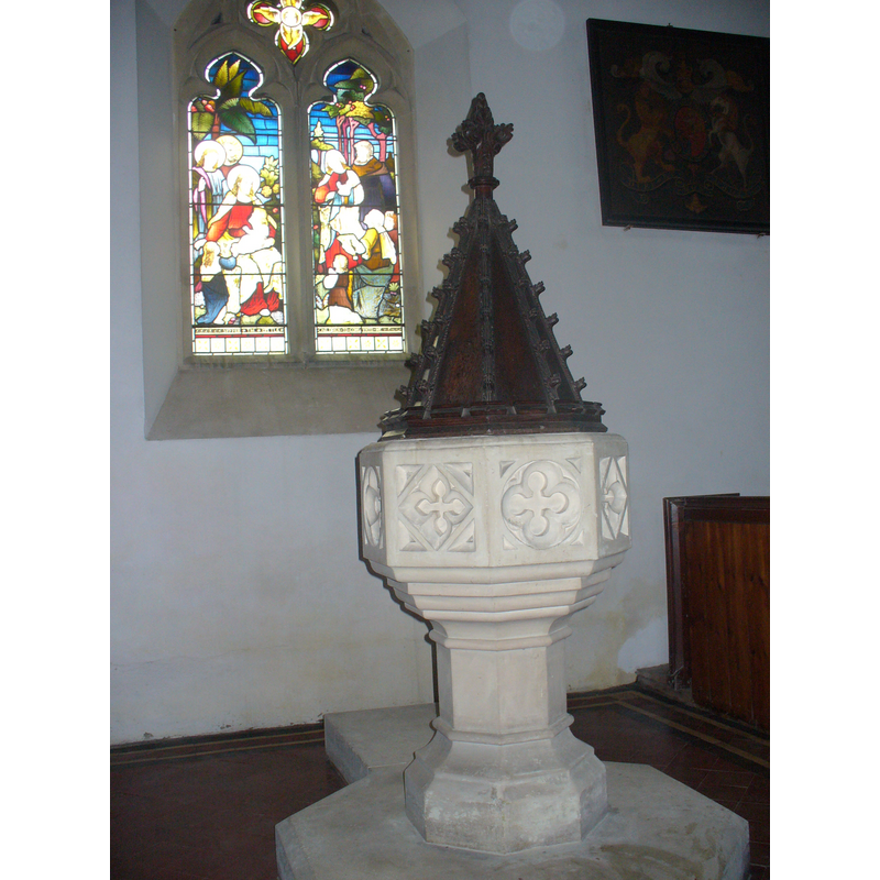
Image copyright © Colin Smith, 2009
Standing permission
Results: 7 records
view of font and cover
Copyright Statement: Image copyright © Colin Smith, 2009
Image Source: digital photograph taken by Colin Smith March 2009
Copyright Instructions: Standing permission
view of font
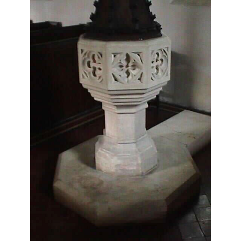
Copyright Statement: Image copyright © John Wilkes, 2004
Image Source: John Wilkes [www.allthecotswolds.com]
Copyright Instructions: Standing permission
design element - architectural - window - quatrefoiled - 8
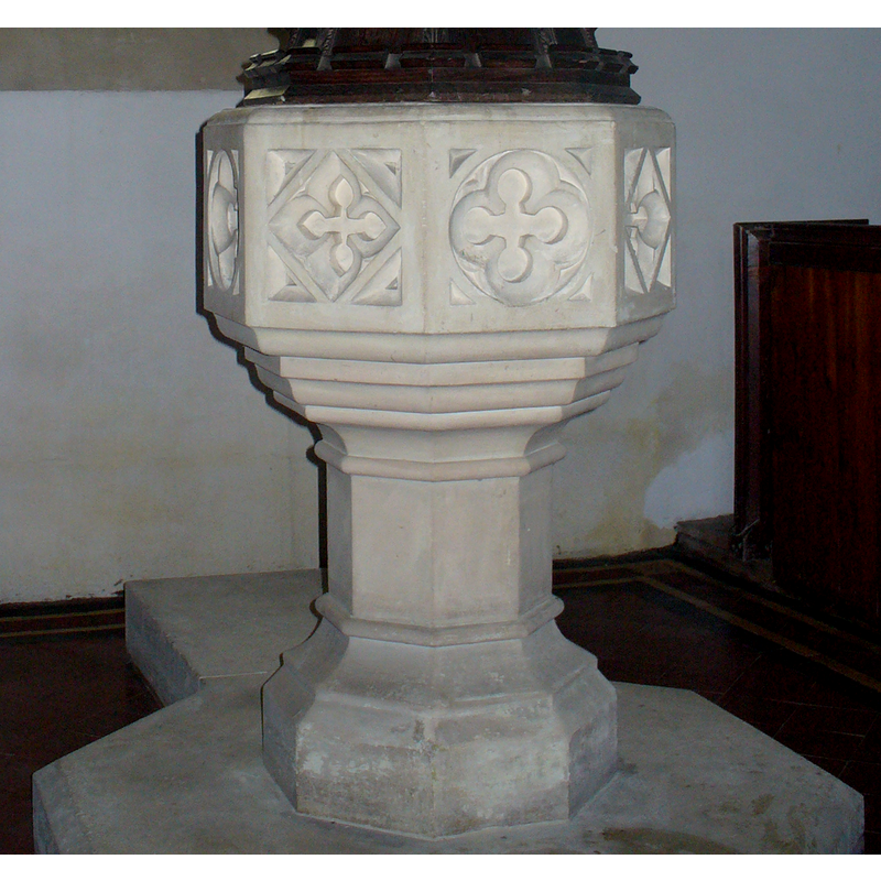
Scene Description: one on each side of the octagonal basin, some pointed, some round
Copyright Statement: Image copyright © Colin Smith, 2009
Image Source: detail of a digital photograph taken by Colin Smith March 2009
Copyright Instructions: Standing permission
design element - motifs - moulding - graded
Copyright Statement: Image copyright © Colin Smith, 2009
Image Source: detail of a digital photograph taken by Colin Smith March 2009
Copyright Instructions: Standing permission
view of church exterior - southwest view
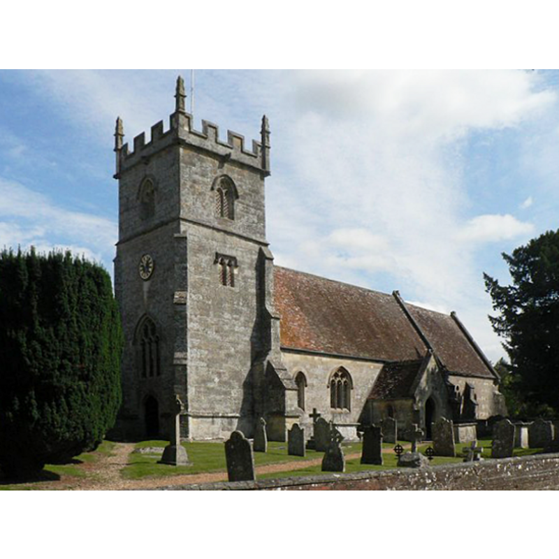
Copyright Statement: Image copyright © Chris Downer, 2007
Image Source: digital photograph taken 27 August 2007 by Chris Downer [www.geograph.org.uk/photo/537326] [accessed 22 February 2012]
Copyright Instructions: CC-BY-SA-3.0
view of font cover
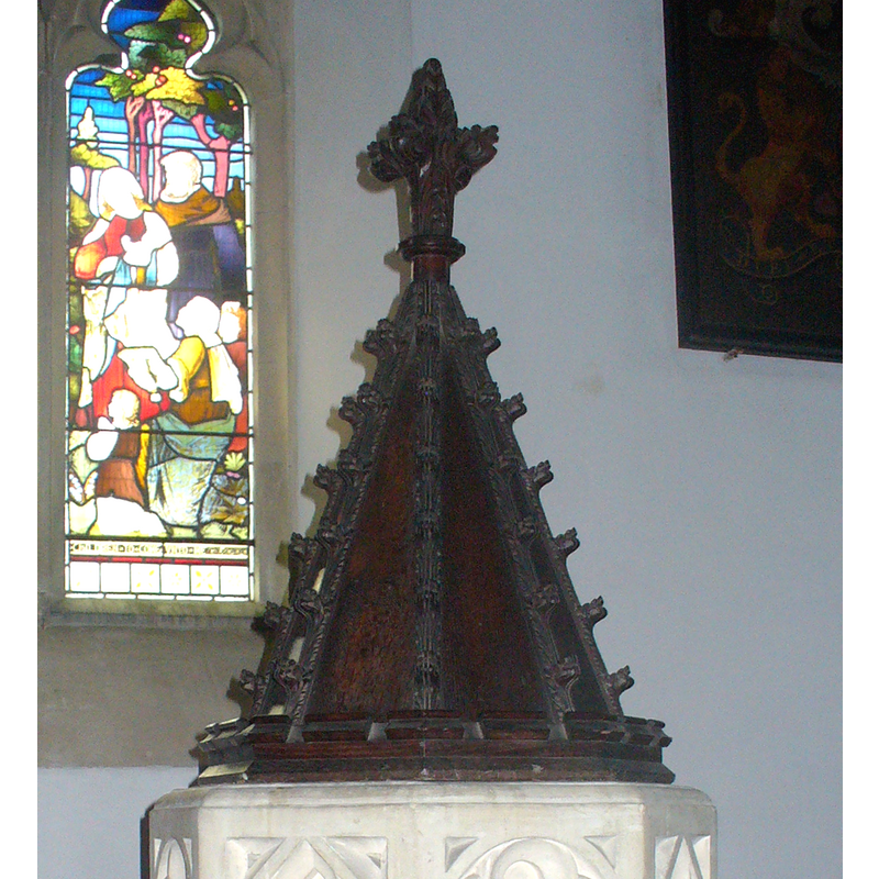
Copyright Statement: Image copyright © Colin Smith, 2009
Image Source: detail of a digital photograph taken by Colin Smith March 2009
Copyright Instructions: Standing permission
design element - motifs - moulding
Scene Description: several on the base and lower base
Copyright Statement: Image copyright © Colin Smith, 2009
Image Source: detail of a digital photograph taken by Colin Smith March 2009
Copyright Instructions: Standing permission
INFORMATION
Font ID: 10164WYL
Object Type: Baptismal Font1
Font Century and Period/Style: 12th century, Late Norman? / Transitional?
Church / Chapel Name: Parish Church of St. Mary the Virgin
Church Patron Saint(s): St. Mary the Virgin
Church Notes: "church of ST. MARY, so called in 1333" [cf. VCH entry in bib.]
Church Address: Church Street, Wylye, Wiltshire, BA120QZ
Site Location: Wiltshire, South West, England, United Kingdom
Directions to Site: Located off the A303, just SW of the Deptford junction, 16 km WNW of Salisbury
Ecclesiastic Region: Diocese of Salisbury
Historical Region: Hundred of Branch and Dole
Additional Comments: disappeared font?
Font Notes:
Click to view
The Victoria County History (Wiltshire, vol. 15, 1995) notes: "Wylye church may have been standing in the 12th century and had a rector in 1249. [...] Both the new font given in 1765 and that which replaced it in 1846 [...] were in the north aisle in 1991." Noted in Pevsner & Cherry (1975): "Font. Baluster font of 1765." The baptismal font illustrated in Wilkes (2004) is an octagonal mounted baptismal font in the Perpendicular style; the sides of the basin are decorated with deeply carved quatrefoil windows; the underbowl has a graded chamfer; plain stem and moulded lower base, both octagonal. Raised on an octagonal plinth with kneeling stone. Wooden font cover. [NB: we have no information on the medieval font of this church].
Credit and Acknowledgements: We are grateful to John Wilkes, of www.allthecotswolds.com, and to Colin Smith, for the photographs of this font.
COORDINATES
UTM: 30U 570673 5665760
Latitude & Longitude (Decimal): 51.138929, -1.989801
Latitude & Longitude (DMS): 51° 8′ 20.14″ N, 1° 59′ 23.29″ W
MEDIUM AND MEASUREMENTS
Material: stone
Font Shape: octagonal, mounted
Basin Interior Shape: round
Basin Exterior Shape: octagonal
LID INFORMATION
Date: unknown
Material: wood
Apparatus: no
REFERENCES
- Victoria County History [online], University of London, 1993-. URL: https://www.british-history.ac.uk.
- Cox, John Charles, Nottinghamshire, London: Allen, 1912, p. 601