Hale nr. Brummore / Hales / Hall / La Hale
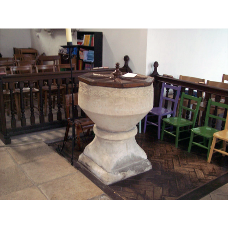
Image copyright © Trish Steel, 2007
CC-BY-SA-2.0
Results: 3 records
view of font and cover
Scene Description: the faint band of carving on the sides of the basin, just below the rim, is a later re-carving [cf. FontNotes] - the wooden cover is modern
Copyright Statement: Image copyright © Trish Steel, 2007
Image Source: digital photograph taken 5 March 2007 by Trish Steel [www.geograph.org.uk/photo/355070] [accessed 4 August 2011]
Copyright Instructions: CC-BY-SA-2.0
view of church exterior
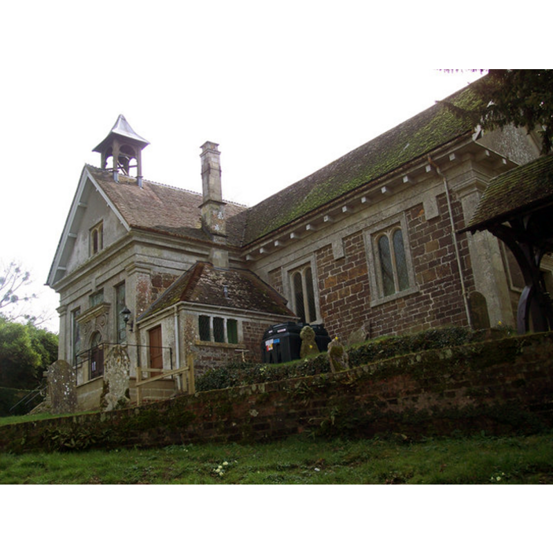
Copyright Statement: Image copyright © Trish Steel, 2007
Image Source: digital photograph taken 5 March 2007 by Trish Steel [www.geograph.org.uk/photo/355075] [accessed 4 August 2011]
Copyright Instructions: CC-BY-SA-2.0
view of church exterior
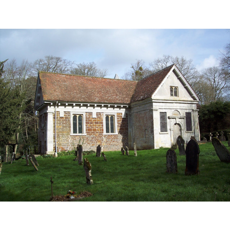
Copyright Statement: Image copyright © Trish Steel, 2007
Image Source: digital photograph taken 5 March 2007 by Trish Steel [www.geograph.org.uk/photo/355025] [accessed 4 August 2011]
Copyright Instructions: CC-BY-SA-2.0
INFORMATION
Font ID: 10151HAL
Object Type: Baptismal Font1
Font Century and Period/Style: 14th century [basin only] [composite font], Medieval [composite]
Church / Chapel Name: Parish Church of St. Mary
Font Location in Church: Inside the church, et the W end
Church Patron Saint(s): St. Mary the Virgin
Church Address: Hale Lane, Hale, Nr Fordingbridge, Hants, SP6 2RF, UK
Site Location: Hampshire, South East, England, United Kingdom
Directions to Site: Located off (W) the B3080 and the A338, 6 km NE of Fordingbridge, 13 km SSE of Salisbury
Ecclesiastic Region: Diocese of Winchester
Historical Region: Hundred of Fordingbridge --
Additional Comments: altered font? re-carved? / composite font?
Font Notes:
Click to view
No entry found for this Hale in the Domesday survey [NB: there is an entry for Hale but it is on the Isle of Wight]. The Victoria County Council (Hampshire, vol. 4, 1911) notes: "Near the west doorway stands a circular font on a square base, which is probably of ancient date, with an added band of early 17th-century ornament." The Historic Churches Preservation Trust mentions that "the nave and the font are 14th century" [source: 'Recent Grants' issue of the Grants Cttee. Meeting of 22 June 2004, www.historicchurches.org.uk]. The entry for this church in Historic England [Listing NGR: SU1794718577] notes: "At west is medieval circular font on square base with early C17 carved band." The flat octagonal cover is modern." Judith Leigh [www.buildingconservation.com/articles/stmaryschurch/stmarys.htm] [accessed 17 September 2018] writes: "A church has existed on this steeply sloping site probably since pre-Domesday time, but the existing church’s foundations were laid in the 14th century by the neighbouring priory of Breamore."
COORDINATES
UTM: 30U 587969 5646927
Latitude & Longitude (Decimal): 50.96722, -1.7472
Latitude & Longitude (DMS): 50° 58′ 1.99″ N, 1° 44′ 49.92″ W
MEDIUM AND MEASUREMENTS
Material: stone
Font Shape: round, mounted
Basin Interior Shape: round
Basin Exterior Shape: round
LID INFORMATION
Date: modern
Material: wood, oak?
Apparatus: no
Notes: [cf. FontNotes]
REFERENCES
- Victoria County History [online], University of London, 1993-. URL: https://www.british-history.ac.uk.