Waterden / Warenna / Wat'denna
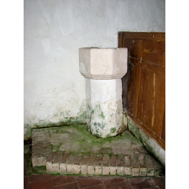
Image copyright © Evelyn Simak, 2010
CC-BY-SA-3.0
Results: 8 records
view of font
Copyright Statement: Image copyright © Evelyn Simak, 2010
Image Source: digital photograph taken 2 September 2010 by Evelyn Simak [www.geograph.org.uk/photo/2051537] [accessed 6 August 2013]
Copyright Instructions: CC-BY-SA-3.0
design element - motifs - moulding - graded
Copyright Statement: Image copyright © Evelyn Simak, 2010
Image Source: digital photograph taken 2 September 2010 by Evelyn Simak [www.geograph.org.uk/photo/2051537] [accessed 6 August 2013]
Copyright Instructions: CC-BY-SA-3.0
view of church exterior - north porch
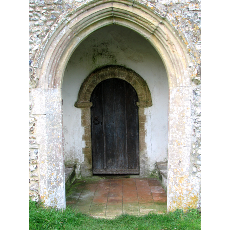
Scene Description: the arch of this north porch is Early English, but the doorway inside is Norman
Copyright Statement: Image copyright © Evelyn Simak, 2010
Image Source: digital photograph taken 2 September 2010 by Evelyn Simak [www.geograph.org.uk/photo/2051522] [accessed 6 August 2013]
Copyright Instructions: CC-BY-SA-3.0
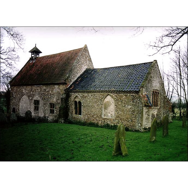
view of church exterior - northwest end
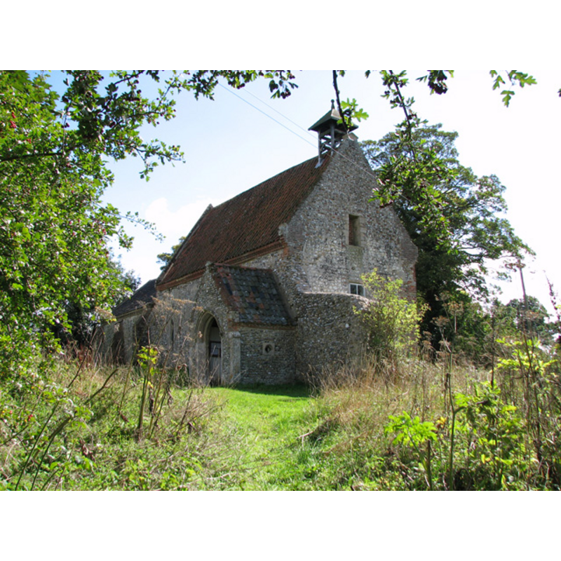
Copyright Statement: Image copyright © Evelyn Simak, 2010
Image Source: digital photograph taken 2 September 2010 by Evelyn Simak [www.geograph.org.uk/photo/2051487] [accessed 6 August 2013]
Copyright Instructions: CC-BY-SA-3.0
view of church exterior - west view
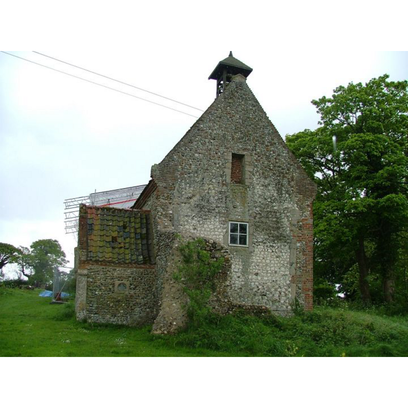
Copyright Statement: Image copyright © Simon Knott, 2005
Image Source: digital photograph taken May 2005 by Simon Knott [www.norfolkchurches.co.uk/waterden/waterden.htm] [accessed 6 August 2013]
Copyright Instructions: Standing permission
view of church exterior - southeast view
Copyright Statement: Image copyright © Simon Knott, 2005
Image Source: digital photograph taken May 2005 by Simon Knott [www.norfolkchurches.co.uk/waterden/waterden.htm] [accessed 6 August 2013]
Copyright Instructions: Standing permission
view of church interior - nave - looking west
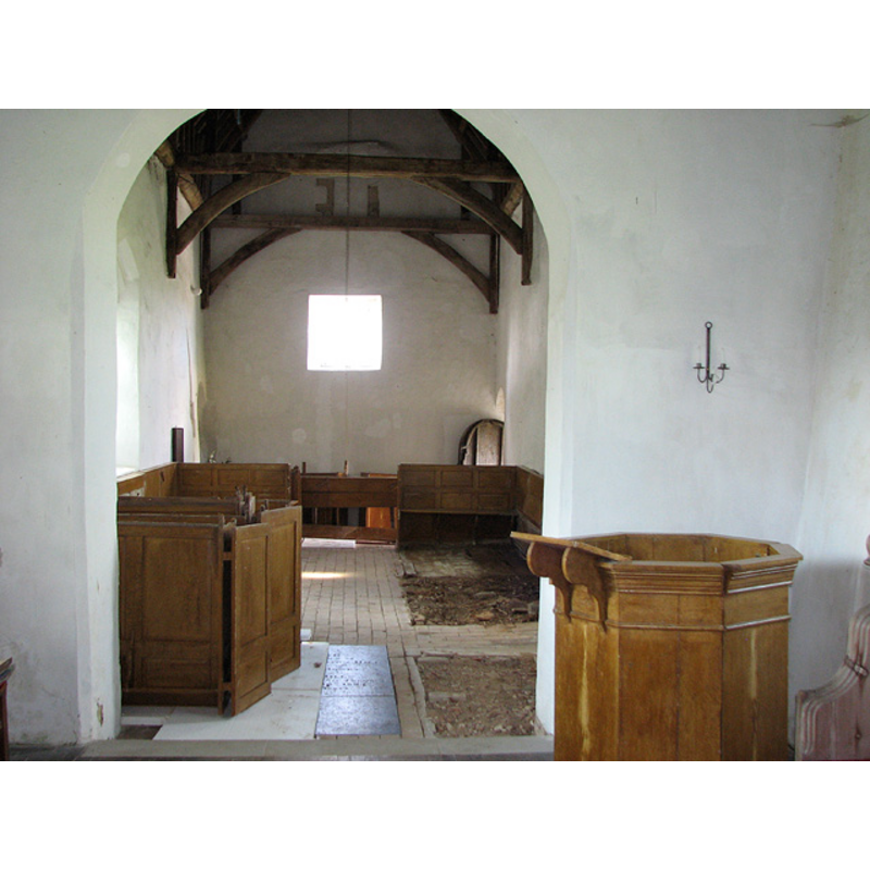
Scene Description: the font is not visible here; it is located behind the back of the last pew on the right (north) side, by the north door
Copyright Statement: Image copyright © Evelyn Simak, 2010
Image Source: digital photograph taken 2 September 2010 by Evelyn Simak [www.geograph.org.uk/photo/2051533] [accessed 6 August 2013]
Copyright Instructions: CC-BY-SA-3.0
view of church interior - nave - looking east
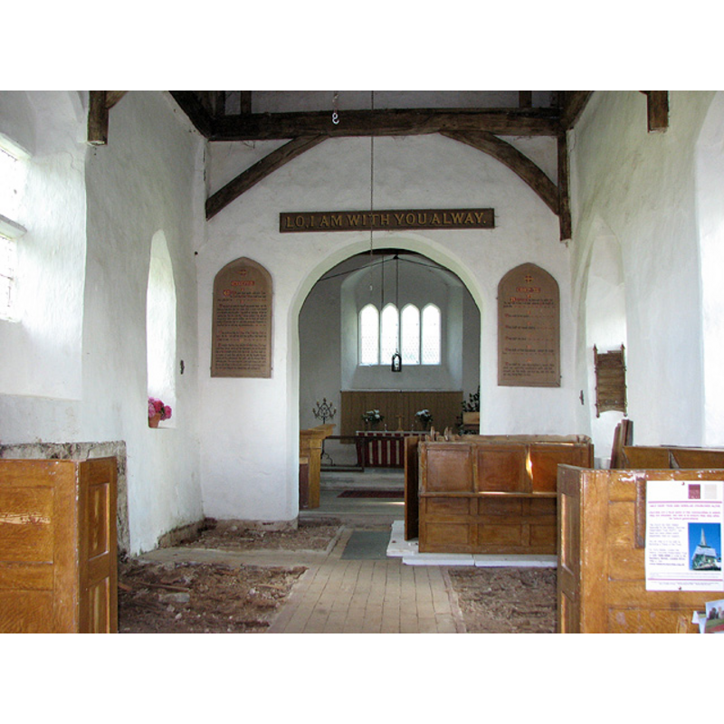
Copyright Statement: Image copyright © Evelyn Simak, 2010
Image Source: digital photograph taken 2 September 2010 by Evelyn Simak [www.geograph.org.uk/photo/2051525] [accessed 6 August 2013]
Copyright Instructions: CC-BY-SA-3.0
INFORMATION
Font ID: 10144AWT
Object Type: Baptismal Font1
Font Century and Period/Style: 14th century, Decorated
Church / Chapel Name: Parish Church of All Saints [redundant]
Font Location in Church: Inside the church, at the W end of the nave, by the N entranceway
Church Patron Saint(s): All Saints
Church Notes: the entrance to the church is through the northwest porch
Church Address: Waterden, South Creake, Norfolk NR22 6AT
Site Location: Norfolk, East Anglia, England, United Kingdom
Directions to Site: Located 8 km SSE of Burnham Market
Ecclesiastic Region: Diocese of Norwich
Historical Region: Hundreds of Gallow and Brothercross
Additional Comments: disappeared font? (the one from the [pre-]Conquest time church here)
Font Notes:
Click to view
The Domesday entry for "Warenna" / "Wat' denna", cited in Blomefield (1805-1810), includes "a church with 5 acres". Blomefield (ibid.) gives the dedication as All Saints', and names "Adam de Rusteyn" as first recorded rector, about 1260. The present font here is noted in Pevsner & Wilson (1999) as octagonal, 14th-century. Noted and illustrated in Knott (2005). The Historic Churches Preservation Trust mentions "a C14 font" in this church [source: 'Recent Grants' issue of the Grants Cttee. Meeting of 22 June 2004, www.historicchurches.org.uk]. The font, located near the entrance, consists of a small octagonal basin with plain vertical sides, the underbowl moulded, raised on a plain octagonal pedestal base and a brick plinth. The font is whitewashed and appears to have some damage to the back of the upper rim; it is now (?) built against the south wall and the back of the pews. [NB: we have no information on the font of the Conquest-time church here].
Credit and Acknowledgements: We are grateful to Simon Knott, of Norfolk Churches [www.norfolkchurches.co.uk], for his photographs of this church building
COORDINATES
UTM: 31U 351956 5861906
Latitude & Longitude (Decimal): 52.886444, 0.799642
Latitude & Longitude (DMS): 52° 53′ 11.2″ N, 0° 47′ 58.71″ E
MEDIUM AND MEASUREMENTS
Material: stone
Font Shape: octagonal, mounted
Basin Interior Shape: round
Basin Exterior Shape: octagonal
REFERENCES
- Blomefield, Francis, An essay towards a topographical history of Norfolk, 1805-1810, vol. 7: 205-207 / [www.british-history.ac.uk/report.aspx?compid=78332] [accessed 6 August 2013]
- Knott, Simon, The Norfolk Churches Site, Simon Knott, 2004. [standing permission to reproduce images received from Simon (February 2005]. URL: www.norfolkchurches.co.uk.
- Pevsner, Nikolaus, Norfolk 2: North-West and South (2nd ed.), London: Penguin, 1999, p. 745