Haroldston St. Issels / East Harroldston / Haroldston East / Haroldston St. Issells / Harroldston St. Issels
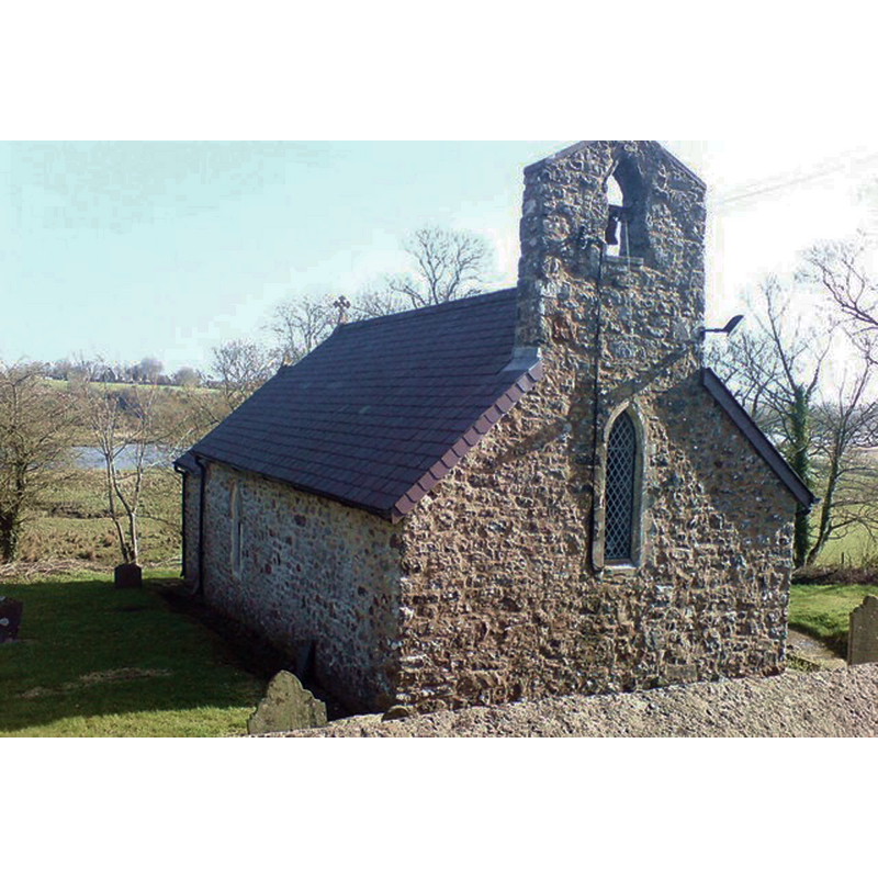
Image copyright © Deborah Tilley, 2009
CC-BY-SA-2.0
Results: 2 records
view of church exterior - northwest view
Copyright Statement: Image copyright © Deborah Tilley, 2009
Image Source: digital photograph taken 14 March 2009 by Deborah Tilley [www.geograph.org.uk/photo/1202816] [accessed 13 February 2020]
Copyright Instructions: CC-BY-SA-2.0
view of church exterior - southwest view
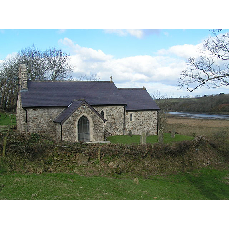
Copyright Statement: Image copyright © phniggs, 2006
Image Source: digital photograph taken 22 February 2004 by phniggs [www.geograph.org.uk/photo/190890] [accessed 13 February 2020]
Copyright Instructions: CC-BY-SA-2.0
INFORMATION
Font ID: 10096HAR
Object Type: Baptismal Font1
Font Century and Period/Style: 11th - 12th century [re-tooled?], Norman [altered]
Church / Chapel Name: Parish Church of St. Issel
Font Location in Church: Inside the church
Church Patron Saint(s): St. Issell [aka Ishel, Ishmael, Issel]
Church Address: Merlin's Bridge, Haroldston St. Issels / Haverfordwest, UK
Site Location: Pembrokeshire, Wales, United Kingdom
Directions to Site: Located off the A4076, 2 km SE of Haverfordwest, on the W bank of the Western Cleddau
Ecclesiastic Region: Diocese of St Davids
Historical Region: Hundred of Rhos [aka Roose]
Additional Comments: recycled font? re-tooled Norman font?
Font Notes:
Click to view
Lewis' Topographycal Dictionary of 1834 notes: "A Norman font has survived much restoration." Noted in the RCAHMW (Pembroke, 1925): "The font is of Norman type, the bowl measuring outside 27 inches by 25 inches, and inside 20 inches square; it stands on a circular shaft 9 inches high and 50 inches round; the base is modern.—Visited, 8th July, 1920." Lloyd et al. (2004: 201) write: "Font. Square bowl, probably a retooling of the Norman one."
COORDINATES
UTM: 30U 365293 5739275
Latitude & Longitude (Decimal): 51.7881, -4.9531
Latitude & Longitude (DMS): 51° 47′ 17.16″ N, 4° 57′ 11.16″ W
MEDIUM AND MEASUREMENTS
Material: stone
Font Shape: square
Basin Exterior Shape: square
Diameter (inside rim): 50.8 x 50.8 cm*
Height of Base: 22.86 cm* [diameter 127 cm*]
Trapezoidal Basin: 68.58 x 63.5 cm*
Notes on Measurements: * [in inches in the RCAHMW (Pembroke, 1925) [cf. FontNotes]]
REFERENCES
- Great Britain. Royal Commission on Ancient Monuments and Constructions in Wales and Monmouthshire, An inventory of the ancient and historical monuments of the County of Pembroke, London: H.M. Stationary Office, 1925, p. 106
- Lewis, Samuel, A Topographical Dictionary of Wales, Comprising the Several Counties, Cities, Boroughs, Corporate and Market Towns, Parishes, Chapelries, and Townships, with Historical and Statistical Descriptions [...], London: S. Lewis, 1833
- Lloyd, Thomas, Pembrokeshire, New Haven and London: Yale University Press, 2004, p. 200