Diddington / Doditone / Dodinctun / Dodington / Dodintone / Dudington / Dydyngton
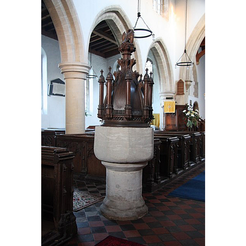
Image copyright © Richard Croft, 2009
CC-BY-SA-2.0
Results: 8 records
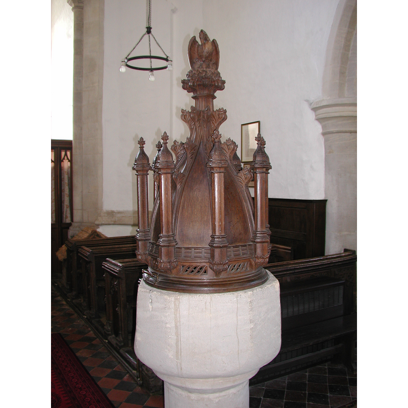
view of font and cover in context
Copyright Statement: Image copyright © Richard Croft, 2009
Image Source: digital photograph taken 29 January 2009 by Richard Croft [www.geograph.org.uk/photo/1139600] [accessed 24 April 2012]
Copyright Instructions: CC-BY-SA-2.0
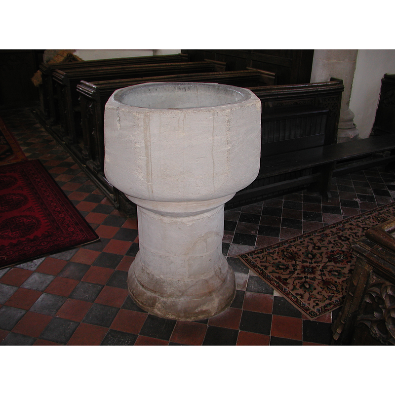
view of font
Copyright Statement: Image copyright © Colin Hinson, 2008
Image Source: Colin Hinson [www.yorkshireCDbooks.coml]
Copyright Instructions: Image and permission received (e-mail of 10 September 2004)
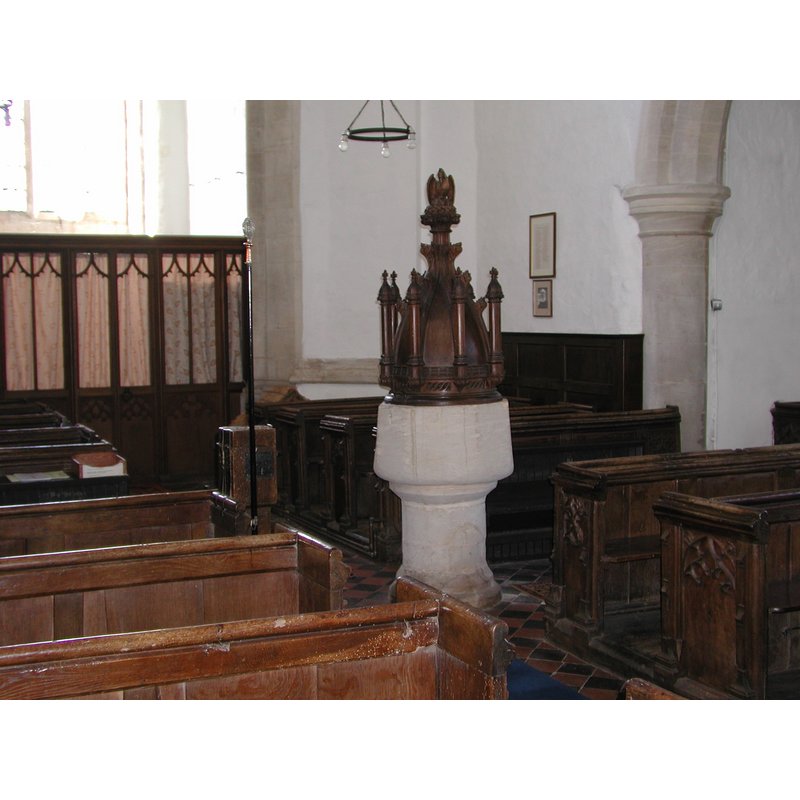
view of font and cover in context
Copyright Statement: Image copyright © Colin Hinson, 2008
Image Source: Colin Hinson [www.yorkshireCDbooks.coml]
Copyright Instructions: Image and permission received (e-mail of 10 September 2004)
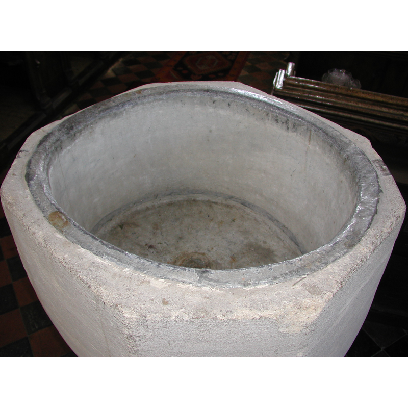
view of basin's top
Copyright Statement: Image copyright © Colin Hinson, 2008
Image Source: Colin Hinson [www.yorkshireCDbooks.coml]
Copyright Instructions: Image and permission received (e-mail of 10 September 2004)
view of church exterior - southwest view
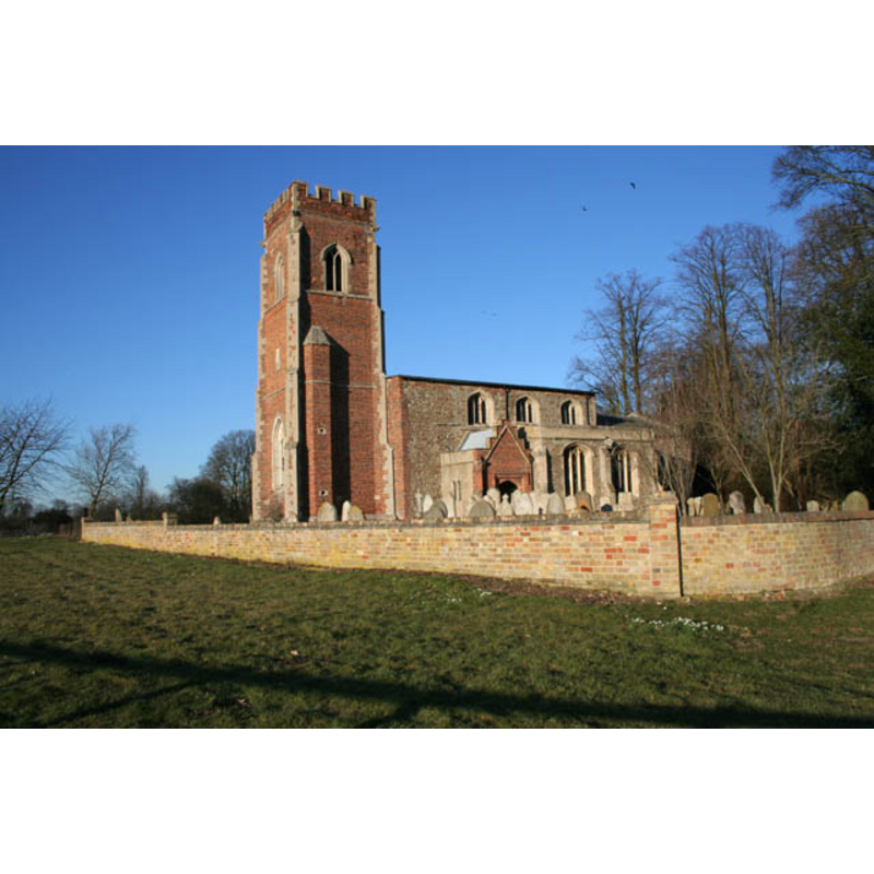
Copyright Statement: Image copyright © Kate Jewell, 2010
Image Source: digital photograph taken 7 March 2010 by Kate Jewell [www.geograph.org.uk/photo/1741331] [accessed 24 April 2012]
Copyright Instructions: CC-BY-SA-3.0
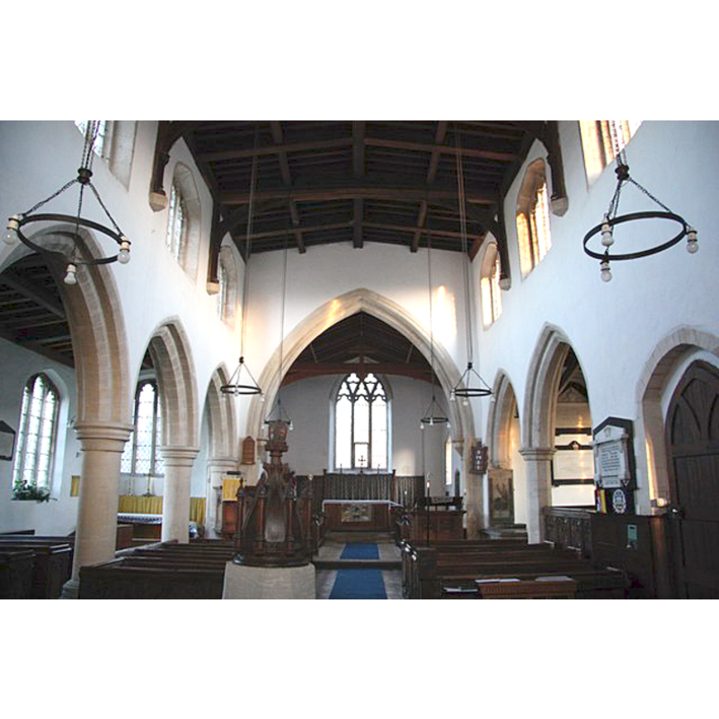
view of church interior - nave - looking west
Copyright Statement: Image copyright © Richard Croft, 2009
Image Source: digital photograph taken 29 January 2009 by Richard Croft [www.geograph.org.uk/photo/1139580] [accessed 24 April 2012]
Copyright Instructions: CC-BY-SA-2.0
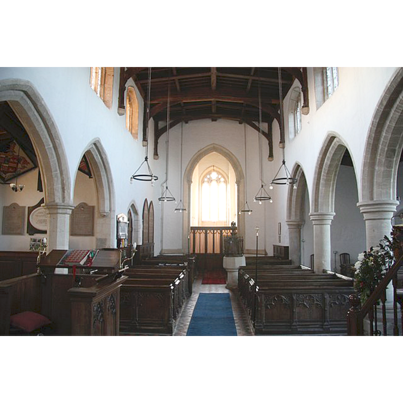
view of church interior - nave - looking east
Copyright Statement: Image copyright © Richard Croft, 2009
Image Source: digital photograph taken 29 January 2009 by Richard Croft [www.geograph.org.uk/photo/1139574] [accessed 24 April 2012]
Copyright Instructions: CC-BY-SA-2.0
view of font cover
Copyright Statement: Image copyright © Colin Hinson, 2008
Image Source: Colin Hinson [www.yorkshireCDbooks.coml]
Copyright Instructions: Image and permission received (e-mail of 10 September 2004)
INFORMATION
Font ID: 10051DID
Object Type: Baptismal Font1
Font Century and Period/Style: 13th century [re-cut], Medieval [altered]
Church / Chapel Name: Parish Church of St. Lawrence
Font Location in Church: Inside the church, in the nave, W end
Church Patron Saint(s): St. Lawrence [aka Laurence]
Church Address: Diddington, Cambridgeshire, PE19 5XT
Site Location: Cambridgeshire, East, England, United Kingdom
Directions to Site: Located on the A1, about 7 km S of Brampton and N of St. Neots
Ecclesiastic Region: Diocese of Ely
Historical Region: formerly in Huntingdonshire -- Hundred of Toseland
Additional Comments: altered font?: basin re-cut from round?
Font Notes:
Click to view
The Victoria County History (Huntingdon, vol. 2, 1932) notes: "The church of Diddington existed in 1086, when it belonged to the Bishop of Lincoln's manor. [...] Although mentioned in the Domesday Survey (1086), the nucleus of the present church is the chancel and nave of the first half of the 13th century, to which a north aisle was added c. 1275. The church was much altered c. 1500 [...] The 13th-century font has an octagonal bowl on a circular shaft with chamfered cap and base." The baptismal font at Diddington has been very roughly treated, most of its earlier surface stripped from it; from what is left now, the basin may have been round, tub-shaped, but re-cut at a later date; the sizes of the sides are irregular and give the general impression of not being the original form of the basin; plain underbowl; plain cylindrical stem; the lower base may be the only part of this font that has any resemblence to the original one. The basin well is lead-lined. Tallish wooden font cover, a domed core with eight elongated towers all around; pelican-plucking-its-breast finial; Victorian.
Credit and Acknowledgements: We are grateful to Colin Hinson., of www.yorkshireCDbooks.com, for his photographs of this font.
COORDINATES
UTM: 30U 687150 5795555
Latitude & Longitude (Decimal): 52.278456, -0.256559
Latitude & Longitude (DMS): 52° 16′ 42.44″ N, 0° 15′ 23.61″ W
MEDIUM AND MEASUREMENTS
Material: stone
Font Shape: octagonal? [re-cut from round?] (mounted)
Basin Interior Shape: round
Basin Exterior Shape: octagonal, re-cut from round?
Drainage System: centre hole in basin
Drainage Notes: lead lining
LID INFORMATION
Date: 19th century / Victorian
Material: wood, oak?
Apparatus: no
Notes: dome with eight outer turrets, and pelican-plucking-its-breast finial
REFERENCES
- Victoria County History [online], University of London, 1993-. URL: https://www.british-history.ac.uk.