Little Abington No. 2 / Abintone
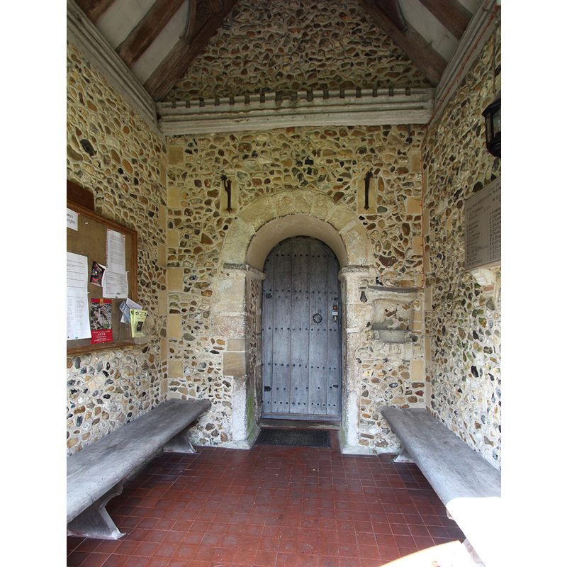
Image copyright © John Salmon, 2015
CC-BY-SA-2.0
Results: 2 records
view of church exterior - south porch
Scene Description: the old holy-water stoup is wall-mounted to the right of the south portal
Copyright Statement: Image copyright © John Salmon, 2015
Image Source: digital photograph taken 1 September 2015 by John Salmon [www.geograph.org.uk/photo/4672348] [accessed 17 May 2016]
Copyright Instructions: CC-BY-SA-2.0
view of stoup
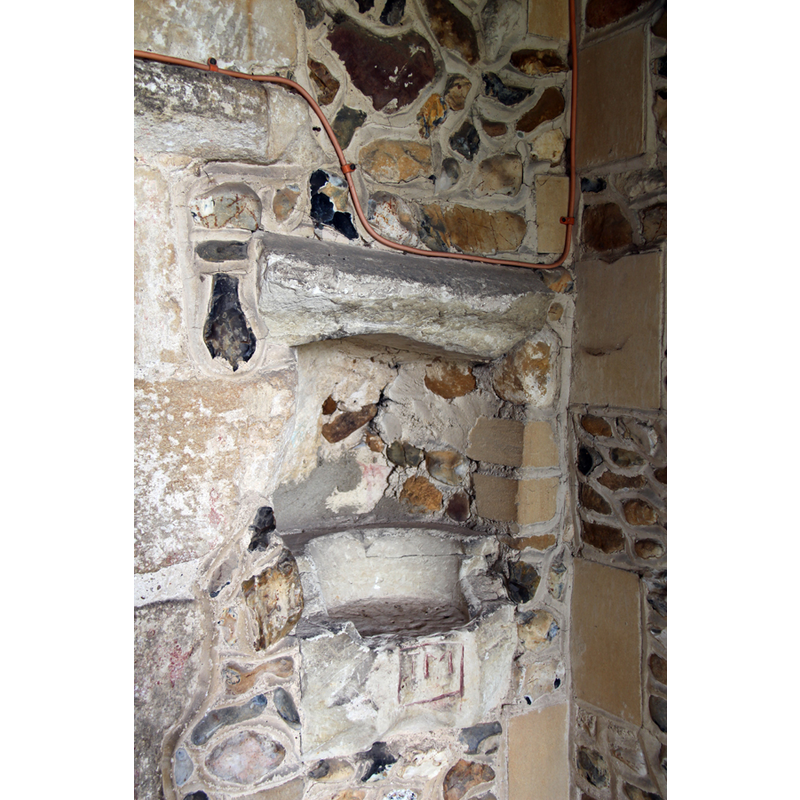
Scene Description: what remains of it
Copyright Statement: Image copyright © John Salmon, 2015
Image Source: digital photograph taken 1 September 2015 by John Salmon [www.geograph.org.uk/photo/4672412] [accessed 17 May 2016]
Copyright Instructions: CC-BY-SA-2.0
INFORMATION
Font ID: 10027ABI
Object Type: Stoup
Font Century and Period/Style: 11th - 12th century, Pre-Conquest? / Norman?
Church / Chapel Name: Parish Church of St. Mary the Virgin
Font Location in Church: Outside, in the S porch, to the right of the doorway
Church Patron Saint(s): St. Mary the Virgin
Church Address: Church Lane, Little Abington, Cambridgeshire CB1 6BQ
Site Location: Cambridgeshire, East, England, United Kingdom
Directions to Site: Located at the junction A11-A1307, 11-12 km SE of Cambridge
Ecclesiastic Region: Diocese of Ely
Historical Region: Hundred of Chilford
Additional Comments: damaged stoup: mutilated [cf. FontNotes]
Font Notes:
Click to view
There are two entries for [Great and Little] Abington [variant spelling] in the Domesday survey [http://opendomesday.org/place/XX0000/great-and-little-abington/] [accessed 17 May 2016], neither of which mentions a church in it. Cox & Harvey (1907) list a baptismal font of the Early English period here. The Victoria County History (Cambridge..., vol. 6, 1978) notes: "The church of Little Abington includes fabric which may be of c. 1100; demesne tithes there were granted c. 1130, and the advowson was recorded c. 1200 [...] The fabric of the nave may be of c. 1100. Its surviving doorways have round arches and heavy stonework. The blocked north doorway has rough chip-carving on its abacus
"; no stoup mentioned in the VCH entry. A stoup here is described in the Cambridgeshire Churches web site [www.druidic.org/camchurch] as a mutilated holy-water stoup located outside, by the doorway [NB: the doorway has been dated usually to the 11th century]. [cf. Index entry for Little Abington No. 1 for a baptismal font of the Early English period in this same church]
"; no stoup mentioned in the VCH entry. A stoup here is described in the Cambridgeshire Churches web site [www.druidic.org/camchurch] as a mutilated holy-water stoup located outside, by the doorway [NB: the doorway has been dated usually to the 11th century]. [cf. Index entry for Little Abington No. 1 for a baptismal font of the Early English period in this same church]
COORDINATES
UTM: 31U 310285 5777911
Latitude & Longitude (Decimal): 52.119132, 0.228891
Latitude & Longitude (DMS): 52° 7′ 8.87″ N, 0° 13′ 44.01″ E
MEDIUM AND MEASUREMENTS
Material: stone
REFERENCES
- Victoria County History [online], University of London, 1993-. URL: https://www.british-history.ac.uk.