Holme next the Sea No. 1 / Holm / Holm by the Sea / Holme next the Sea / Holme-next-the-Sea / Hulmo
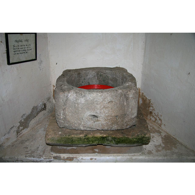
Image copyright © Brokentaco, 2007
CC-BY-SA-3.0
Results: 7 records
view of basin
Copyright Statement: Image copyright © Brokentaco, 2007
Image Source: digital photograph taken 5 July 2007 by Brokentaco [www.flickr.com/photos/brokentaco/1005917160/] [accessed 28 May 2012]
Copyright Instructions: CC-BY-SA-3.0
design element - motifs - piping or ribbed - 4
Scene Description: at 90-degree angles
Copyright Statement: Image copyright © Brokentaco, 2007
Image Source: digital photograph taken 5 July 2007 by Brokentaco [www.flickr.com/photos/brokentaco/1005917160/] [accessed 28 May 2012]
Copyright Instructions: CC-BY-SA-3.0
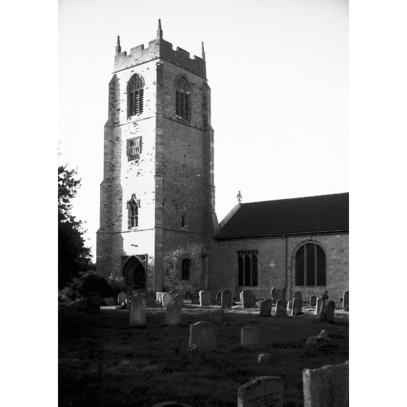
view of church exterior - northwest view
Copyright Statement: Image copyright © Simon Knott, 2006
Image Source: digital photograph September 2006 taken by Simon Knott [www.norfolkchurches.co.uk/holme/holme.htm] [accessed 7 April 2014]
Copyright Instructions: Standing permission
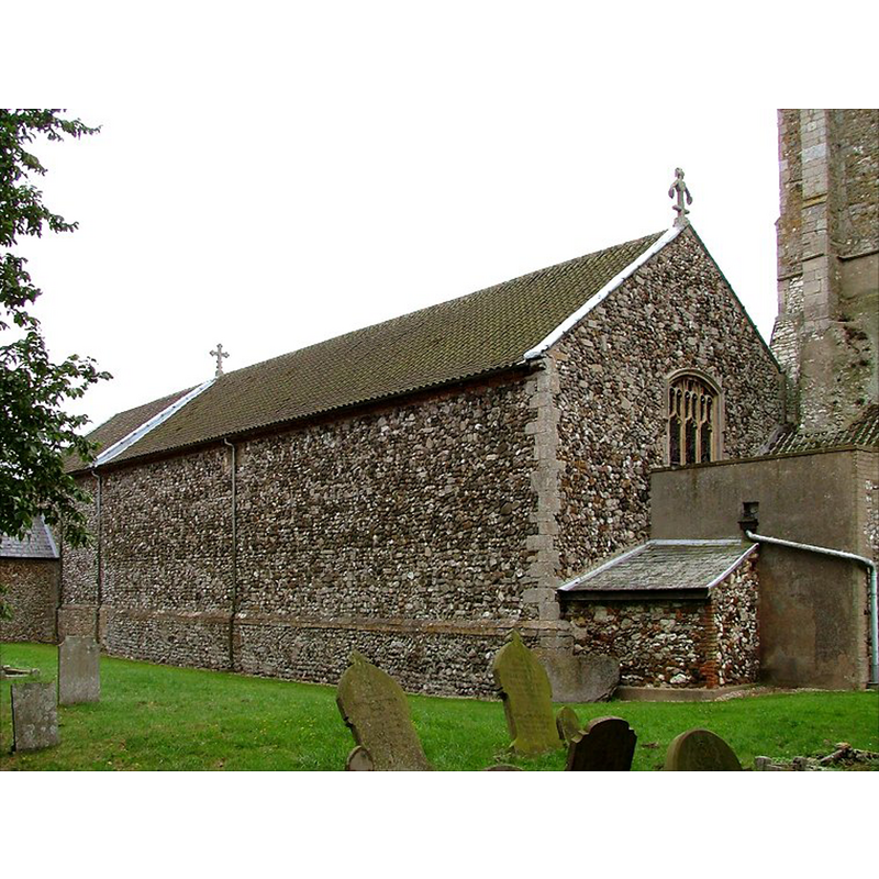
view of church exterior - southeast view
Scene Description: Photo caption: "The nave rebuilt in 1779 mainly using material from the aisles"
Copyright Statement: Image copyright © George Plunkett, 2014
Image Source: B&W photograph taken 1 October 1995 by George Plunkett [www.georgeplunkett.co.uk/Norfolk/H/Holme next Sea St Mary's church from SE [7279] 1995-10-01.jpg] [accessed 7 April 2014]
Copyright Instructions: Standing permission by Jonathan Plunkett
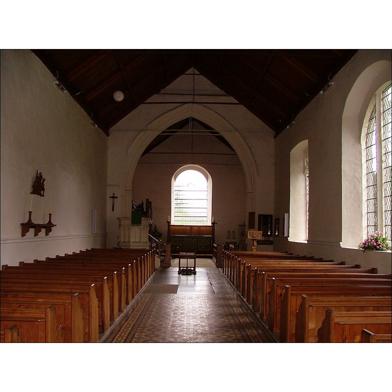
view of church interior - nave - looking west
![the modern font partially visible at the far [west] end, right [north] side](/static-50478a99ec6f36a15d6234548c59f63da52304e5/compressed/1140407004_compressed.png)
Scene Description: the modern font partially visible at the far [west] end, right [north] side
Copyright Statement: Image copyright © Simon Knott, 2006
Image Source: digital photograph September 2006 taken by Simon Knott [www.norfolkchurches.co.uk/holme/holme.htm] [accessed 7 April 2014]
Copyright Instructions: Standing permission
view of church interior - nave - looking east
Copyright Statement: Image copyright © Simon Knott, 2006
Image Source: digital photograph September 2006 taken by Simon Knott [www.norfolkchurches.co.uk/holme/holme.htm] [accessed 7 April 2014]
Copyright Instructions: Standing permission
view of font

Copyright Statement: Image copyright © The Saxonshore Benefice, 2004
Image Source: The Saxonshore Benefice [www.saxonshorebenefice.fsnet.co.uk]
Copyright Instructions: PERMISSION NOT AVAILABLE -- IMAGE NOT FOR PUBLIC USE
INFORMATION
Font ID: 10016HOL
Object Type: Baptismal Font1, basin only
Font Century and Period/Style: 12th century (late) (?), Late Norman
Church / Chapel Name: Parish Church of St. Mary the Virgin
Font Location in Church: Inside the porch
Church Patron Saint(s): St. Mary the Virgin
Church Address: Kirkgate, Holme next the sea, Norfolk, PE36 6LJ
Site Location: Norfolk, East Anglia, England, United Kingdom
Directions to Site: Located off the A149, 5 km NE of Hunstanton, to thw W of Brancaster Bay on the northern coast of the county
Ecclesiastic Region: Diocese of Norwich
Historical Region: Hundred of Smethdon
Additional Comments: recycled font? : appears to have been used as water trough at some point
Font Notes:
Click to view
There are two entries for Holme [next the Sea] in the Domesday survey [http://domesdaymap.co.uk/place/TF7043/holme-next-the-sea/] [accessed 7 April 2014], but neither mentions a church or cleric in it. Blomefield (1805-1810) writes: "The Church was anciently a rectory [...] The church is dedicated to the Virgin Mary, and is a regular pile, containing a nave, a north and south isle, with a chancel covered with lead, and a four-square tower at the west end of the south isle, with 5 bells, and was built by Henry de Nottingham, who was one of the council of the duchy of Lancaster, in the 5th and 6th, &c. of Henry IV" [i.e., 1404, 1405]. Blomefield (ibid.), however, gives information that make it clear an earlier church existed here: "William de Tregos was rector in the time of William de Ralegh Bishop of Norwich" [NB: Ralegh, aka Raley, Raleigh, became bishop of Norwich in 1239 and died in 1250]; one other event related to the earlier church here was: "George, son of Laurence de Holm, impleaded the abbot of Lilleshall in Shropshire, for the advowson of the church of St. Mary de Hulmo, by the Sea, of which his ancestor was possessed in the time of King Richard I. but George not appearing, judgment was given that the abbot and his successors, should quietly enjoy it." The reference to the earlier holder of the advowson of the "de Hulmo" church in Richard I's reign [1189-1199], gives us a possible date range for the original church here between 1086 and 1199, which would correspond to the period of the old font here. The church at Holme-next-the-Sea has three baptismal fonts according to The Saxonshore Benefice [www.saxonshorebenefice.fsnet.co.uk], the oldest of which is an "old primitive stone [...] supported on a drainage stone" inside the church. The basin is roughly cilyndrical with rounded vertical bulges at 90-degree angles; it appears totally plain [NB: the font has a drainage hole on the front side consistent with its use as water trough at some point in its existence]. [cf. Index entry for Holme next the Sea No. 2 for a later font in use until 1885 in this church -- the font currently in use dates from 1885 and is therefore not included in this Index; it is the font noted and Pevsner & Wilson (1999) and illustrated in Knott (2006)]
COORDINATES
UTM: 31U 334771 5870742
Latitude & Longitude (Decimal): 52.9608, 0.539975
Latitude & Longitude (DMS): 52° 57′ 38.88″ N, 0° 32′ 23.91″ E
MEDIUM AND MEASUREMENTS
Material: stone
Number of Pieces: one [basin only]
Font Shape: cylindrical
Basin Interior Shape: round
Basin Exterior Shape: round (with angle knobs)
REFERENCES
- Blomefield, Francis, An essay towards a topographical history of Norfolk, 1805-1810, vol. 10: 328-334 / [www.british-history.ac.uk/report.aspx?compid=78687] [accessed 7 April 2014]
- Knott, Simon, The Norfolk Churches Site, Simon Knott, 2004. [standing permission to reproduce images received from Simon (February 2005]. URL: www.norfolkchurches.co.uk.
- Pevsner, Nikolaus, Norfolk 2: North-West and South (2nd ed.), London: Penguin, 1999, p. 426