Horningsea / Horningesie
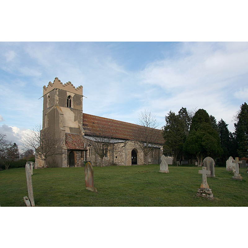
Image copyright © Mark Ynys-Mon, 2004
Standing permission
Results: 3 records
view of church exterior - southwest view
Copyright Statement: Image copyright © Mark Ynys-Mon, 2004
Image Source: digital photograph by Mark Ynys-Mon, in Cambridgeshire Churches [http://www.druidic.org/camchurch/fulllist.htm] [accessed 28 October 2007]
Copyright Instructions: Standing permission
view of font in context
Copyright Statement: Image copyright © Mark Ynys-Mon, 2004
Image Source: detail of a digital photograph by Mark Ynys-Mon, in Cambridgeshire Churches [http://www.druidic.org/camchurch/fulllist.htm] [accessed 28 October 2007]
Copyright Instructions: Standing permission
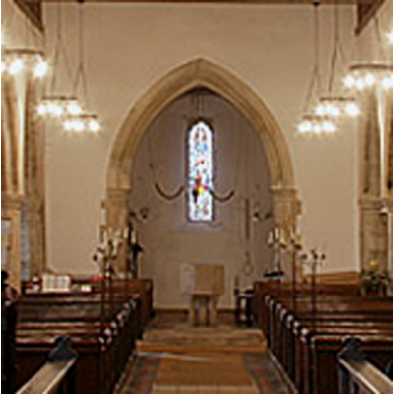
view of church interior - nave - looking west

Copyright Statement: Image copyright © Mark Ynys-Mon, 2004
Image Source: digital photograph by Mark Ynys-Mon, in Cambridgeshire Churches [http://www.druidic.org/camchurch/fulllist.htm] [accessed 28 October 2007]
Copyright Instructions: Standing permission
INFORMATION
Font ID: 10010HOR
Object Type: Baptismal Font1
Font Century and Period/Style: 13th century (early?) [basin only] [composite font], Medieval [composite]
Church / Chapel Name: Parish Church of St. Peter
Font Location in Church: Inside the church, in the W end, beneath the tower arch
Church Patron Saint(s): St. Peter
Church Address: 4 Church End, Cambridge CB25 9JQ
Site Location: Cambridgeshire, East, England, United Kingdom
Directions to Site: Located off (N) the A14, 4-5 km NE of Cambridge
Ecclesiastic Region: Diocese of Ely
Historical Region: Hundred of Flendish [Fleamdyke in Domesday]
Additional Comments: altered font / composite font: new base -- disappeared font? (the one from the 9thC church here)
Font Notes:
Click to view
There is an entry for Horningsea [variant spelling] in the Domesday survey [http://opendomesday.org/place/TL4962/horningsea/] [accessed 19 July 2016], but it mentions neither cleric nor church in it. The RCHM (1972) notes: "Font: octagonal bowl with deep uncarved sides, lead-lined, set on one central and four peripheral octagonal columns each with splayed capitals, necking and triple-roll bases, stands on moulded octagonal base and large octagonal foot-pace, early 13th-century." The Victoria County History (Cambridge and the Isle of Ely, vol. 10, 2002) notes: "A minster recorded at Horningsea in the early 10th century may have survived the occupation of the area by the invading Danes in the late 9th. […] In the early 10th century the priest Cenwold was succeeded as its head by the priest Herulf. Between 963 and 970 Bishop Aethelwold purchased the minster from King Edgar […] but control of its property remained in dispute. Bishop Aethelwold eventually gained possession of the minster, and before his death in 984 granted it to the monks of Ely. From 1109 rights over the church at Horningsea passed to the newly established bishops of Ely. […] The existing parish church […] may occupy the site of the 10th-century minster. […] That earlier church perhaps consisted of a single-celled main body with porticus to north and south, putatively providing the ground plan for its successor. […] he existing parish church, dedicated to ST. PETER by 1266, (fn. 46) may occupy the site of the 10th-century minster. (fn. 47) That earlier church perhaps consisted of a single-celled main body with porticus to north and south, putatively providing the ground plan for its successor." The old basin is octagognal with plain vertical sides; it is now raised on a modern columnar base. The Victoria County History (Cambridge, vol. 10, 2002) notes: "A minster recorded at Horningsea in the early 10th century may have survived the occupation of the area by the invading Danes in the late 9th [century] [...] The existing parish church, dedicated to St. Peter by 1266, [...] may occupy the site of the 10th-century minster [...] Surviving fittings include the early 13th-century font bowl" [i.e., survivor of the 13th-century additions to the earlier minster]
Credit and Acknowledgements: We are grateful to Mark Ynys-Mon, of Cambridgeshire Churches [www.druidic.org/camchurch/], for his photographs of this church
COORDINATES
UTM: 31U 307795 5791637
Latitude & Longitude (Decimal): 52.241531, 0.184778
Latitude & Longitude (DMS): 52° 14′ 29.51″ N, 0° 11′ 5.2″ E
MEDIUM AND MEASUREMENTS
Material: stone
Number of Pieces: one [basin only]
Font Shape: octagonal, mounted
Basin Interior Shape: round
Basin Exterior Shape: octagonal
Drainage Notes: lead-lined
REFERENCES
- The Victoria History of the Counties of England: A History of the County of Cambridge and the Isle of Ely, 2002, vol. X: p. [168?]
- Victoria County History [online], University of London, 1993-. URL: https://www.british-history.ac.uk.
- Great Britain. Royal Commission on Historical Monuments (England), An inventory of historical monuments in the County of Cambridge, Woking; London: Printed in England for Her Majesty's Stationary Office by Unwin Brothers Unlimited, 1968, vol. 2: 68