Bosherston No. 2 / Llanfihangel-clogwyn-gofan
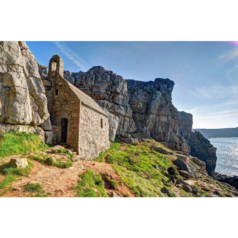
Image copyright © David Skinner, 2014
CC-BY-SA-2.0
Results: 4 records
view of church exterior in context - southwest view
Scene Description: Source caption: "Capel Sant Gofan, Sir Benfro / St Govan's Chapel, Pembrokeshire"
Copyright Statement: Image copyright © David Skinner, 2014
Image Source: digital photograph 4 September 2014 by David Skinner [https://commons.wikimedia.org/wiki/File:St_Govan's_Chapel.jpg] [accessed 9 March 2024]
Copyright Instructions: CC-BY-SA-2.0
view of church interior
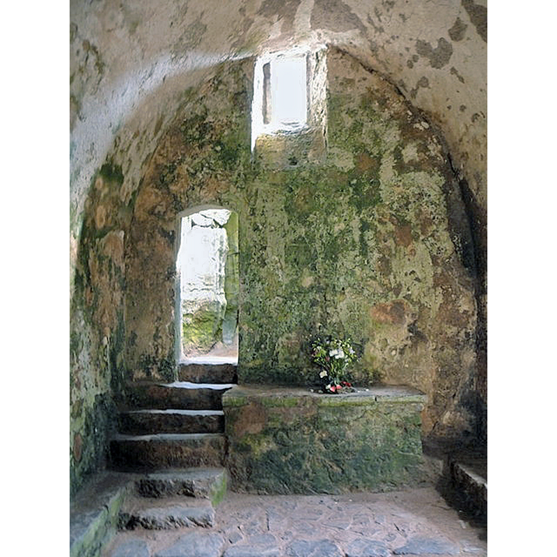
Scene Description: Source caption: "St. Govan’s Head: inside the chapel"
Copyright Statement: Image copyright © Chris Downer, 2010
Image Source: digital photograph 19 August 2010 by Chris Downer [https://www.geograph.org.uk/photo/2027185] [accessed 9 March 2024]
Copyright Instructions: CC-BY-SA-2.5
view of stoup - fragment

Scene Description: Source caption: "Holy water stoup, Church of St Michael and All Angels, Bosherston, Pembrokeshire"
view of font and stoup in context
Scene Description: Source caption: "Square Norman font, the decoration machined away, Church of St Michael and All Angels, Bosherston, Pembrokeshire" -- the altered Norman font and, on the floor, to the left, the damaged stoup basin
INFORMATION
Font ID: 10005BOT
Object Type: Stoup
Font Century and Period/Style: 11th - 13th century, Medieval
Church / Chapel Name: Chapel of St. Govan
Font Location in Church: [cf. FontNotes]
Church Patron Saint(s): St. Govan [aka Gofan]
Church Address: St Govan's Head, Bosherston, Pembrokeshire, SA71 5DR , United Kingdom
Site Location: Pembrokeshire, Wales, United Kingdom
Directions to Site: Located 2 km S of Bosherston, itself off the B4319, near Pembroke
Additional Comments: fragment of a stoup?
Font Notes:
Click to view
Listed in Lloyd et al. (2004) as a stoup in this chapel. The chapel itself is of difficult dating and suggestions range from the 6th to the 13th century, but the building and the stoup are most likely closer to the latter. An early well -both wishing and healing, according to the web site of the parish- is related to the legend of saint Govan, a 6th-century missionary originally from Co. Wexford, Ireland, is said to go back to his time [source: www.revjones.fsnet.co.uk/govan/] [NB: the fragment of the stoup appears to heve been moved to the parish church at Bosherston]
COORDINATES
UTM: 30U 365858 5718183
Latitude & Longitude (Decimal): 51.5987, -4.9368
Latitude & Longitude (DMS): 51° 35′ 55.32″ N, 4° 56′ 12.48″ W
MEDIUM AND MEASUREMENTS
Material: stone
Font Shape: fragment
REFERENCES
- Lloyd, Thomas, Pembrokeshire, New Haven and London: Yale University Press, 2004, p. 131