Souldrop / Soulthorp
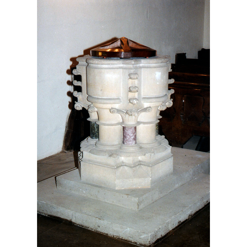
Image copyright © John Salmon, 2012
CC-BY-SA-2.0
Results: 3 records
view of font and cover
Scene Description: the modern font; mid-19thC?
Copyright Statement: Image copyright © John Salmon, 2012
Image Source: photograph taken in 1980 by John Salmon [www.geograph.org.uk/photo/3263694] [accessed 11 September 2015]
Copyright Instructions: CC-BY-SA-2.0
view of church exterior - southeast view
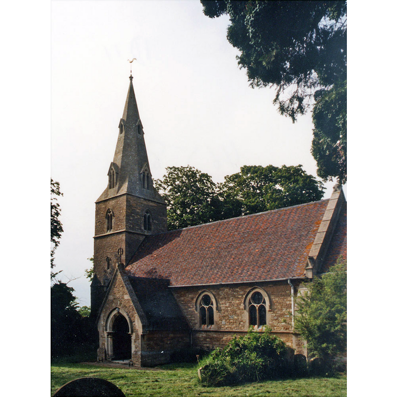
Copyright Statement: Image copyright © John Salmon, 2012
Image Source: photograph taken in 1980 by John Salmon [www.geograph.org.uk/photo/3263690] [accessed 11 September 2015]
Copyright Instructions: CC-BY-SA-2.0
view of church interior - nave - looking east
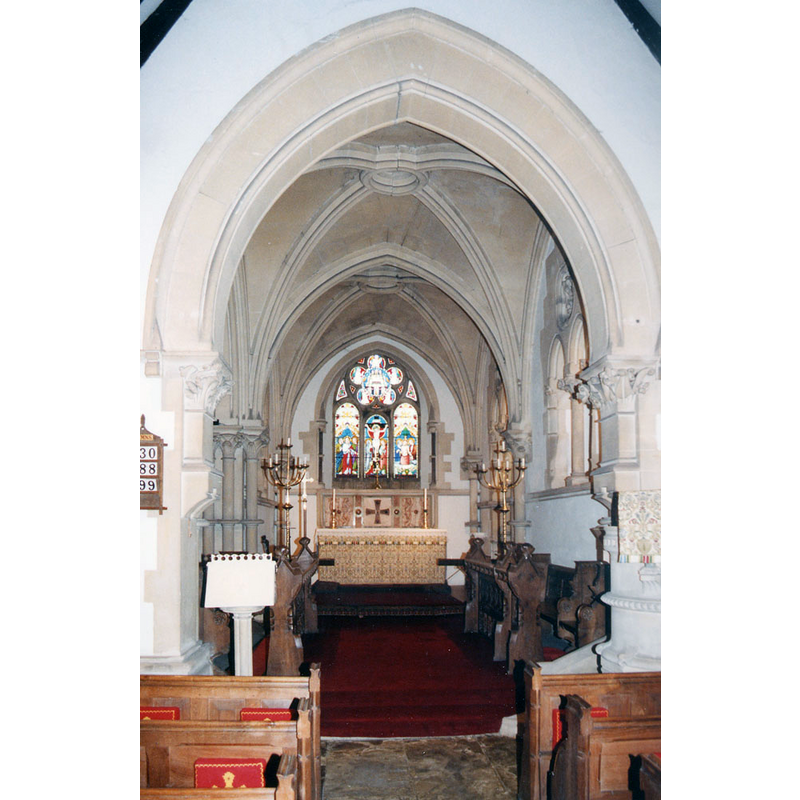
Copyright Statement: Image copyright © John Salmon, 2012
Image Source: photograph taken in 1980 by John Salmon [www.geograph.org.uk/photo/3263692] [accessed 11 September 2015]
Copyright Instructions: CC-BY-SA-2.0
INFORMATION
Font ID: 09983SOU
Object Type: Baptismal Font1
Font Century and Period/Style: 13th century (late?), Medieval
Church / Chapel Name: Parish Church of All Saints
Church Patron Saint(s): All Saints
Church Address: Sharnbrook Lane, Souldrop, Bedfordshire, MK44 1EX
Site Location: Bedfordshire, East, England, United Kingdom
Directions to Site: Located near Sharnbrook, Podington and Odell, near the county border with Nhants.
Ecclesiastic Region: Diocese of St. Albans
Historical Region: Hundred of Willey
Additional Comments: disappeared font? (the medieval one)
Font Notes:
Click to view
No entry for Souldrop found in the Domesday survey. The Victoria County History (Bedford, vol. 3, 1912) notes: "The church of Souldrop formed part of the original endowment of the preceptory of Melchbourne, and continued to belong to the Knights Hospitallers until their dissolution [...] The only ancient part of the church is the west tower, which dates from the second half of the 13th century. The old church fell down towards the end of the 18th century and was replaced by a barn-like structure, which was succeeded by the present building"; there is no mention of a font in the VCH entry. The modern font dates probably from the 1861 renovation-re-building of the church. [NB: we have no information on the medieval font of this church].
COORDINATES
UTM: 30U 666698 5790871
Latitude & Longitude (Decimal): 52.242966, -0.558359
Latitude & Longitude (DMS): 52° 14′ 34.68″ N, 0° 33′ 30.09″ W
REFERENCES
- Victoria County History [online], University of London, 1993-. URL: https://www.british-history.ac.uk.