Acton Turville / Achetone
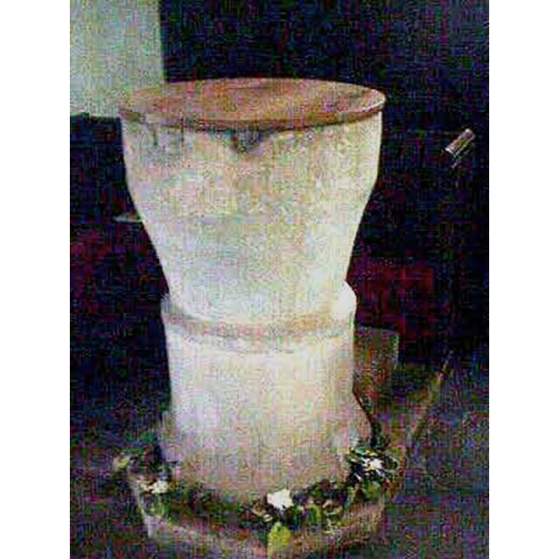
Image copyright © John Wilkes, 2008
Standing permission
Results: 3 records
view of font and cover
Copyright Statement: Image copyright © John Wilkes, 2008
Image Source: digital photograph by John Wilkes in www.allthecotswolds.com [accessed 18 March 2008]
Copyright Instructions: Standing permission
view of church exterior - north porch
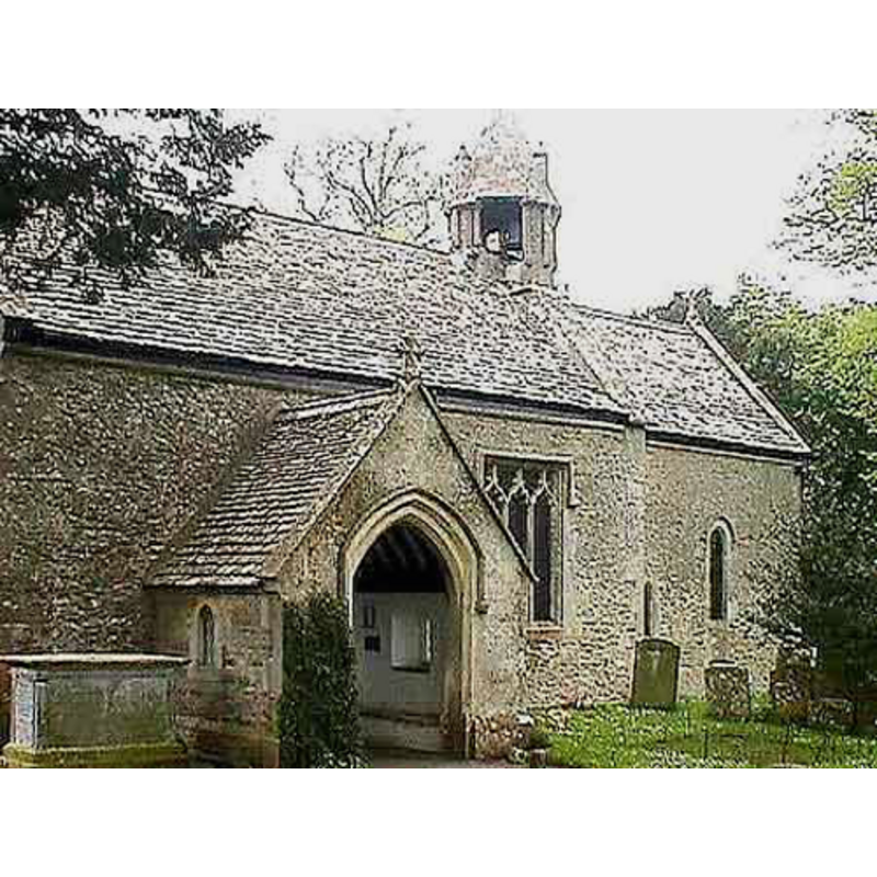
Copyright Statement: Image copyright © John Wilkes, 2008
Image Source: digital photograph by John Wilkes in www.allthecotswolds.com [accessed 18 March 2008]
Copyright Instructions: Standing permission
view of church exterior
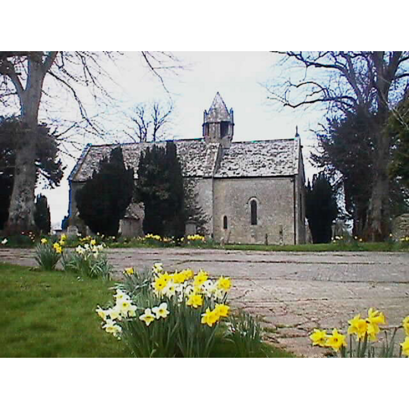
Copyright Statement: Image copyright © John Wilkes, 2008
Image Source: digital photograph by John Wilkes in www.allthecotswolds.com [accessed 18 March 2008]
Copyright Instructions: Standing permission
INFORMATION
Font ID: 09877ACT
Object Type: Baptismal Font1
Font Century and Period/Style: 12th century, Late Norman
Church / Chapel Name: Parish Church of St. Mary
Font Location in Church: Inside the church
Church Patron Saint(s): St. Mary the Virgin
Church Address: Acton Turville, Chipping Sodbury GL9 1HL , UK -- Tel.: 01454 219236
Site Location: Gloucestershire, South West, England, United Kingdom
Directions to Site: Located off the B4039, N of the M4, 3-4 km S of Badminton, near the Wiltshire border, in S Gloucestershire, 28 km ENE of Bristol
Ecclesiastic Region: Diocese of Gloucester
Historical Region: Hundred of Grimboldestou
Additional Comments: damaged font [cf. FontNotes
Font Notes:
Click to view
There is an entry for Acton [Turville] [variant spelling] in the Domesday survey [https://opendomesday.org/place/ST8080/acton-turville/] [accessed 20 June 2019] but it mentions neither cleric nor church in it. Kelly's Directory of 1856 mentions a font in this church. Noted in Verey & Brooks (1999-2002) as a Norman tub-shaped font. Baptismal font of the Norman period noted and illustrated in John Wilkes [www.allthecotswolds.com] [accessed 18 March 2008]; the basin is cylindrical at the upper part but the tapers off, all plain; it is raised on base that is cylindrical and plain except towards the bottom, where it splays out slightly. The plinth is narrow and polygonal, with a kneeling extension. The wooden cover is round, flat and plain, modern. There is evidence of damage on the upper rim of the basin, the sort related to the removal of the staples of the old cover.
Credit and Acknowledgements: We are grateful to John Wilkes, of www.allthecotswolds.com, for his photographs of church and font
COORDINATES
UTM: 30U 550120 5708609
Latitude & Longitude (Decimal): 51.526369, -2.277517
Latitude & Longitude (DMS): 51° 31′ 34.93″ N, 2° 16′ 39.06″ W
MEDIUM AND MEASUREMENTS
Material: stone
Font Shape: tub-shaped, mounted
Basin Interior Shape: round
Basin Exterior Shape: round
LID INFORMATION
Date: modern
Material: wood
Apparatus: no
Notes: [cf. FontNotes]
REFERENCES
- Kelly, Kelly's Directory of Gloucestershire, London: Kelly's Directories Ltd., 1856, [http://www.parishmouse.com/acton_turville_kellys_gloucestershire_directory_1856] [accessed 18 March 2008
- Verey, David, Gloucestershire, London: Penguin Books, 1999-2002, vol. 1: 130