Penkridge No. 1 / Pankriz
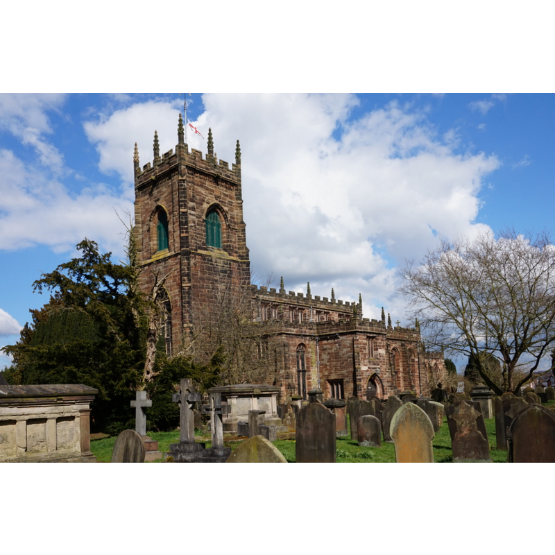
Image copyright © Ian S, 2016
CC-BY-SA-2.0
Results: 2 records
view of church exterior - southwest view
Copyright Statement: Image copyright © Ian S, 2016
Image Source: digital photograph taken 31 March 2016 by Ian S [www.geograph.org.uk/photo/4899376] [accessed 18 July 2019]
Copyright Instructions: CC-BY-SA-2.0
view of church exterior in context - southwest view
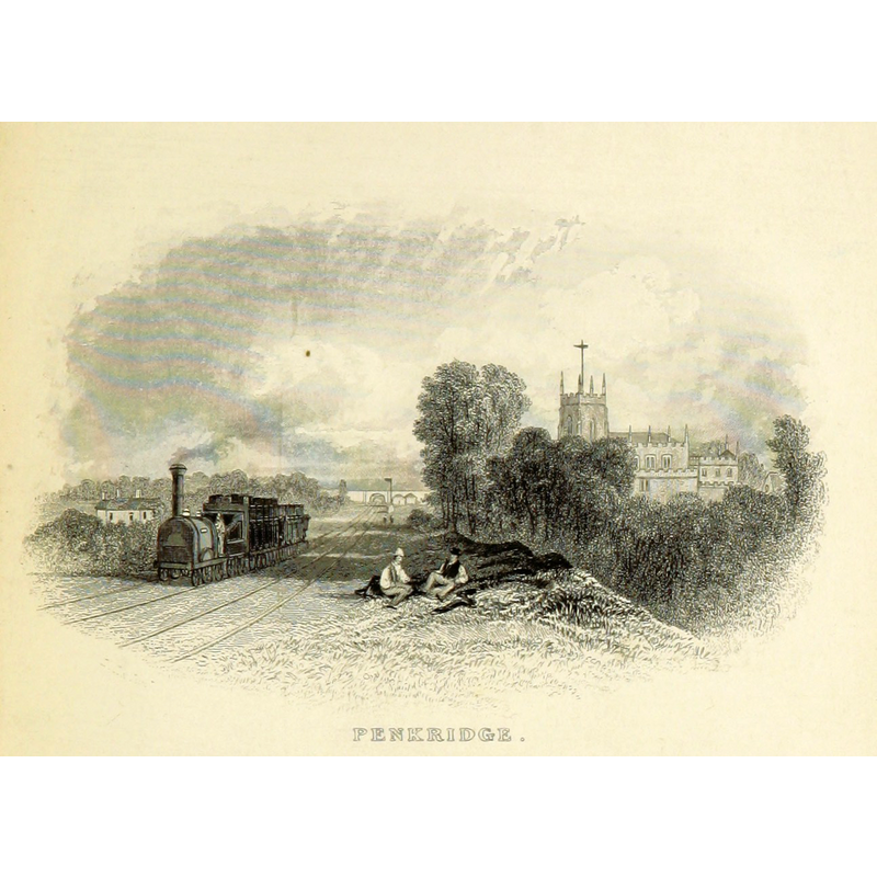
Copyright Statement: Image copyright © [in the public domain]
Image Source: digital image of a illustration in Thomas Roscoe's The Book of The Grand Junction Railway, being a history and description of the line from Birmingham to Liverpool and Manchester (1839). Original held and digitised by the British Library [www.flickr.com/photos/britishlibrary/11224121473/] [accessed 18 July 2019]
Copyright Instructions: CC-PD-Mark / PD-old-70-expired
INFORMATION
Font ID: 09874PEN
Object Type: Baptismal Font1, basin only
Font Century and Period/Style: 13th - 16th century, Medieval
Church / Chapel Name: Parish Church of St. Michael and All Angels
Font Location in Church: Inside the church, W tower
Church Patron Saint(s): St. Michael & All Angels
Church Address: New Rd, Penkridge, Stafford ST19 5DN, UK -- Tel.: +44 1785 714344
Site Location: Staffordshire, West Midlands, England, United Kingdom
Directions to Site: Located off (W) the A449 [aka Stafford / Wolverhampton Rd / Clay St]
Ecclesiastic Region: Diocese of Lichfield
Historical Region: Hundred of East Cuttlestone
Additional Comments: recycled font (the basin of a medieval font, disused in the tower [cf. FontNotes]) -- disappeared font? (the one from the pre-Conquest church here [cf. FontNotes])
Font Notes:
Click to view
There are two entries for Penkridge [variant spelling] in the Domesday survey [https://opendomesday.org/place/SJ9214/penkridge/] [accessed 18 July 2019] one of which records the Church of Penkridge as lord and tenant both in 1066 and 1086. There is an entry for the College of St. Michael, Penkridge, in the Victoria County History (Stafford, vol. 3, 1970) which notes: "Tradition in the later Middle Ages attributed the foundation of the royal free chapel of St. Michael [...] at Penkridge to King Edgar (957-75). A safer guide is the evidence of the Liber Niger, the register of John Alen, Archbishop of Dublin and Dean of Penkridge from 1528 to 1534; a note written in Alen's own hand and appended to certain records of Penkridge in the register states that the 'original founder' of the church was King Eadred (946-55). [...] In 1086 there is evidence of a community at Penkridge in the nine clerks whom Domesday Book records as holding one hide of land there in demesne of the Crown [...] The permanent union of the deanery of Penkridge and the archbishopric of Dublin had no effect on the status of the church as a royal free chapel." The VCH entry (ibid.) further relates the complex relations between the College and the parish church with the episcopacy and the college patrons, especially those involving episcopal visitations of the church and collegiate against the royal will. The VCH entry (ibid.) informs of the happenings the college faced at the Dissolution: "On the eve of the Dissolution the college of Penkridge comprised the dean and 7 prebendaries, 2 resident canons without prebends, an official principal, 6 vicars, a high deacon, a subdeacon, and a sacrist [...] Penkridge College was dissolved in 1548 under the Act of 1547. [...] The collegiate buildings may have lain to the west of the church. Some buildings of medieval and possibly early-16th-century date survive in this area, and these may have been connected with the college." The entry for this parish in the Victoria County History (Stafford, vol. 5, 1959) repeats some of the information on the origins of this church given already in its vol. 3 (1970); it further notes: "The existing building was begun early in the 13th century and was completed on approximately its present plan by c. 1300. There are no traces of the earlier church. The porch and tower were in the first instance 14th-century additions. In the 16th century the tower was raised, clerestories were added and new windows inserted, so that the exterior is now almost entirely of Perpendicular character. [...] The octagonal font dates from 1668. It has a reeded base and the bowl is carved with various devices including the initials 'C.R.' After a period of disuse the stonework was recut in 1864 and the font restored to the church", but it footnotes the following information: "An earlier inscription is shown in W.S.L., Staffs. Views, viii, p. 10 (b). Another view (p. 10 (a), 1831) describes the font as in the vicarage garden." The South Staffordshire Council web site [www.sstaffs.gov.uk] writes of a "bowl of a medieval font in the West tower" [NB: the original church is 13th-14th century] [cf. Index entry for Penkridge No. 2 for a later font of the 17th century also in this church] [NB: cf. Index entry for Pillaton for a font at the Chapel of St Modwenna, in Pillaton Hall]
COORDINATES
UTM: 30U 559600 5842045
Latitude & Longitude (Decimal): 52.725, -2.1175
Latitude & Longitude (DMS): 52° 43′ 30″ N, 2° 7′ 3″ W
MEDIUM AND MEASUREMENTS
Material: stone
Number of Pieces: one [basin oly]
REFERENCES
- Victoria County History [online], University of London, 1993-. URL: https://www.british-history.ac.uk.
- Victoria County History [online], University of London, 1993-. URL: https://www.british-history.ac.uk.