Crowell No. 1 / Clawelle
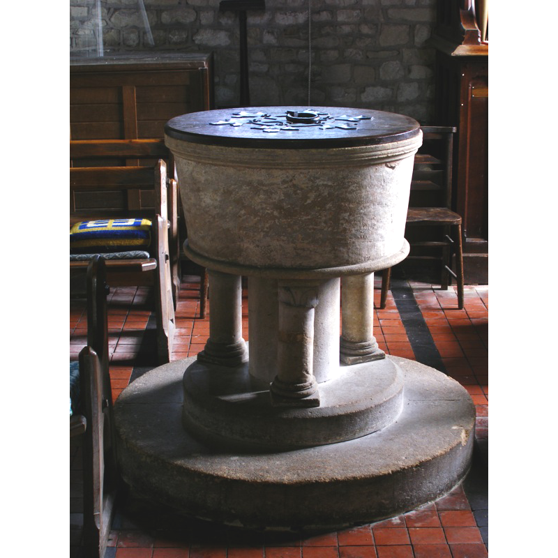
Image copyright © John Ward, 2007
Standing permission
Results: 5 records
view of font and cover
Copyright Statement: Image copyright © John Ward, 2007
Image Source: digital photograph taken 23 April 1007 by John Ward
Copyright Instructions: Standing permission
view of church exterior in context - northwest view
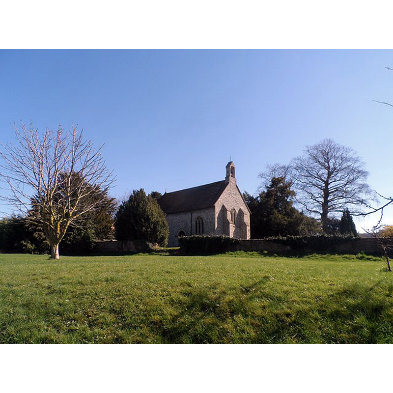
Scene Description: Source caption: "Church of the Nativity of the Blessed Virgin Mary. C12 origins as witnessed by a blocked up Norman doorway. However the church was largely rebuilt in 1878."
Copyright Statement: Image copyright © Bikeboy, 2014
Image Source: digital photograph taken 16 March 2014 by Bikeboy [www.geograph.org.uk/photo/3895709] [accessed 31 October 2017]
Copyright Instructions: CC-BY-SA-2.0
view of church exterior - southeast view
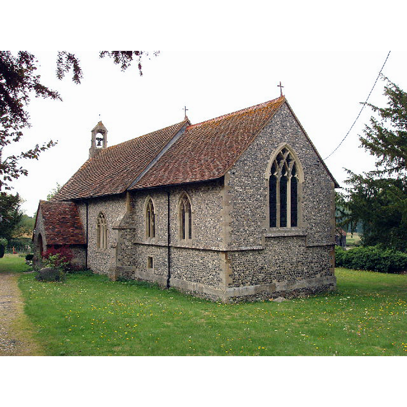
Scene Description: Source caption: "Church of The Nativity of the Blessed Virgin Mary, Crowell. The church dates from the 12th or 13th century, but was substantially rebuilt in the 1870s".
Copyright Statement: Image copyright © David Hawgood, 2005
Image Source: digital photograph taken 16 August 2005 by David Hawgood [www.geograph.org.uk/photo/39367] [accessed 31 October 2017]
Copyright Instructions: CC-BY-SA-2.0
view of church exterior in context - west view
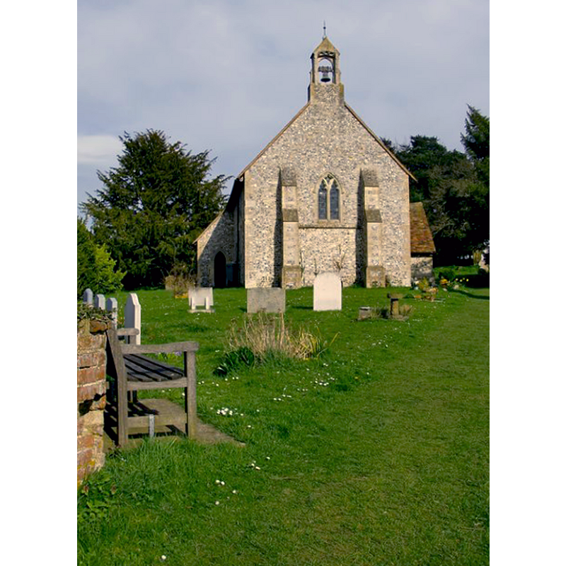
Scene Description: Source caption: "Crowell church and churchyard. Seen from the west. The open bellcote is typical of Oxfordshire churches."
Copyright Statement: Image copyright © Stefan Czapski, 2014
Image Source: digital photograph taken 1 April 2014 by Stefan Czapski [www.geograph.org.uk/photo/3916111] [accessed 31 October 2017]
Copyright Instructions: CC-BY-SA-2.0
design element - architectural - column - columns with capitals and bases
Scene Description: only the original colonnette [cf. Font notes]
Copyright Statement: Image copyright © John Ward, 2007
Image Source: digital photograph taken 23 April 1007 by John Ward
Copyright Instructions: Standing permission
INFORMATION
Font ID: 09862CRO
Object Type: Baptismal Font1
Font Century and Period/Style: 12th - 13th century [re-built], Medieval [composite]
Church / Chapel Name: Parish Church of the Nativity of the Blessed Virgin St. Mary
Font Location in Church: Inside the church
Church Patron Saint(s): St. Mary the Virgin
Church Address: off the B4009, Crowell, Oxfordshire, OX39 4RP, UK
Site Location: Oxfordshire, South East, England, United Kingdom
Directions to Site: Located off the B4009, just SW of Chinnor, 9 km S of Thame
Ecclesiastic Region: Diocese of Oxford
Historical Region: Hundred of Lewknor
Additional Comments: altered font / re-built font
Font Notes:
Click to view
There is an entry for Crowell [variant spelling] in the Domesday survey [http://opendomesday.org/place/SU7499/crowell/] [accessed 31 October 2017], but it mentions neither priest nor church in it. Kelly's Oxford Directory of 1911] reports a baptismal font of the Transitional period here. The Victoria County History (Oxford, vol. 8, 1964) notes: "The original 12th-century church has been largely rebuilt [...] In the 13th century the chancel arch was rebuilt, a south doorway was added, and perhaps the holy-water stoup which is now in the south porch. A new font was installed". The VCH also notes that there is "an illustration of the font see MS. Top. Oxon. a 66, no. 198" [i.e., Bodleian Library, Oxford]. Neither font nor stoup mentioned in Sherwood & Pevsner (1974). The re-built font consists of a round basin of plain tapering sides with mouldings at both ends, raised on a broad central shaft and four outer colonnettes, on a modern two-step plinth; one of the colonnettes of the base appears original and has a decorated capital and a moulded base; the others appear modern and have just moulded bases. The wooden cover is flat and round, with metal decoration and ring handle; appears modern too.
Credit and Acknowledgements: We are grateful to John Ward, of Oxfordshire Churches [http://homepage.mac.com/john.ward/oxfordshirechurches], for his photograph of this font
COORDINATES
UTM: 30U 643320 5728618
Latitude & Longitude (Decimal): 51.6902, -0.9265
Latitude & Longitude (DMS): 51° 41′ 24.72″ N, 0° 55′ 35.4″ W
MEDIUM AND MEASUREMENTS
Material: stone
Font Shape: tub-shaped, mounted
Basin Interior Shape: round
Basin Exterior Shape: round
LID INFORMATION
Date: modern?
Material: wood
Apparatus: no
Notes: [cf. FontNotes]
REFERENCES
- Victoria County History [online], University of London, 1993-. URL: https://www.british-history.ac.uk.
- Kelly, Kelly's Directory of Oxfordshire, London: Kelly's Directories Ltd., 1911, p. 89 / [http://www.historicaldirectories.org/hd/d.asp] [accessed 30 June 2007]