Clanfield / Chenefelde
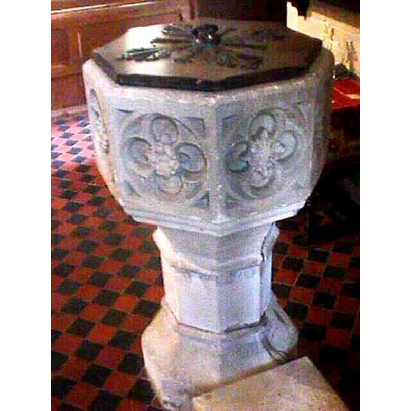
Image copyright © John Wilkes, 2009
Standing permission
Results: 6 records
view of font and cover
Copyright Statement: Image copyright © John Wilkes, 2009
Image Source: digital photograph by John Wilkes [www.allthecotswolds.com]
Copyright Instructions: Standing permission
design element - motifs - floral - in a quatrefoil - in a cricle - in a square - 8
Scene Description: one on each side of the basin
Copyright Statement: Image copyright © John Wilkes, 2009
Image Source: digital photograph by John Wilkes [www.allthecotswolds.com]
Copyright Instructions: Standing permission
design element - motifs - moulding - graded
Copyright Statement: Image copyright © John Wilkes, 2009
Image Source: digital photograph by John Wilkes [www.allthecotswolds.com]
Copyright Instructions: Standing permission
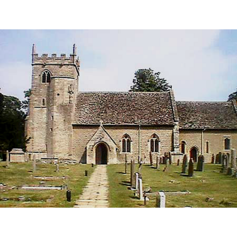
view of church exterior - south view
Copyright Statement: Image copyright © John Wilkes, 2009
Image Source: digital photograph by John Wilkes [www.allthecotswolds.com]
Copyright Instructions: Standing permission
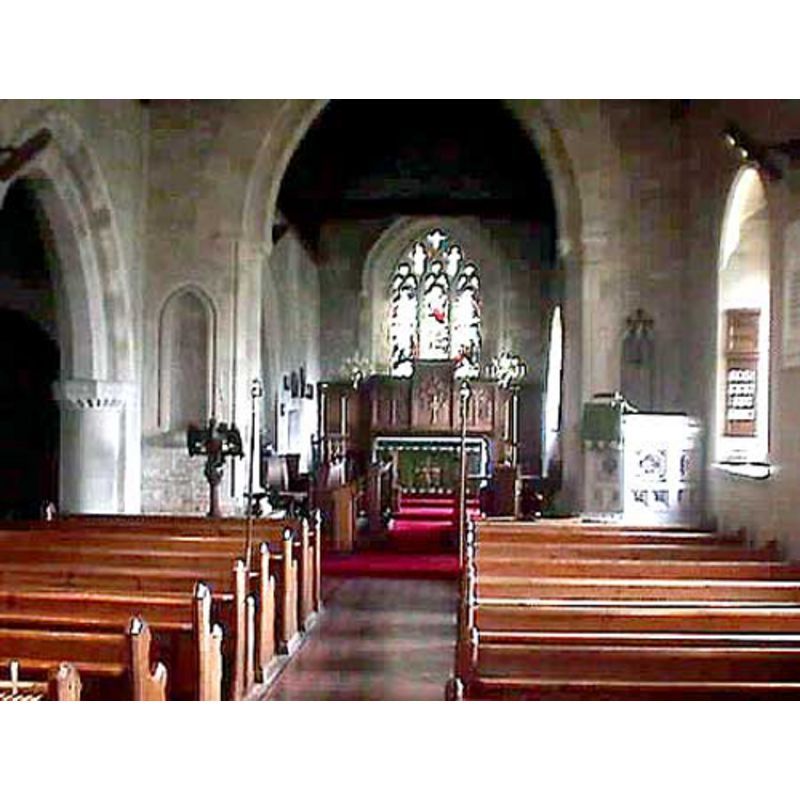
view of church interior - nave - looking east
Copyright Statement: Image copyright © John Wilkes, 2009
Image Source: digital photograph by John Wilkes [www.allthecotswolds.com]
Copyright Instructions: Standing permission
design element - motifs - moulding
Scene Description: on the stem and lower base
Copyright Statement: Image copyright © John Wilkes, 2009
Image Source: digital photograph by John Wilkes [www.allthecotswolds.com]
Copyright Instructions: Standing permission
INFORMATION
Font ID: 09846CLA
Object Type: Baptismal Font1
Font Century and Period/Style: 15th century [basin only] [composite font], Late Medieval
Church / Chapel Name: Parish Church of St. Stephen the Martyr [originally St John the Baptist's]
Font Location in Church: Inside the church
Church Patron Saint(s): Medieval dedication to St. John the Baptist -- present dedication to St. Stephen [since at least 1506]
Church Address: Pound Lane, Clanfield, Oxford OX18 2PA, UK
Site Location: Oxfordshire, South East, England, United Kingdom
Directions to Site: Located off the A4095-B4020 crossroads, 3 km SE of Alvescot, 6 km N of Faringdon, 13 km SW of Witney
Ecclesiastic Region: Diocese of Oxford
Historical Region: Hundred of Bampton
Additional Comments: altered font (the present font has a later replacement base) -- disappeared font? (the one from the original 12thC church here)
Font Notes:
Click to view
There is an entry for Clanfield [variant spelling] in the Domesday survey [http://opendomesday.org/place/SP2802/clanfield/] [accessed 12 December 2017], but it mentions neither priest nor church in it. The Ecclesiastical and Architectural Topography of England: Oxfordshire (1850) notes: "The font is P[erpendicular], cup-shaped, panelled with quatrefoils and roses." Noted in Kelly's Oxford Directory of 1911: "the font is octagonal and panelled". In Sherwood & Pevsner (1974): "Font. C15. Octagonal, with a quatrefoil on each face. The base is new." The entry for this parish in the Victoria County History (Oxon., vol. 15, 2006) notes: "clanfield had its own church by the late 12th century, though the former minster church at Bampton retained burial rights until the early 16th [...] A chapel subject to Bampton, within whose late Anglo-Saxon parochia Clanfield lay, was established before the late 12th century, presumably by a lord of Clanfield manor [...] In the early 14th century it was dedicated to St John the Baptist, [...] but probably by the late 15th century and certainly by 1506 its dedication was to St Stephen the Martyr [...] The church had baptismal rights probably from its foundation and certainly by the 15th century, the date of the existing font [...] The font, which has quatrefoils on each face, was provided about that time, though its wooden cover was given in 1913”; this same source, in footnote 91 refers to an illustration of it: " Illust. in Bodl. MS. Top. Oxon. a 66, no. 171; for cover, O.R.O., PAR 67/2/A 1/1". [NB: we have no information on the earlier font of the original church] [source: VCH: www.englandpast.net/oxon/main.html].
Credit and Acknowledgements: We are grateful to John Wilkes, of www.allthecotswolds.com, for his photographs of church and font
COORDINATES
UTM: 30U 639867 5645755
Latitude & Longitude (Decimal): 50.946431, -1.008941
Latitude & Longitude (DMS): 50° 56′ 47.15″ N, 1° 0′ 32.19″ W
MEDIUM AND MEASUREMENTS
Material: stone
Font Shape: octagonal, mounted
Basin Interior Shape: round
Basin Exterior Shape: octagonal
LID INFORMATION
Date: 1913
Material: wood
Apparatus: no
Notes: [cf. FontNotes]
REFERENCES
- Victoria County History [online], University of London, 1993-. URL: https://www.british-history.ac.uk.
- Kelly, Kelly's Directory of Oxfordshire, London: Kelly's Directories Ltd., 1911, p. 83 / [http://www.historicaldirectories.org/hd/d.asp] [accessed 30 June 2007]
- Parker, John Henry, The Ecclesiastical and architectural topography of England: Oxfordshire, Oxford, London: Published under the sanction of the Central Commitee of the Archaeological Institute of Great Britain and Ireland [by] John Henry Parker, 1850, [unpaged -- entry 187] / [http://books.google.ca/books?id=maikb1i3wSUC&pg=PT144&lpg=PT144&dq=longcot+church+font&source=web&ots=p3k5tJJE6J&sig=KYjkm8H5wOoAuH7BvnLp7JqMPus&hl=en&sa=X&oi=book_result&resnum=6&ct=result#PPA17,M1] [accessed 31 December 2008]
- Pevsner, Nikolaus, Oxfordshire, Harmondsworth: Penguin Books, 1974, p. 546