Rosedale / Rosedale Abbey
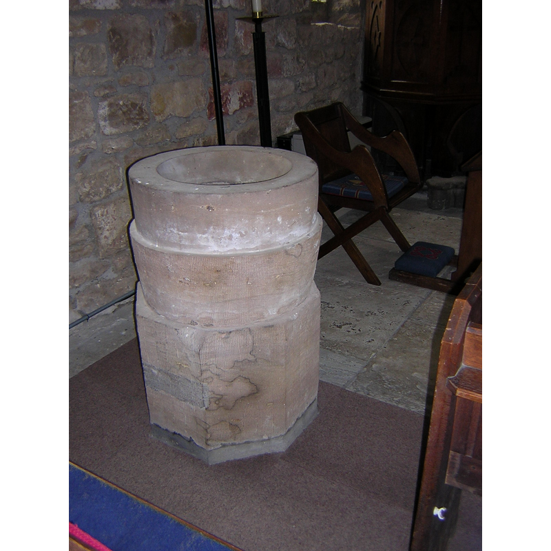
Image copyright © The Vicar and Parochial Church Council of Rosedale, 2004
Image and permission received (e-mail of 8 July 2004 and 9 July 2004)
Results: 12 records
view of font - east side
Copyright Statement: Image copyright © The Vicar and Parochial Church Council of Rosedale, 2004
Image Source: The Vicar and Parochial Church Council of Rosedale
Copyright Instructions: Image and permission received (e-mail of 8 July 2004 and 9 July 2004)
view of font - west side
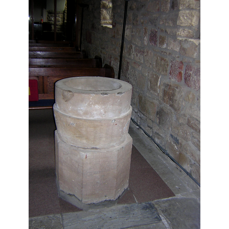
Copyright Statement: Image copyright © The Vicar and Parochial Church Council of Rosedale, 2004
Image Source: The Vicar and Parochial Church Council of Rosedale
Copyright Instructions: Image and Permission received (e-mail of 8 July 2004 and 9 July 2004)
view of font - front side
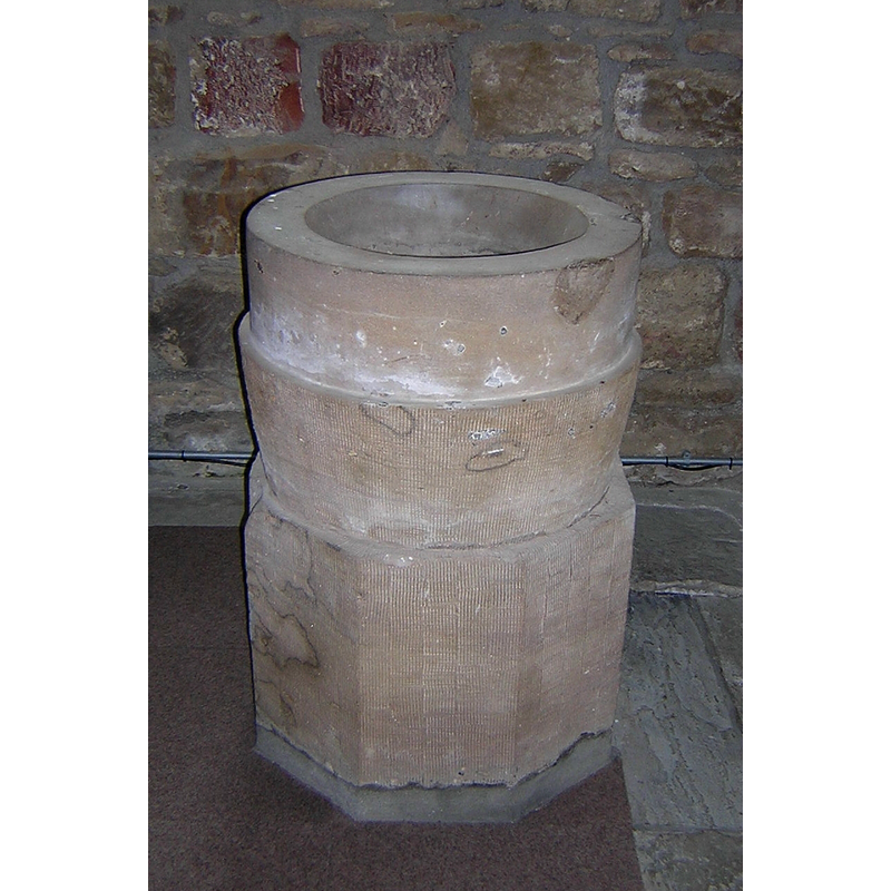
Copyright Statement: Image copyright © The Vicar and Parochial Church Council of Rosedale, 2004
Image Source: The Vicar and Parochial Church Council of Rosedale
Copyright Instructions: Image and permission received (e-mail of 8 July 2004 and 9 July 2004)
view of font
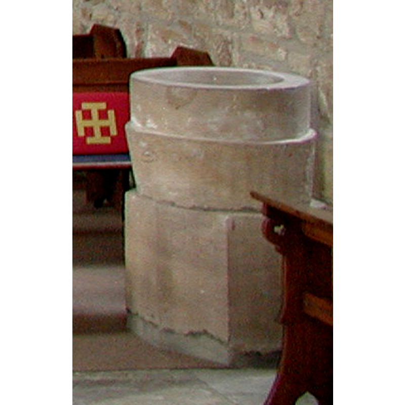
Copyright Statement: Image copyright © Colin Hinson, 2008
Image Source: edited detail of a digital photograph taken by Colin Hinson [www.yorkshireCDbooks.com]
Copyright Instructions: Image and permission received (e-mail of 26 May 2004)
view of basin - interior
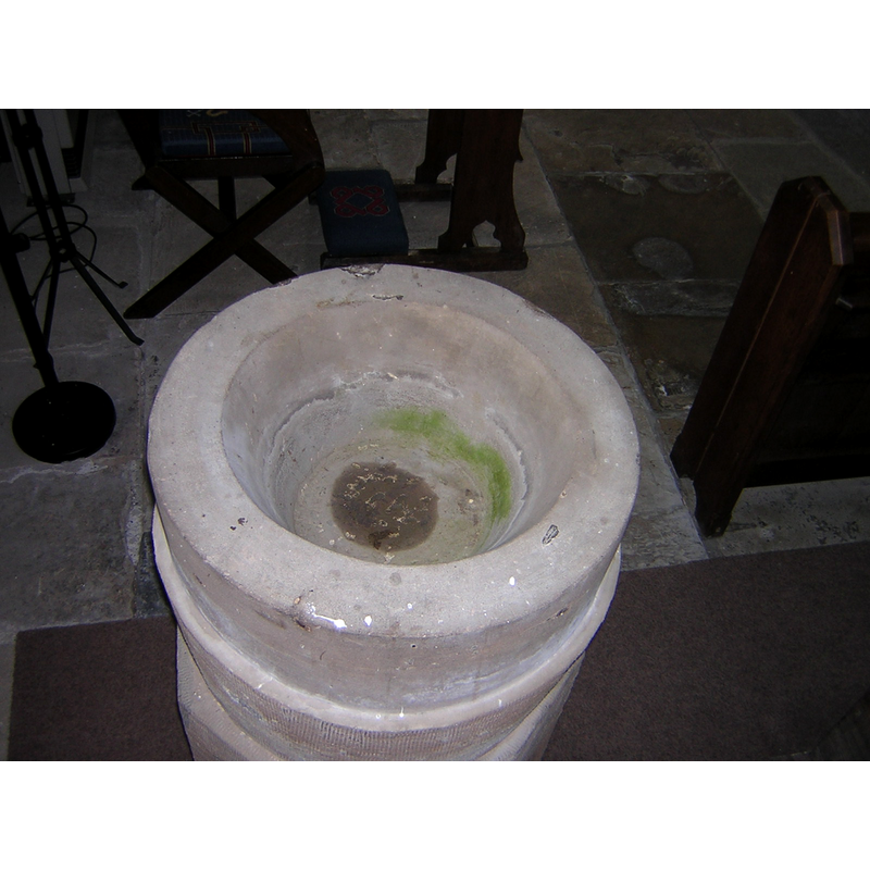
Copyright Statement: Image copyright © The Vicar and Parochial Church Council of Rosedale, 2004
Image Source: The Vicar and Parochial Church Council of Rosedale
Copyright Instructions: Image and permission received (e-mail of 8 July 2004 and 9 July 2004)
view of church interior - detail
![Source caption: "This staircase is all that remains of the abbey at Rosedale Abbey" [i.e., Priory]](/static-50478a99ec6f36a15d6234548c59f63da52304e5/compressed/1190925013_compressed.png)
Scene Description: Source caption: "This staircase is all that remains of the abbey at Rosedale Abbey" [i.e., Priory]
Copyright Statement: Image copyright © op47, 2018
Image Source: digital photograph taken 10 March 2018 by op47 [www.geograph.org.uk/photo/5703747] [accessed 25 September 2019]
Copyright Instructions: CC-BY-SA-2.0
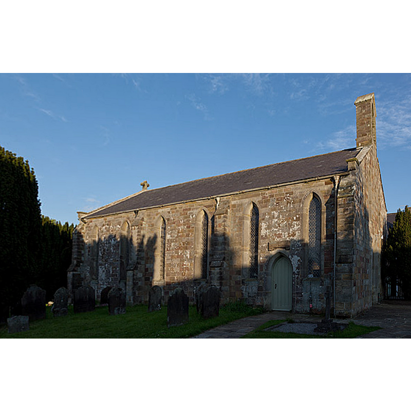
view of church exterior - west view
Scene Description: the structure at the extreme right of the image is said to be what remains of the original priory church here
Copyright Statement: Image copyright © [in the public domain]
Image Source: digital photograph taken 24 Septemver 2008 by John Armagh [https://commons.wikimedia.org/wiki/File:RosedalePriory.JPG] [accessed 25 September 2019]
Copyright Instructions: PD-self
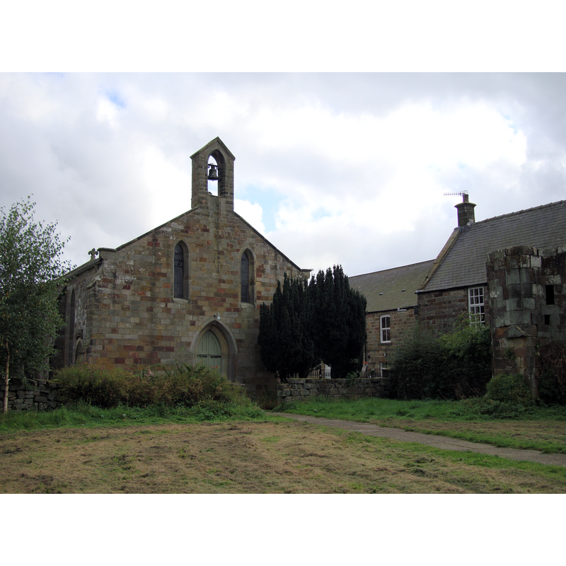
view of church exterior - northwest view
Copyright Statement: Image copyright © Colin Grice, 2011
Image Source: edited detail of a digital photograph taken 13 June 2011 by Colin Grice [www.geograph.org.uk/photo/2459052] [accessed 25 September 2019
Copyright Instructions: CC-BY-SA-2.0
view of church interior - detail
Scene Description: Source caption: "Spiral stair detail. Rosedale Abbey remains".
Copyright Statement: Image copyright © Colin Grice, 2011
Image Source: digital photograph taken 13 June 2011 by Colin Grice [www.geograph.org.uk/photo/2459072] [accessed 25 September 2019]
Copyright Instructions: CC-BY-SA-2.0
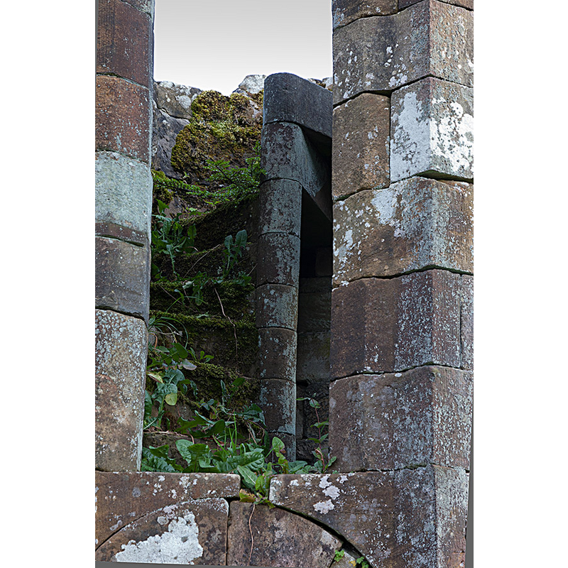
view of church interior - detail
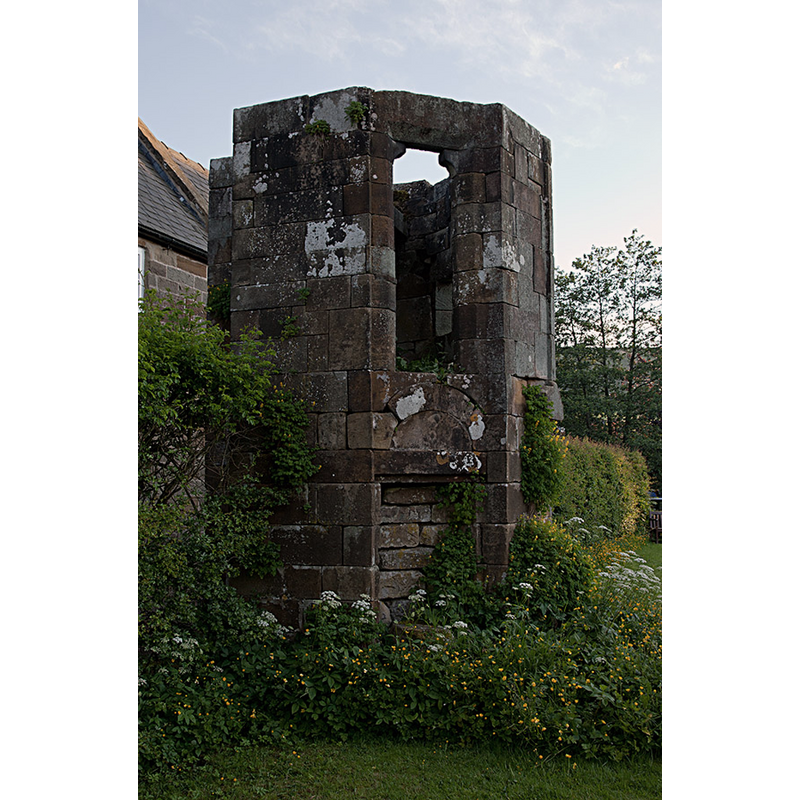
Scene Description: Source caption: "This small turret containing a blocked doorway and stone spiral staircase is the only surviving portion of the Abbey which gave the village its name. Presumably it has been deliberately saved perhaps as a garden ornament - it seems curious that every other last stone has been removed to use elsewhere."
Copyright Statement: Image copyright © Colin Grice, 2011
Image Source: digital photograph taken 13 June 2011 by Colin Grice [www.geograph.org.uk/photo/2459071] [accessed 25 September 2019]
Copyright Instructions: CC-BY-SA-2.0
view of church interior - looking east
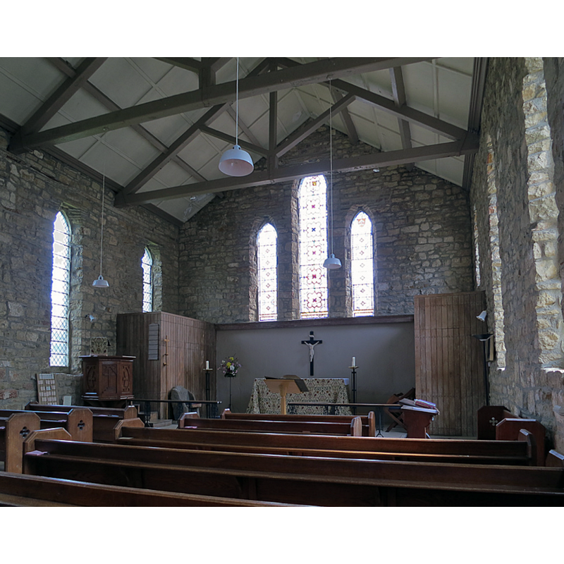
Copyright Statement: Image copyright © Colin Grice, 2011
Image Source: digital photograph taken 8 June 2013 by Colin Grice [www.geograph.org.uk/photo/3501158] [accessed 25 September 2019]
Copyright Instructions: CC-BY-SA-2.0
view of font in context
Copyright Statement: Image copyright © Colin Hinson, 2008
Image Source: digital photograph taken by Colin Hinson [www.yorkshireCDbooks.com]
Copyright Instructions: Image and permission received (e-mail of 26 May 2004)
INFORMATION
Font ID: 09814ROS
Object Type: Baptismal Font1, basin only
Font Century and Period/Style: Medieval
Church / Chapel Name: Parish Church of St. Mary and St. Lawrence
Font Location in Church: Inside the modern church, E end, N side
Church Patron Saint(s): St. Mary the Virgin & St. Lawrence [aka Laurence]
Church Notes: present 19thC church said to have been built on approximately the same site as the disappeared priory church, of which only a turret with an internal and stairwell remains
Church Address: Village Green, Rosedale Abbey, York YO62 6TN, UK -- Tel.: +44 751 417344 / +44 751 417223
Site Location: North Yorkshire, Yorkshire and the Humber, England, United Kingdom
Directions to Site: Located off (N) the A170, in the North York Moors National Park, about 15 km NW of Pickering
Ecclesiastic Region: Diocese of York
Font Notes:
Click to view
No individual entry found for Rosedale in the Domesday survey. The entry for the Cistercian priory here in the Victoria County History (York, vol. 3, 1974) notes: "The priory of Rosedale was founded in the reign of Richard I by Robert, the son of Nicholas de Stuteville, and was under the invocation of St. Mary and St. Lawrence [...] The house was supervised on 7 June and suppressed on 17 August 1535." The entry for this church in A Church Near You [ww.achurchnearyou.com/church/8013/about-us/] [accessed 25 September 2019] notes: "In 1839 the old Priory chapel was pulled down and a larger church built on much the same site." The baptismal font located in the church of St. Lawrence, Rosedale, consists of a round basin raised on a quadrangular base, the latter clearly modern; the basin however appears old and harks back in shape and general design to the crude forms of pre-Conquest basins, especifically the one at Morwenstow [cf. BSI entry], although this is one is even less decorated; it may be either re-tooled or a modern version; if it is indeed medieval, its date could be as early as the 11th century. There are metal staples in the upper rim, probably from the cover locking hardware.
Credit and Acknowledgements: We are grateful to Colin Hinson, of www.yorkshireCDbooks.com, Paul T., and the Vicar and Parochial Church Council of Rosedale for the photographs of this font.
COORDINATES
UTM: 30U 637253 6024965
Latitude & Longitude (Decimal): 54.354, -0.888
Latitude & Longitude (DMS): 54° 21′ 14.4″ N, 0° 53′ 16.8″ W
MEDIUM AND MEASUREMENTS
Material: stone
Number of Pieces: two
Font Shape: cylindrical, mounted
Basin Interior Shape: round
Basin Exterior Shape: round
REFERENCES
- Victoria County History [online], University of London, 1993-. URL: https://www.british-history.ac.uk.