Wormsley / Wermeslai / Wrmeslev
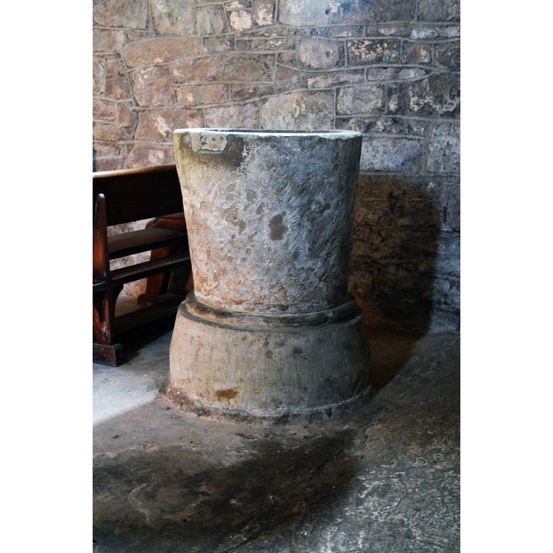
Image copyright © Philip Pankhurst, 2022
CC-BY-SA-2.5
Results: 6 records
view of font
Scene Description: Source caption: "St Mary, Wormsley. The plain late 12th century font."
Copyright Statement: Image copyright © Philip Pankhurst, 2022
Image Source: digital photograph 22 March 2022 by Philip Pankhurst [https://www.geograph.org.uk/photo/7129161] [accessed 30 August 2023]
Copyright Instructions: CC-BY-SA-2.5
view of font
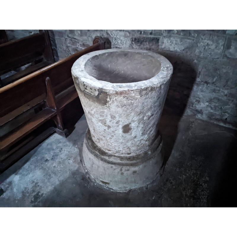
Scene Description: Source caption: "St. Mary's church (Font | Wormsley) The font in the west end of the nave possibly dates from the twelfth or thirteenth century"
Copyright Statement: Image copyright © Fabian Musto, 2022
Image Source: digital photograph 22 December 2022 by Fabian Musto [https://www.geograph.org.uk/photo/7366853] [accessed 30 August 2023]
Copyright Instructions: CC-BY-SA-2.5
view of church exterior - southeast view
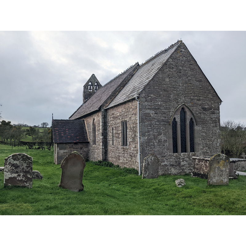
Scene Description: Source caption: "Here is the church of St. Mary in Wormsley, built in the twelfth and thirteenth century with later alterations. The chancel was rebuilt during the mid or late nineteenth century, and the church was grade II* listed in September 1966. The church closed as a place of worship in 1970, and has been managed by the Churches Conservation Trust since then."
Copyright Statement: Image copyright © Fabian Musto, 2022
Image Source: digital photograph 22 December 2022 by Fabian Musto [https://www.geograph.org.uk/photo/7366745] [accessed 30 August 2023]
Copyright Instructions: CC-BY-SA-2.5
view of church exterior - north view
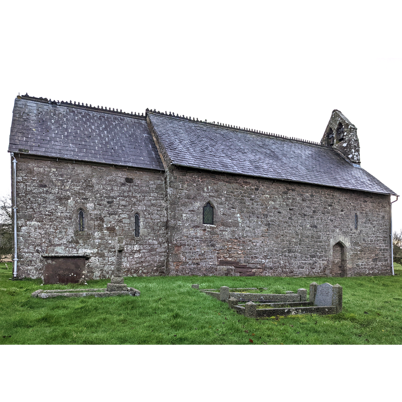
Scene Description: Source caption: "Here is the church of St. Mary in Wormsley, built in the twelfth and thirteenth century with later alterations. The chancel was rebuilt during the mid or late nineteenth century, and the church was grade II* listed in September 1966. The church closed as a place of worship in 1970, and has been managed by the Churches Conservation Trust since then."
Copyright Statement: Image copyright © Fabian Musto, 2022
Image Source: digital photograph 22 December 2022 by Fabian Musto [https://www.geograph.org.uk/photo/7366913] [accessed 30 August 2023]
Copyright Instructions: CC-BY-SA-2.5
view of church interior - looking west
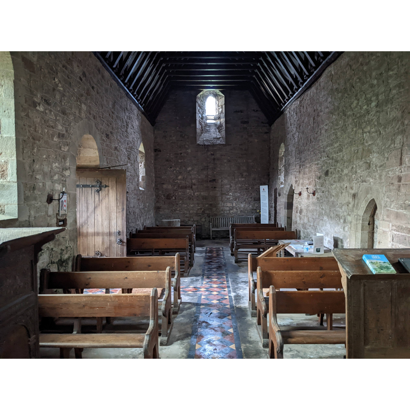
Scene Description: Source caption: "St. Mary's church (Nave | Wormsley)" -- showing the medieval font in the southwest corner of the nave
Copyright Statement: Image copyright © Fabian Musto, 2022
Image Source: digital photograph 22 December 2022 by Fabian Musto [https://www.geograph.org.uk/photo/7366895] [accessed 30 August 2023]
Copyright Instructions: CC-BY-SA-2.5
view of font

Copyright Statement: Image copyright © H.M.S.O., 1931-1934
Image Source: digital image of a B&W photograph in Herefordshire (1931-1934, vol. III: pl. 55)
Copyright Instructions: PERMISSION NOT AVAILABLE -- IMAGE NOT FOR PUBLIC USE
INFORMATION
Font ID: 09751WOR
Object Type: Baptismal Font1
Font Century and Period/Style: 12th - 13th century, Transitional
Church / Chapel Name: Parish Church of St. Mary
Font Location in Church: Inside the church, in the SW corner of the nave
Church Patron Saint(s): St. Mary the Virgin
Church Address: Wormsley, Hereford HR4 8LY, United Kingdom
Site Location: Herefordshire, West Midlands, England, United Kingdom
Directions to Site: Located off (SE) the A4112, 11.5 km NW of Hereford
Historical Region: Hundred of Stepleset [in Domesday]
Font Notes:
Click to view
There are three entries for Wormsley in the Domesday survey [https://opendomesday.org/place/SO4247/wormsley/] [accessed 30 August 2023], one of which mentions a priest but not a church in it. The inventory of Herefordshire (1931-1934) notes : "Font[...]: tapering cylindrical bowl with roll-moulding at base, late 12th or early 13th-century." The entry for this church in Historic England [Listing NGR: SO4274947794] notes: "Church of St Mary [...] Parish church, now redundant. C12 and C13 with later alterations, and chancel rebuilt probably in late C19 [...] Font is probably C12 or C13 with tapered cyclindrical base and a round-tapered bowl. [...] The Church of St Mary is maintained by the Redundant Churches Fund". There is no cover present but the upper side of the basin shows anchoring evidence for an old cover.
COORDINATES
UTM: 30U 511111 5775009
Latitude & Longitude (Decimal): 52.1255, -2.8377
Latitude & Longitude (DMS): 52° 7′ 31.8″ N, 2° 50′ 15.72″ W
MEDIUM AND MEASUREMENTS
Material: stone
Number of Pieces: two?
Font Shape: bucket-shaped, mounted
Basin Interior Shape: round
Basin Exterior Shape: round
REFERENCES
- Great Britain. Royal Commission on Historical Monuments (England), An Inventory of the Historical Monuments in Herefordshire, London: H.M. Stationary Office, 1931-1934, vol. 3: 214 and pl. 55