Eardisley No. 3 / Bollingham / Erdesley
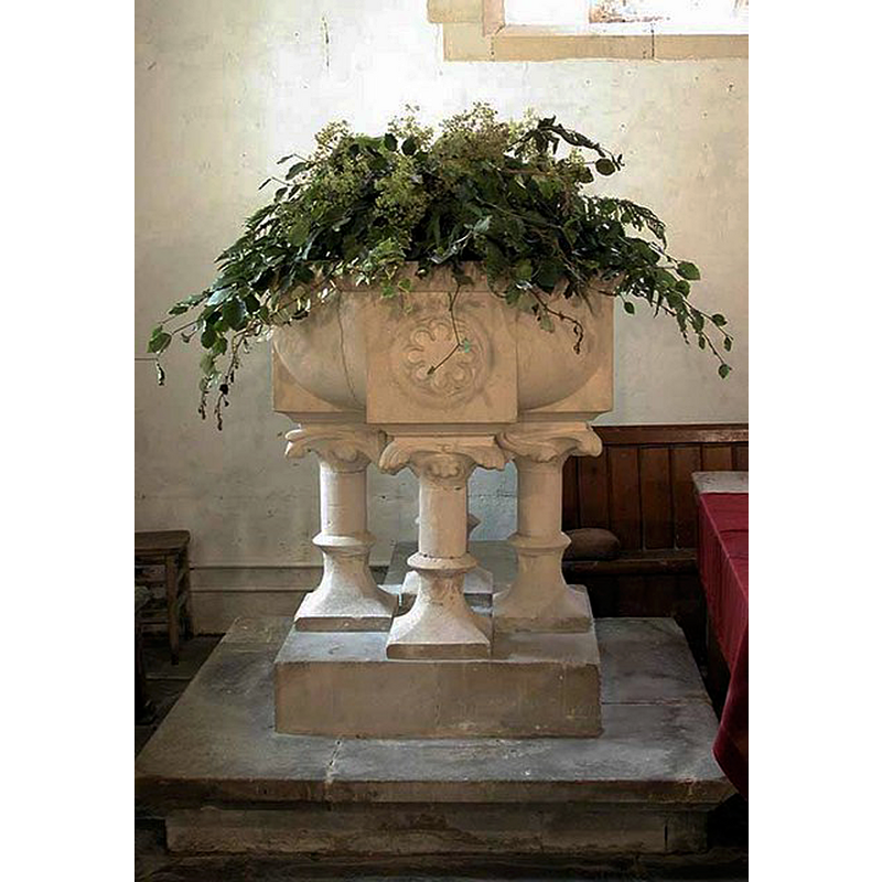
Image copyright © John Salmon, 2003
CC-BY-SA-2.0
Results: 4 records
view of font
Scene Description: the modern font
Copyright Statement: Image copyright © John Salmon, 2003
Image Source: digital photograph taken 14 July 2003 by John Salmon [www.geograph.org.uk/photo/984309] [accessed 2 November 2014]
Copyright Instructions: CC-BY-SA-2.0
view of church exterior - south view
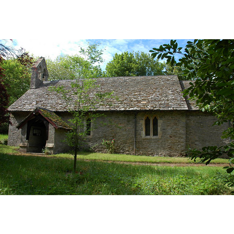
Copyright Statement: Image copyright © Philip Halling, 2007
Image Source: digital photograph taken 20 May 2007 by Philip Halling [www.geograph.org.uk/photo/442636] [accessed 2 November 2014]
Copyright Instructions: CC-BY-SA-2.0
view of church interior - nave - looking east
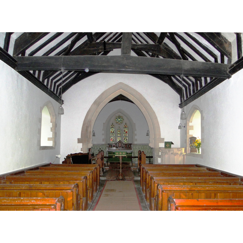
Scene Description: Source caption: "St Silas, Bollingham. Tiny church between Eardisley and Kington, set in the grounds of Bollingham House."
Copyright Statement: Image copyright © Philip Pankhurst, 2010
Image Source: digital photograph taken 29 August 2010 by Philip Pankhurst [www.geograph.org.uk/photo/2039871] [accessed 2 November 2014]
Copyright Instructions: CC-BY-SA-2.0
view of stoup
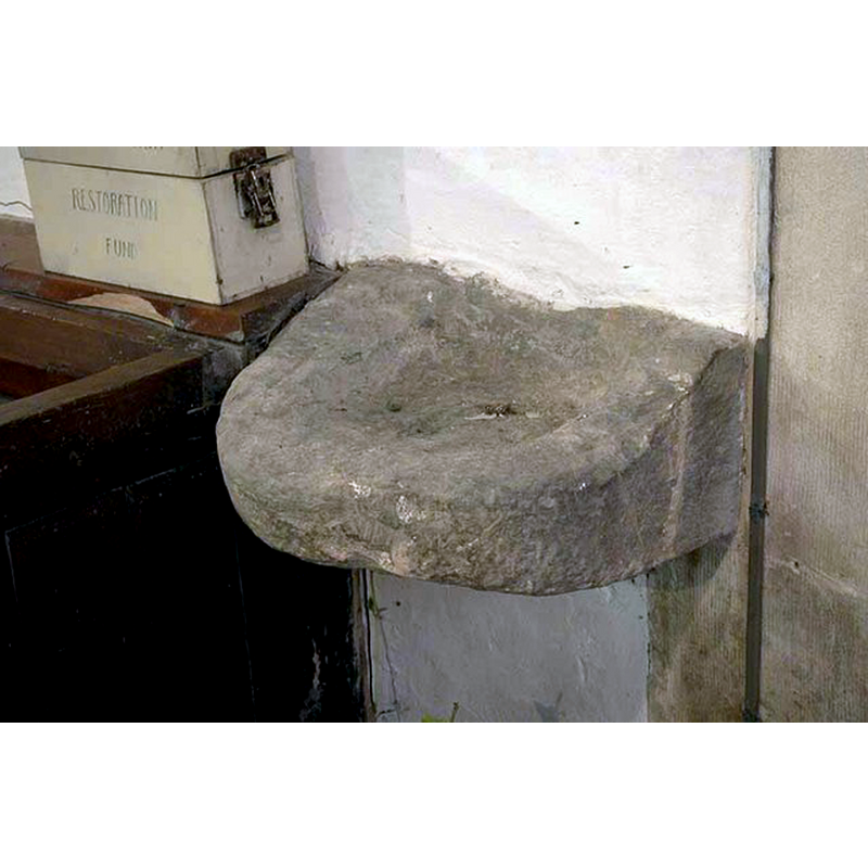
Copyright Statement: Image copyright © John Salmon, 2003
Image Source: digital photograph taken 14 July 2003 by John Salmon [www.geograph.org.uk/photo/984313] [accessed 2 November 2014]
Copyright Instructions: CC-BY-SA-2.0
INFORMATION
Font ID: 09735EAR
Object Type: Stoup
Font Century and Period/Style: 12th - 13th century, Medieval
Church / Chapel Name: Bollingham chapel / Chapel of St. Silas
Font Location in Church: Inside the chapel, wall-mounted in the nave, E of the S doorway
Church Patron Saint(s): St. Silas [aka Silvanus] [1stC]
Church Address: Eardisley, Herefordshire HR3 6LS
Site Location: Herefordshire, West Midlands, England, United Kingdom
Directions to Site: Eardisley is located WSW of Leominster down the A4112, in a corner of the Welsh Marches [Bollingham chapel is located 4-5 km NNW of St. Mary's]
Ecclesiastic Region: Diocese of Hereford
Historical Region: Hundred of Elsdon
Additional Comments: damaged stoup (mutilated flat bowl) -- disappeared font? (the one insidethe chapel now is modern)
Font Notes:
Click to view
There is an entry for Bollingham in the Domesday survey [http://domesdaymap.co.uk/place/SO3052/bollingham/] [accessed 2 November 2014, but it mentions neither cleric nor church in it. An old wall-mounted stoup here is described in the inventory of Herefordshire (1931-1934, vol. III: 52): "Stoup: In nave -- E. of S. doorway, mutilated flat bowl with round basin." The modern font here is 19th-century [NB: the chapel may date to the 12th or 13th century, as may the stoup]
COORDINATES
Latitude & Longitude (Decimal): 52.16803, -3.02299
Latitude & Longitude (DMS): 52° 10′ 4.92″ N, 3° 1′ 22.77″ W
MEDIUM AND MEASUREMENTS
Material: stone
Number of Pieces: one
Font Shape: round, wall-mounted
Basin Interior Shape: round
Basin Exterior Shape: round
REFERENCES
- Great Britain. Royal Commission on Historical Monuments (England), An Inventory of the Historical Monuments in Herefordshire, London: H.M. Stationary Office, 1931-1934, vol. III: 52