Thornbury / Torneberie
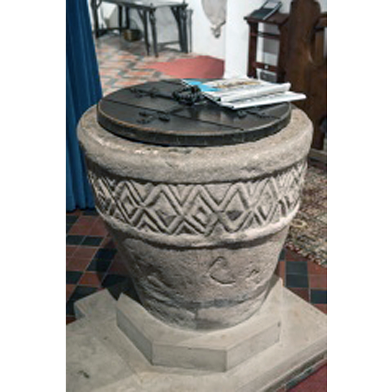
Image copyright © David Ross & Britain Express Ltd, 2015
Standing permission
Results: 8 records
view of font and cover in context
Copyright Statement: Image copyright © David Ross & Britain Express Ltd, 2015
Image Source: edited digital photograph by David Ross [www.britainexpress.com/counties/hereford/churches/thornbury.htm] [accessed 16 May 2015]
Copyright Instructions: Standing permission
view of font
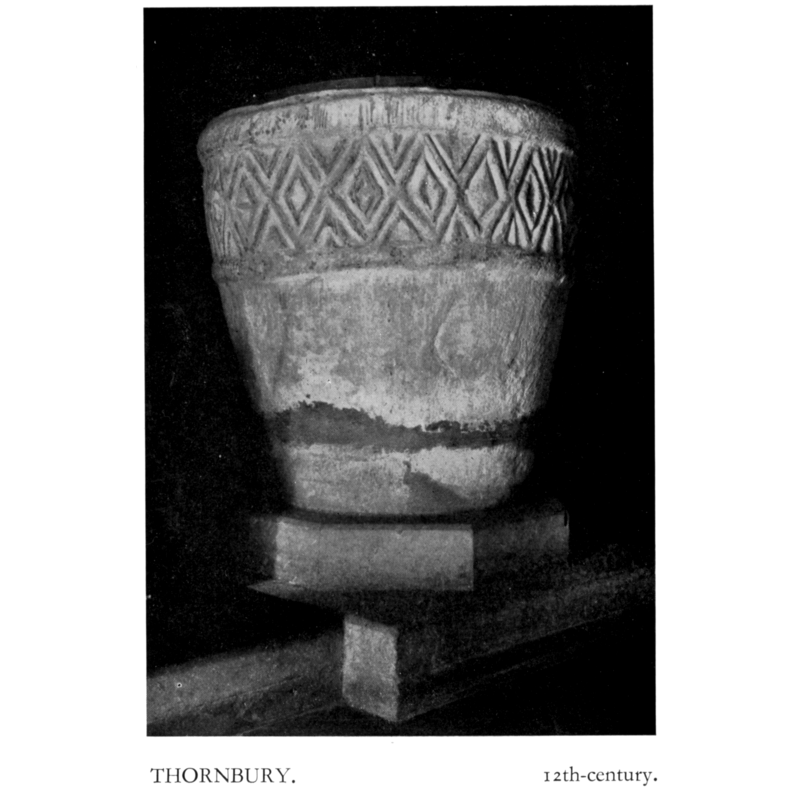
Copyright Statement: Image copyright © H.M.S.O., 1931-1934
Image Source: Herefordshire (1931-1934, vol. II: pl. 52)
Copyright Instructions: No known copyright restriction / Fair Dealing
design element - motifs - roll moulding
Copyright Statement: Image copyright © David Ross & Britain Express Ltd, 2015
Image Source: edited digital photograph by David Ross [www.britainexpress.com/counties/hereford/churches/thornbury.htm] [accessed 16 May 2015]
Copyright Instructions: Standing permission
design element - patterns - diaper - nested
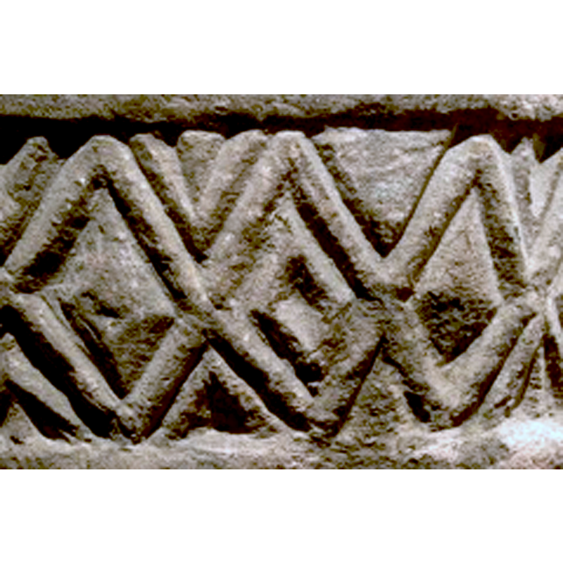
Copyright Statement: Image copyright © David Ross & Britain Express Ltd, 2015
Image Source: edited digital photograph by David Ross [www.britainexpress.com/counties/hereford/churches/thornbury.htm] [accessed 16 May 2015]
Copyright Instructions: Standing permission
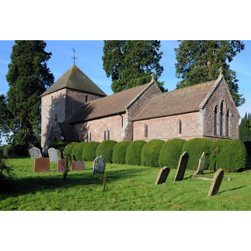
view of church exterior - southwest view
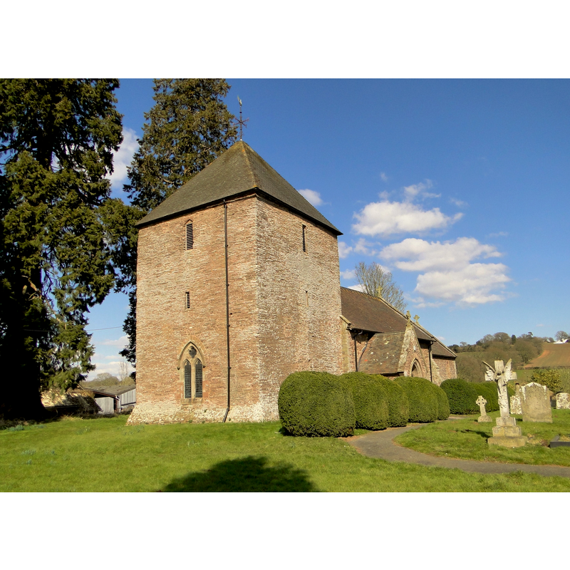
Scene Description: Source caption: "St Anna, Thornbury. The squat, unbuttressed West tower dates from the 13th century. F.R. Kempson added the somewhat intrusive West window in 1865-6 when he restored the church, rebuilding the chancel in the process and exposing the blocked 3-bay South arcade. Remote, but clearly loved and well cared for. Kempson added a shingled spire to the tower; this was replaced by the present pyramid roof in 1955."
Copyright Statement: Image copyright © Philip Pankhurst, 2013
Image Source: digital photograph taken 2 April 2013 by Philip Pankhurst [www.geograph.org.uk/photo/3398408] [accesed 16 May 2015]
Copyright Instructions: CC-BY-SA-2.0
view of church exterior - southeast view
Scene Description: Source caption: "Thornbury church is dedicated to St Anne. The church nave dates from Norman times, the tower is 13th century and chancel was built in 1865."
Copyright Statement: Image copyright © Philip Halling, 2013
Image Source: digital photograph taken 30 November 2013 by Philip Halling [www.geograph.org.uk/photo/3765297] [accessed 16 May 2015]
Copyright Instructions: CC-BY-SA-2.0
view of church interior - nave - looking east
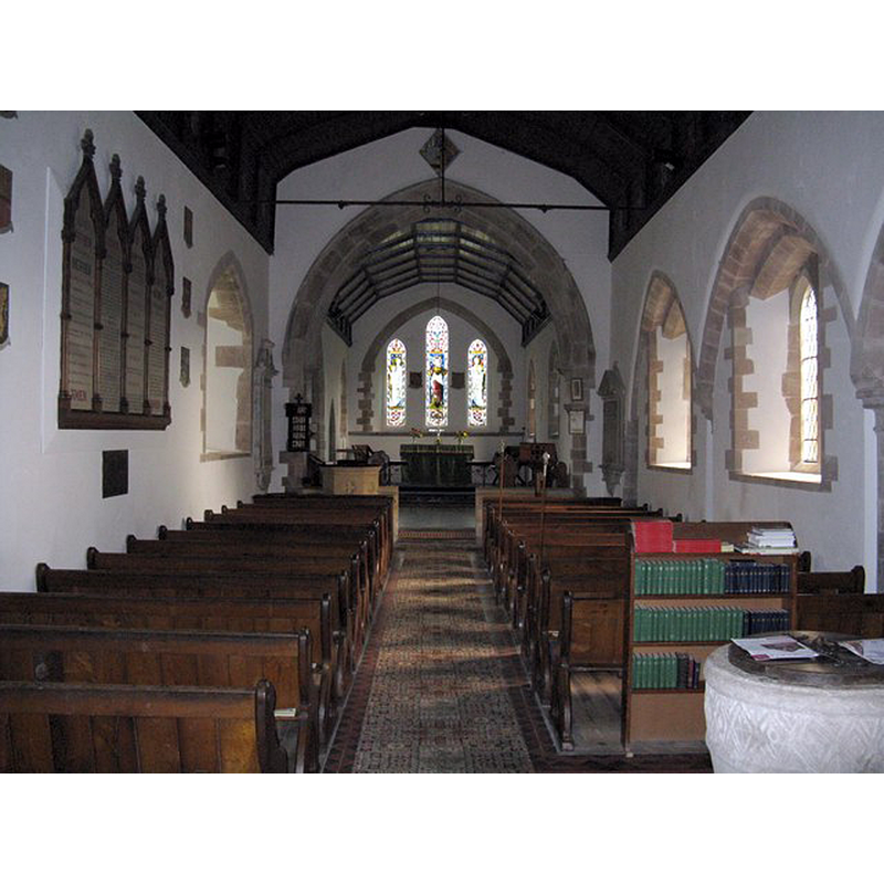
Scene Description: with the font partially visible in the foreground, right corner
Copyright Statement: Image copyright © Peter Whatley, 2008
Image Source: digital photograph taken 16 October 2008 by Peter Whatley [www.geograph.org.uk/photo/1008345] [accessed 16 May 2015]
Copyright Instructions: CC-BY-SA-2.0
INFORMATION
Font ID: 09670THO
Object Type: Baptismal Font1
Font Century and Period/Style: 12th century (early?), Norman
Church / Chapel Name: Parish Church of St. Anne [aka St. Anna's]
Font Location in Church: Inside the church, at the W end, by the S entrance
Church Patron Saint(s): St. Anne
Church Address: Thornbury, Herefordshire HR7 4NH
Site Location: Herefordshire, West Midlands, England, United Kingdom
Directions to Site: Located 6.5 km NW of Bromyard, E of Leominster
Ecclesiastic Region: Diocese of Hereford
Historical Region: Hundred of Plegelgete [in Domesday]
Font Notes:
Click to view
There are two entries for this Thornbury [variant spelling] in the Domesday survey [http://opendomesday.org/place/SO6259/thornbury/] [accessed 16 May 2015], neither of which mentions cleric or church in it. A font here is described and illustrated in Herefordshire (1931-1934): "Font:[...]: tapering cylindrical bowl, with deep band of lozenge-ornament round upper part, 12th-century." The octagonal base and polygonal plinth are modern. The wooden cover is round and flat; appears modern.
Credit and Acknowledgements: We are grateful to David ross, of Britain Express [www.britainexpress.com], for his photographs of this font
COORDINATES
UTM: 30U 530457 5787100
Latitude & Longitude (Decimal): 52.233473, -2.554025
Latitude & Longitude (DMS): 52° 14′ 0.5″ N, 2° 33′ 14.49″ W
MEDIUM AND MEASUREMENTS
Material: stone
Number of Pieces: one
Font Shape: tub-shaped, mounted
Basin Interior Shape: round
Basin Exterior Shape: round
LID INFORMATION
Date: modern
Material: wood
Apparatus: no
Notes: [cf. FontNotes]
REFERENCES
- Great Britain. Royal Commission on Historical Monuments (England), An Inventory of the Historical Monuments in Herefordshire, London: H.M. Stationary Office, 1931-1934, vol. II: p. xxx, 188 and pl. 52 / [www.british-history.ac.uk/rchme/heref/vol2/pp187-191] [accessed 16 May 2015]