Foy No. 1
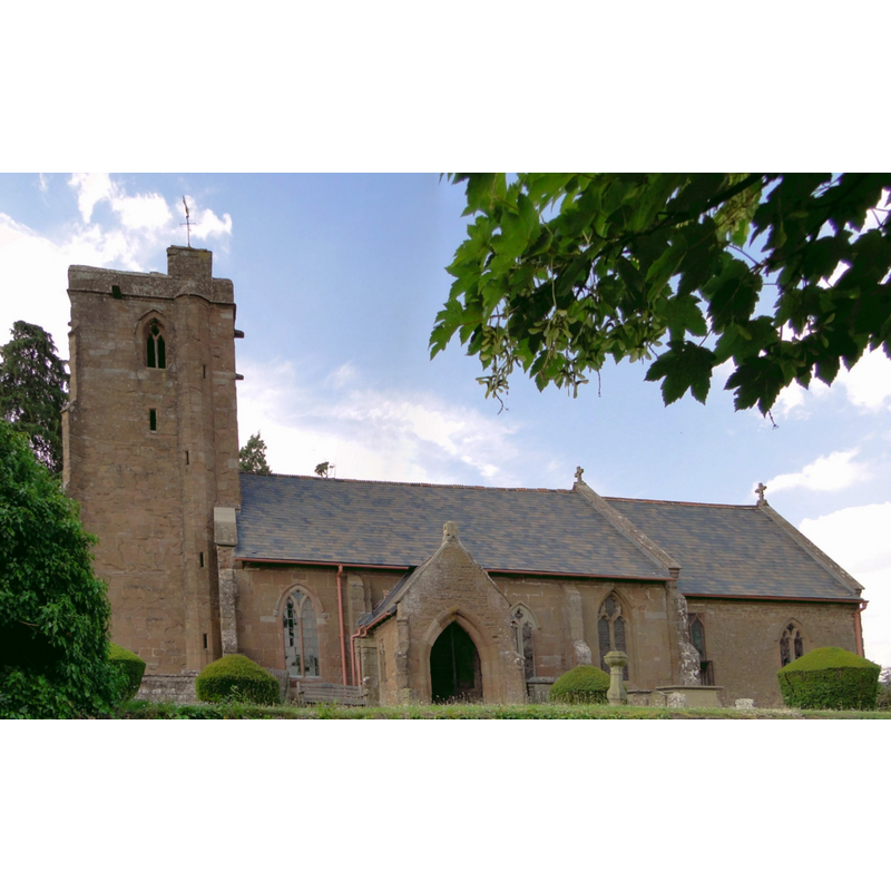
Image copyright © Philip Pankhurst, 2013
CC-BY-SA-2.0
Results: 4 records
view of church exterior - south view
Copyright Statement: Image copyright © Philip Pankhurst, 2013
Image Source: digital photograph taken 19 June 2013 by Philip Pankhurst [www.geograph.org.uk/photo/3518779] [accessed 19 May 2015]
Copyright Instructions: CC-BY-SA-2.0
view of church exterior - north view
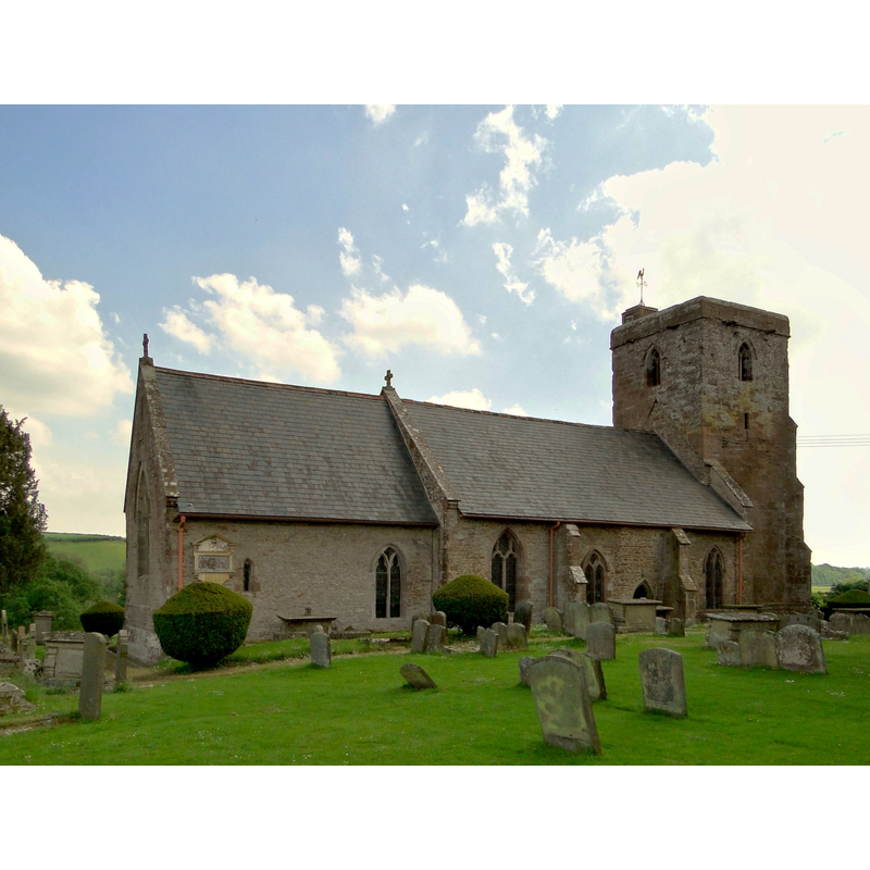
Copyright Statement: Image copyright © Philip Pankhurst, 2013
Image Source: digital photograph taken 19 June 2013 by Philip Pankhurst [www.geograph.org.uk/photo/3518785] [accessed 19 May 2015]
Copyright Instructions: CC-BY-SA-2.0
view of church interior - nave - looking east
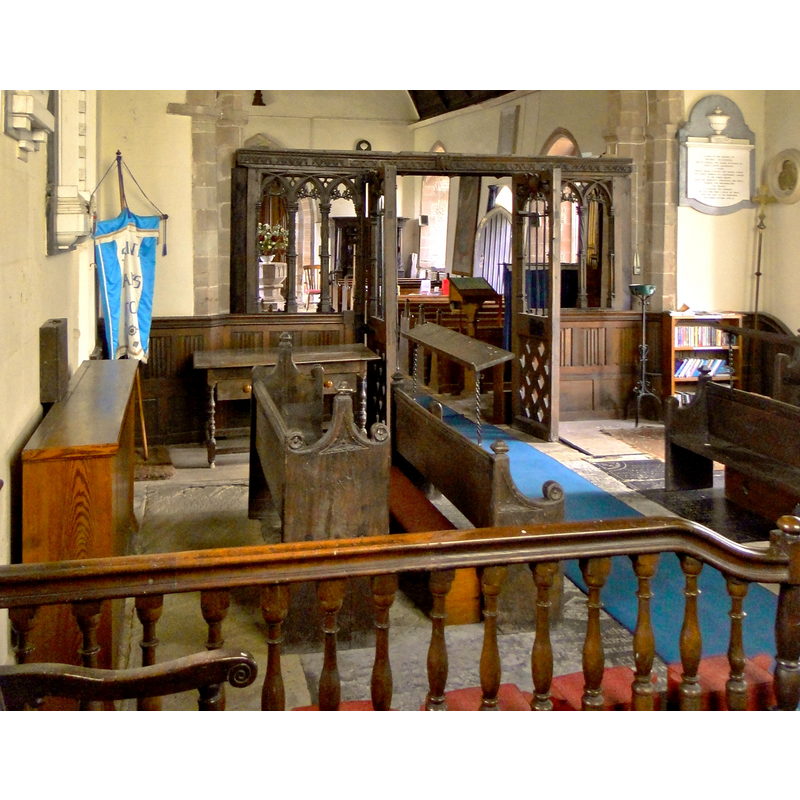
Scene Description: Source caption: "A feast of dark oak, St Mary Foy"
Copyright Statement: Image copyright © Philip Pankhurst, 2013
Image Source: digital photograph taken 19 June 2013 by Philip Pankhurst [www.geograph.org.uk/photo/3519046] [accessed 19 May 2015]
Copyright Instructions: CC-BY-SA-2.0
view of church interior - nave - looking west
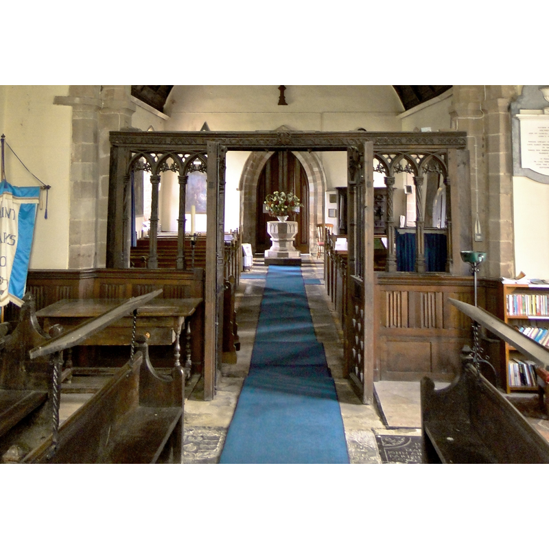
Scene Description: Source caption: "St Mary, Foy. The excellent 17th century woodwork of the screen framing the decagonal 14th century font. "
Copyright Statement: Image copyright © Philip Pankhurst, 2013
Image Source: digital photograph taken 19 June 2013 by Philip Pankhurst [www.geograph.org.uk/photo/3519028] [accessed 19 May 2015]
Copyright Instructions: CC-BY-SA-2.0
INFORMATION
Font ID: 09630FOY
Object Type: Baptismal Font1, basin only
Font Century and Period/Style: 12th - 13th century, Medieval
Church / Chapel Name: Parish Church of St. Mary
Font Location in Church: In the chancel
Church Patron Saint(s): St. Mary the Virgin
Church Address: Foy, Herefordshire HR9 6QY
Site Location: Herefordshire, West Midlands, England, United Kingdom
Directions to Site: Located 5 km N of Ross
Ecclesiastic Region: Diocese of Hereford
Additional Comments: abandoned font: 12th or 13th-century basin no longer in use but kept inside the church
Font Notes:
Click to view
No entry found for Foy in the Domesday survey. Herefordshire (1931-1934, vol. I: 66) notes this as one of two fonts in this church; this one, a "disused bowl of circular font with tapering sides, 12th or 13th-century." [cf. Index entry for Foy No. 2 for the later font in use in this church]
COORDINATES
UTM: 30U 528388 5755760
Latitude & Longitude (Decimal): 51.951816, -2.586922
Latitude & Longitude (DMS): 51° 57′ 6.54″ N, 2° 35′ 12.92″ W
MEDIUM AND MEASUREMENTS
Material: stone
Number of Pieces: one
Font Shape: bucket-shaped
Basin Interior Shape: round
Basin Exterior Shape: round
REFERENCES
- Great Britain. Royal Commission on Historical Monuments (England), An Inventory of the Historical Monuments in Herefordshire, London: H.M. Stationary Office, 1931-1934, vol. I: p. 66