Welsh Newton
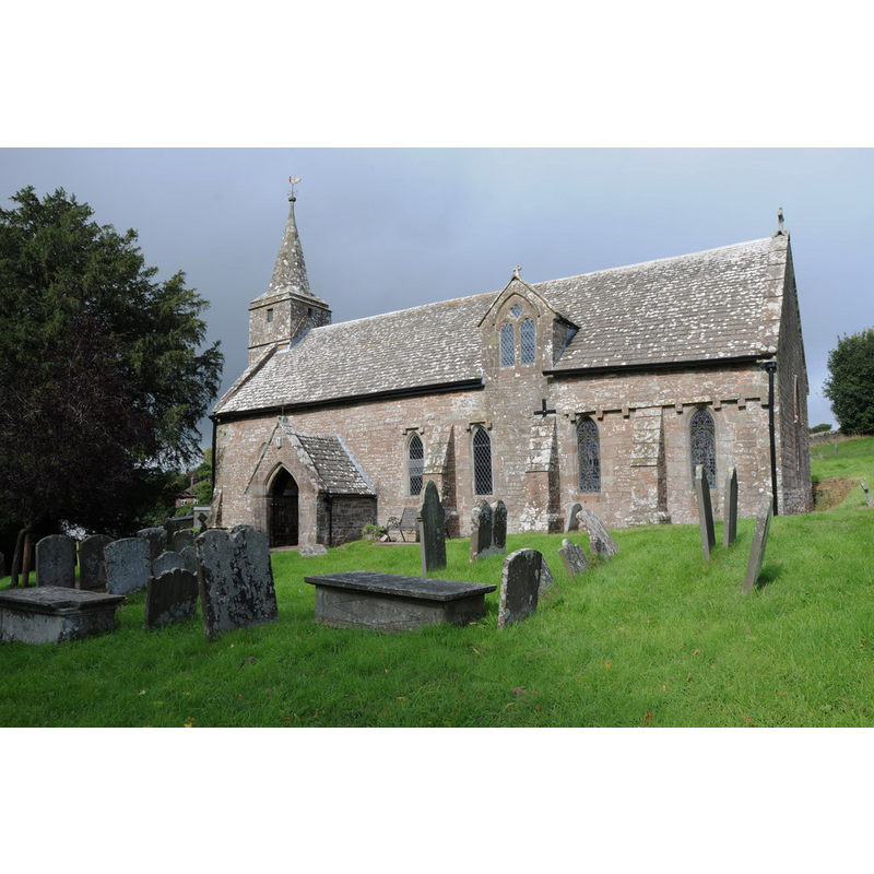
Image copyright © Philip Halling, 2013
CC-BY-SA-2.0
Results: 3 records
view of church exterior - southeast view
Scene Description: Source caption: "Welsh Newton church is dedicated to St Mary the Virgin and is one of a few English churches with a saint buried in its graveyard, St. John Kemble. The village is on the England/Wales border, lying just in England."
Copyright Statement: Image copyright © Philip Halling, 2013
Image Source: digital photograph taken 21 September 2013 by Philip Halling [www.geograph.org.uk/photo/3667173] [accessed 19 May 2015]
Copyright Instructions: CC-BY-SA-2.0
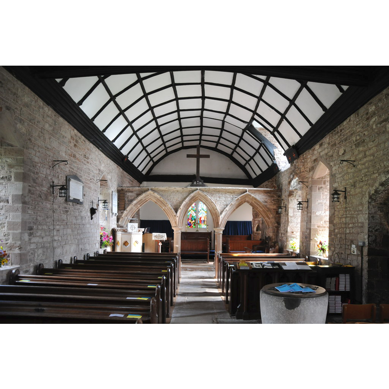
view of church interior - nave - looking west
![the baptismal font is visible at the back [west end], left [south] side](/static-50478a99ec6f36a15d6234548c59f63da52304e5/compressed/1150519003_compressed.png)
Scene Description: the baptismal font is visible at the back [west end], left [south] side
Copyright Statement: Image copyright © Philip Halling, 2013
Image Source: digital photograph taken 21 September 2013 by Philip Halling [www.geograph.org.uk/photo/3667183] [accessed 19 May 2015]
Copyright Instructions: CC-BY-SA-2.0
view of church interior - nave - looking east
Scene Description: the basin of the font in the foreground
Copyright Statement: Image copyright © Philip Halling, 2013
Image Source: digital photograph taken 21 September 2013 by Philip Halling [www.geograph.org.uk/photo/3667181] [accessed 19 May 2015]
Copyright Instructions: CC-BY-SA-2.0
INFORMATION
Font ID: 09629WEL
Object Type: Baptismal Font1
Font Century and Period/Style: 12th century, Norman
Church / Chapel Name: Parish Church of St. Mary
Font Location in Church: Inside the church
Church Patron Saint(s): St. Mary the Virgin
Church Address: Welsh Newton, County of Herefordshire NP25 5RH
Site Location: Herefordshire, West Midlands, England, United Kingdom
Directions to Site: Located on the A466, 13 km WSW of Ross-on-Wye
Ecclesiastic Region: Diocese of Hereford
Font Notes:
Click to view
No entry for Welsh Newton found in the Domesday survey. Described in Herefordshire (1931-1934, vol. I: 249): "Font: tapering cylindrical bowl, with slightly convex sides and projecting band on lower part and narrow projecting band round bottom, short circular stem on modern step, 12th-century or earlier". Noted in the English Heritage entry [Listing NGR: SO4996118022] (1966): "C12 font, plain circular bowl with tapering sides, squat circular base."
COORDINATES
UTM: 30U 518671 5745316
Latitude & Longitude (Decimal): 51.858325, -2.728877
Latitude & Longitude (DMS): 51° 51′ 29.97″ N, 2° 43′ 43.96″ W
MEDIUM AND MEASUREMENTS
Material: stone
Number of Pieces: three
Font Shape: bucket-shaped, mounted
Basin Interior Shape: round
Basin Exterior Shape: round
LID INFORMATION
Date: modern?
Material: wood, oak?
Apparatus: no
Notes: round and flat, with metal decoration and ring handle
REFERENCES
- Great Britain. Royal Commission on Historical Monuments (England), An Inventory of the Historical Monuments in Herefordshire, London: H.M. Stationary Office, 1931-1934, vol. I: p. 249