Blakemere
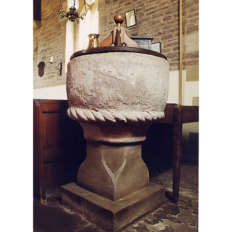
Image copyright © John Salmon, 1998
CC-BY-SA-2.0
Results: 4 records
view of font and cover
Copyright Statement: Image copyright © John Salmon, 1998
Image Source: photograph taken 12 August 1998 by John Salmon [www.geograph.org.uk/photo/3886850] [accessed 1 May 2015]
Copyright Instructions: CC-BY-SA-2.0
design element - motifs - rope moulding
Copyright Statement: Image copyright © John Salmon, 1998
Image Source: photograph taken 12 August 1998 by John Salmon [www.geograph.org.uk/photo/3886850] [accessed 1 May 2015]
Copyright Instructions: CC-BY-SA-2.0
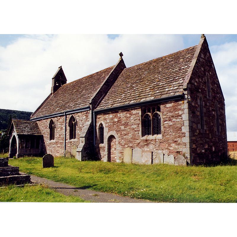
view of church exterior - southeast view
Copyright Statement: Image copyright © John Salmon, 1998
Image Source: photograph taken 12 August 1998 by John Salmon [www.geograph.org.uk/photo/3886846] [accessed 1 May 2015]
Copyright Instructions: CC-BY-SA-2.0
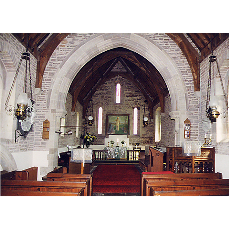
view of church interior - nave - looking east
Copyright Statement: Image copyright © John Salmon, 1998
Image Source: photograph taken 12 August 1998 by John Salmon [www.geograph.org.uk/photo/3886848] [accessed 1 May 2015]
Copyright Instructions: CC-BY-SA-2.0
INFORMATION
Font ID: 09626BLA
Object Type: Baptismal Font1
Font Century and Period/Style: 12th century (late?) [basin only] [composite font], Medieval [composite]
Church / Chapel Name: Parish Church of St. Leonard
Font Location in Church: Inside the church
Church Patron Saint(s): St. Leonard
Church Address: B4352, Blakemere, Herefordshire HR2 9PZ
Site Location: Herefordshire, West Midlands, England, United Kingdom
Directions to Site: Located off the B4352, 15 km W of Hereford
Ecclesiastic Region: Diocese of Hereford
Additional Comments: altered font (stem is 19C)
Font Notes:
Click to view
No entry for Blakemere found in the Domesday survey. A font here is described in Herefordshire (1931-1934, vol. I: 24): "Font: round bowl, moulded necking with cable-moulded top member, late 12th century, stem modern". Round-to-square modern stem and square base. The wooden cover is also modern, four scroll ribs around a centre ivot with ball finial, on a plain round and flat platform.
COORDINATES
UTM: 30U 504626 5768203
Latitude & Longitude (Decimal): 52.0644, -2.932514
Latitude & Longitude (DMS): 52° 3′ 51.84″ N, 2° 55′ 57.05″ W
MEDIUM AND MEASUREMENTS
Material: stone
Number of Pieces: two
Font Shape: round, mounted
Basin Interior Shape: round
Basin Exterior Shape: round
LID INFORMATION
Date: modern
Material: wood, oak?
Apparatus: no
Notes: [cf. FontNotes]
REFERENCES
- Great Britain. Royal Commission on Historical Monuments (England), An Inventory of the Historical Monuments in Herefordshire, London: H.M. Stationary Office, 1931-1934, vol. I: p. 24