Leven / Leaven / Leuene
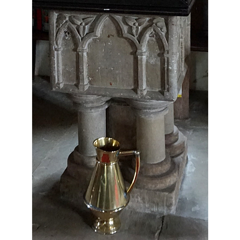
Image copyright © Ian S, 2016
CC-BY-SA-2.0
Results: 7 records
view of font
Copyright Statement: Image copyright © Ian S, 2016
Image Source: edited detail of a digital photograph taken 23 November 2016 by Ian S [www.geograph.org.uk/photo/5203212] [accessed 5 November 2019]
Copyright Instructions: CC-BY-SA-2.0
design element - architectural - arcade - blind - mixed arches
Scene Description: a broad trefoiled arched in the centre with narrow pointed arches at each end on each side
Copyright Statement: Image copyright © Ian S, 2016
Image Source: edited detail of a digital photograph taken 23 November 2016 by Ian S [www.geograph.org.uk/photo/5203212] [accessed 5 November 2019]
Copyright Instructions: CC-BY-SA-2.0
view of church exterior in context - southeast view
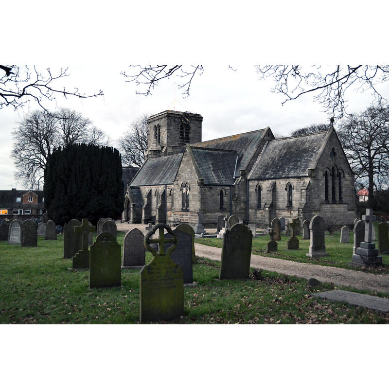
Copyright Statement: Image copyright © Neil Theasby, 2004
Image Source: digital photograph taken 15 December 2012 by Neil Theasby [www.geograph.org.uk/photo/5203151] [accessed 5 November 2019]
Copyright Instructions: CC-BY-SA-2.0
view of font and cover
Copyright Statement: Image copyright © Ian S, 2016
Image Source: digital photograph taken 23 November 2016 by Ian S [www.geograph.org.uk/photo/5203212] [accessed 5 November 2019]
Copyright Instructions: CC-BY-SA-2.0
view of church interior - looking east
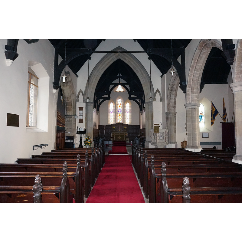
Copyright Statement: Image copyright © Ian S, 2016
Image Source: digital photograph taken 23 November 2016 by Ian S [www.geograph.org.uk/photo/3261000] [accessed 5 November 2019]
Copyright Instructions: CC-BY-SA-2.0
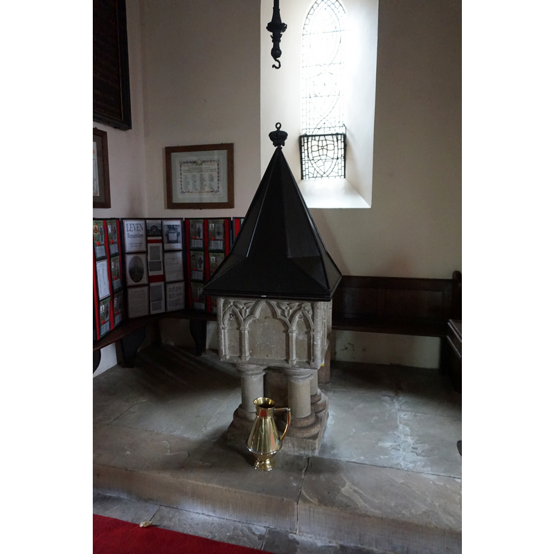
view of font cover
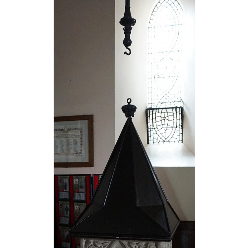
Copyright Statement: Image copyright © Ian S, 2016
Image Source: edited detail of a digital photograph taken 23 November 2016 by Ian S [www.geograph.org.uk/photo/5203212] [accessed 5 November 2019]
Copyright Instructions: CC-BY-SA-2.0
design element - motifs - roll moulding
Scene Description: forming the capitals and bases of the columns of the base -- part of the base appears to be a later replacement
Copyright Statement: Image copyright © Ian S, 2016
Image Source: edited detail of a digital photograph taken 23 November 2016 by Ian S [www.geograph.org.uk/photo/5203212] [accessed 5 November 2019]
Copyright Instructions: CC-BY-SA-2.0
INFORMATION
Font ID: 09619LEV
Object Type: Baptismal Font1
Font Century and Period/Style: 13th century, Early English
Church / Chapel Name: Parish Church of the Holy Trinity [originally from the demolished church of St. Faith]
Font Location in Church: Inside the new 19th-century church, at the W end
Church Patron Saint(s): The Holy Trinity [formerly St. Zita [aka Scytha] and/or St. Faith]
Church Notes: old church dedicated to St Faith was demolished 19thC; new church dedicated to the Holy Trinity built then; medieval font moved to new church
Church Address: South St, Leven, Hull HU17 5LR, UK -- Tel.: +44 1262 488042
Site Location: East Riding of Yorkshire, Yorkshire and the Humber, England, United Kingdom
Directions to Site: Located off (NW) the A165, about 10 km ENE of Beverley, 11 km W of Hornsea, 17-18 N of Hull
Ecclesiastic Region: Diocese of York
Historical Region: Hundred of Holderness [North Hundred]
Additional Comments: recycled font: when the old Early English church was abandoned, the font was moved to the new 19th century church in town
Font Notes:
Click to view
There is an entry for this Leven [variant spelling] in the Domesday survey [https://opendomesday.org/place/TA1045/leven/] [accessed 5 November 2019]; it reports a priest and a church in it. Sheahan & Whellan (1857) note: ''The square font of granite is ancient''. Described in Bulmer's Directory... of East Yorkshire (1892): "The square font from the old church rest on five cylindrical shafts, and is ornamented with two trefoil-headed arches on each side". This was the font from the now disappeared parish church of Leven, dedicated to St. Faith, that had existed about a mile from the village. The new church was built in the vilage and was consecrated in 1845 with a dedication to the Holy Trinity. [Bulmer's reference as transcribed in www.budd.karoo.net/bulmers2.html]. The entry for this parish in the Victoria County History (York East Riding, vol. 7, 2002) notes: "Leven church was recorded as part of the estate of St. John's church, Beverley [...] The medieval church stood 2 km. from the middle of the present village. It was dedicated in 1538 to ST. ZITA (Scytha), a saint popularly associated with rivers and bridges, [...] but ST. FAITH seems to have been an alternative dedicatee. [...] in 1844 most of the decayed church was demolished. The chancel was left and used for burial services until the churchyard was closed in 1876; it was pulled down in 1883. [...] he new church of HOLY TRINITY was built in 1843-4 on land in the centre of the village [...] The new church contains part of a 9thcentury cross shaft, [...] a late 13th-century font, [...] and the head of a 15th-century cross from St. Faith's churchyard." The entry for the new church here in Historic England [Listing NGR: TA1065745232] notes: "Church. 1843-44 by R D Chantrell. [...] Re-used square C13 font on central cylindrical pier and 4 colonettes: the tub is decorated with paired trefoil-headed blank arches with foliage to spandrels on 3 sides, and with a composition of central trefoil headed blank arch to centre flanked by blank lancets, all with foliage to spandrels."
COORDINATES
UTM: 30U 676305 5974749
Latitude & Longitude (Decimal): 53.891171, -0.317053
Latitude & Longitude (DMS): 53° 53′ 28.22″ N, 0° 19′ 1.39″ W
MEDIUM AND MEASUREMENTS
Material: stone, granite?
Number of Pieces: six?
Font Shape: square, mounted
Basin Exterior Shape: square
LID INFORMATION
Material: wood, oak?
Apparatus: yes; pulley
Notes: square lower section with stops to octagonal spire; tuned finial has connector to pulley hook; painted oak?
REFERENCES
- Victoria County History [online], University of London, 1993-. URL: https://www.british-history.ac.uk.
- Bulmer, T., History and Directory of East Yorkshire, 1892, [?]
- Sheahan, James Joseph, History and topography of the city of York; the East Riding of Yorkshire and a portion of the West Riding […], Beverley: printed for the publishers by John Green, Market Place, 1857, p. 420