Kirby Knowle No. 2 / Chirchebi / Kirkby Knowle / Kirkeby Undercnol
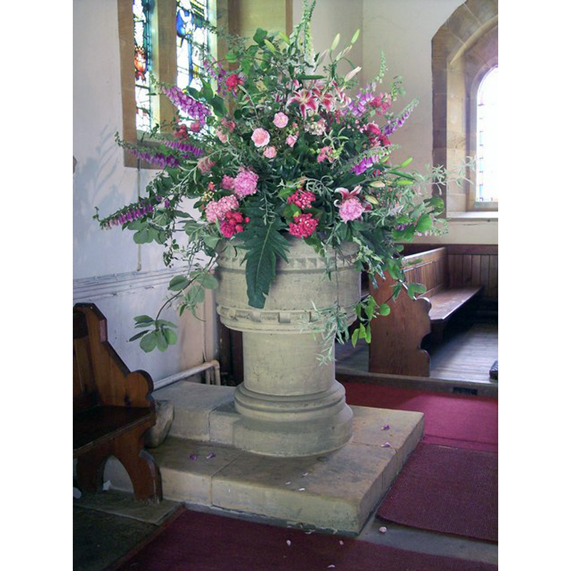
Image copyright © Miss Steel, 2007
CC-BY-SA-2.0
Results: 7 records
view of font
Scene Description: the base is said to belong to the 17th-century basin located outside, by the south portal [cf. FontNotes]
Copyright Statement: Image copyright © Miss Steel, 2007
Image Source: digital photograph taken 10 July 2007 by Miss Steel [www.geograph.org.uk/photo/517074] [accessed 5 December 2014]
Copyright Instructions: CC-BY-SA-2.0
design element - motifs - flat moulding
Copyright Statement: Image copyright © Miss Steel, 2007
Image Source: digital photograph taken 10 July 2007 by Miss Steel [www.geograph.org.uk/photo/517081] [accessed 5 December 2014]
Copyright Instructions: CC-BY-SA-2.0
design element - motifs - moulding - graded
Copyright Statement: Image copyright © Miss Steel, 2007
Image Source: digital photograph taken 10 July 2007 by Miss Steel [www.geograph.org.uk/photo/517081] [accessed 5 December 2014]
Copyright Instructions: CC-BY-SA-2.0
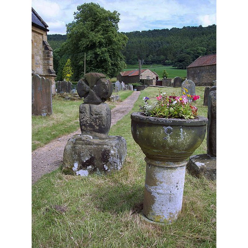
view of font in context
![the 17th-century basin in the cobtext of the south portal [cf. FontNotes]](/static-50478a99ec6f36a15d6234548c59f63da52304e5/compressed/1141212004_compressed.png)
Scene Description: the 17th-century basin in the cobtext of the south portal [cf. FontNotes]
Copyright Statement: Image copyright © Miss Steel, 2007
Image Source: digital photograph taken 10 July 2007 by Miss Steel [www.geograph.org.uk/photo/517058] [accessed 5 December 2014]
Copyright Instructions: CC-BY-SA-2.0
view of church exterior - southwest view
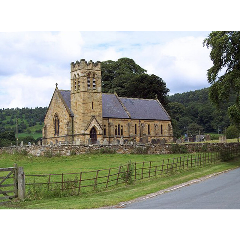
Scene Description: Source caption: "The Church of St Wilfrid, Kirby Knowle. Built in 1873, the very traditional building with its tower over the porch seems always to have been part of the landscape.
Copyright Statement: Image copyright © Miss Steel, 2007
Image Source: digital photograph taken 10 July 2007 by Miss Steel [www.geograph.org.uk/photo/517010] [accessed 5 December 2014]
Copyright Instructions: CC-BY-SA-2.0
view of church interior - nave - looking west
![the font in use, athe far [west] end, left [south] side](/static-50478a99ec6f36a15d6234548c59f63da52304e5/compressed/1141212007_compressed.png)
Scene Description: the font in use, athe far [west] end, left [south] side
Copyright Statement: Image copyright © Miss Steel, 2007
Image Source: digital photograph taken 10 July 2007 by Miss Steel [www.geograph.org.uk/photo/517078] [accessed 5 December 2014]
Copyright Instructions: CC-BY-SA-2.0
view of church interior - nave - looking east
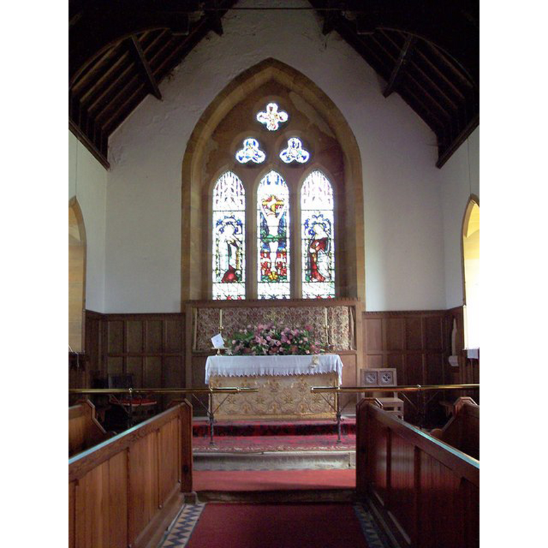
Copyright Statement: Image copyright © Miss Steel, 2007
Image Source: digital photograph taken 10 July 2007 by Miss Steel [www.geograph.org.uk/photo/517076] [accessed 5 December 2014]
Copyright Instructions: CC-BY-SA-2.0
INFORMATION
Font ID: 09599KIR
Object Type: Baptismal Font1
Font Century and Period/Style: 17th century
Church / Chapel Name: Parish Church of St. Wilfrid
Font Location in Church: The basin is outside in the churchyard; the base is inside the church
Church Patron Saint(s): St. Wilfrid [aka Wilfred, Wilfrith]
Church Address: Whinmoor Hill, Kirby Knowle, North Yorkshire YO7 2JQ
Site Location: North Yorkshire, Yorkshire and the Humber, England, United Kingdom
Directions to Site: Located near Upsall, 7 km NE of Thirsk, on the border of the North Yorkshire Moors
Ecclesiastic Region: Diocese of York
Historical Region: Hundred of Yarlestre [in Domesday]
Font Notes:
Click to view
There is an entry for Kirby [Knowle] [variant spelling] in the Domesday survey [http://domesdaymap.co.uk/place/SE4687/kirby-knowle/] [accessed 5 December 2014]; it mentions a priest, but not a church in it, though there probably was one there. Bulmer's Directory... (1890: 737) informs that an old baptismal font was in the churchyard at the time. The entry for this church in the Victoria County History (York North Riding, vol. 2, 1923) notes: "The whole building was erected in 1873–4 on an ancient site, little of the former church being left except one or two stones in different places. The oldest of these are two over the entrance to the south porch, which are carved with early 12th-century interlacing work. [...] In the churchyard are some more old stones, including the head and stump of a pre-Conquest cross, an old stone coffin, a stoup and what appears to be the head of a 12th-century window. There is also a font of much later date, probably of the 17th century, with a circular bowl and a stem of the same form with a moulded capital and base." The Hillside Villages web page [www.thirsk.org.uk/kirbyknowle.church.html] confirms that " a 17th century font is in the churchyard but its original base remains in the church". [cf. Index entry for Kirby Knowle No. 1 for an earlier holy-water stoup moved into the church ca. 1873]
COORDINATES
UTM: 30U 611806 6015958
Latitude & Longitude (Decimal): 54.279297, -1.282733
Latitude & Longitude (DMS): 54° 16′ 45.47″ N, 1° 16′ 57.84″ W
MEDIUM AND MEASUREMENTS
Material: stone
Number of Pieces: two
Font Shape: hemispheric, mounted
Basin Interior Shape: round
Basin Exterior Shape: round
REFERENCES
- Victoria County History [online], University of London, 1993-. URL: https://www.british-history.ac.uk.
- Bulmer, T., History, Topography, and Directory of North Yorkshire, Comprising its Ancient and Modern History; [...], Preston: T. Bulmer & Co. (T. Snape & Co. Printers), 1890, p. 737