North Baddesley / Baldisle / Bedeslei
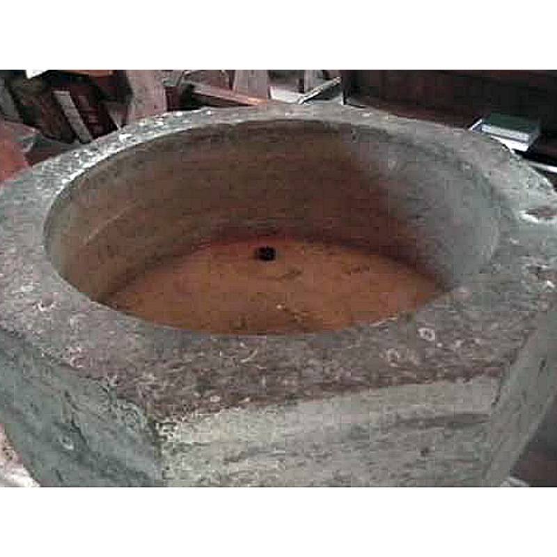
Image copyright © The Church of England in Ampfield, Chilworth and North Baddesley, 2004
No known copyrights restriction / Fair Dealing
Results: 2 records
view of basin - interior
Scene Description: note the off-centre drain hole
Copyright Statement: Image copyright © The Church of England in Ampfield, Chilworth and North Baddesley, 2004
Image Source: digital photograph in The Church of England in Ampfield, Chilworth and North Baddesley [www.baddesleychurch.org]
Copyright Instructions: No known copyrights restriction / Fair Dealing
view of church exterior - northeast view
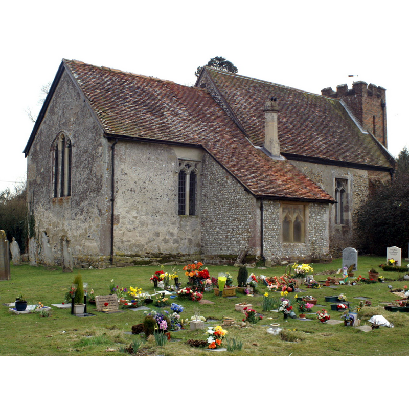
Copyright Statement: Image copyright © Pierre terre, 2006
Image Source: digital photograph taken 20 March 2006 by Pierre terre [www.geograph.org.uk/photo/139884] [accessed 24 July 2018]
Copyright Instructions: CC-BY-SA-2.0
INFORMATION
Font ID: 09380BAD
Object Type: Baptismal Font1
Font Century and Period/Style: 14th century, Decorated
Church / Chapel Name: Parish Church of St. John the Baptist
Font Location in Church: Inside the church, a little to the E of the S door
Church Patron Saint(s): St. John the Baptist
Church Address: Flexford Road, North Baddesley, Hampshire SO52 9BG, UK
Site Location: Hampshire, South East, England, United Kingdom
Directions to Site: Located off (N) the M27, 5 km ESE of Romsey, 10 km N of Southampton, near Chilworth
Ecclesiastic Region: Diocese of Winchester
Historical Region: Hundred of Mainsbridge -- Hundred of Mansbridge [in Domesday]
Additional Comments: re-cycled stoup: the base of the former stoup in the porch may have been a 12th-century column re-cycled -- disappeared font? (the one from the Domesday-time church here)
Font Notes:
Click to view
There is an entry for [North] Baddesley [variant spelling] in the Domesday survey [http://opendomesday.org/place/SU4020/north-baddesley/] [accessed 24 July 2018]; it reports a church in it. The Victoria County History (Hampshire, vol. 3, 1908) notes: "The church of North Baddesley is mentioned in the Domesday Survey; but, like the manor, it had passed into the possession of the Knights of St. John of Jerusalem before 1167 [...] The church remained with the Knights Hospitallers until the dissolution of the monasteries [1536-1541] [...] it is to be noted that in the porch floor, near the north-east angle, is part of an octagonal shaft of twelfth-century date ornamented with zigzag, perhaps a relic of the former church. Its present position, nearly buried in the floor, may be due to its re-use as the pedestal of a holy-water stone here. [...] The west gallery has an eighteenthcentury panelled font". The entry for this church in Historic England [Listing NGR: SU4046020644] reports a "C14 octagonal Purbeck font" in it. Described and illustrated in the Parish web site, after the contents of a booklet written by K.J. Ritchie, churchwarden in 1948-1950: "The Font, which stands a little to the east of the South door of the nave, is of Purbeck marble [i.e., a type of limestone], with an octagonal bowl, stem and base. The details of the base suggest a 14th century date." [source: www.baddesleychurch.org]
COORDINATES
UTM: 30U 610338 5649411
Latitude & Longitude (Decimal): 50.9857, -1.428
Latitude & Longitude (DMS): 50° 59′ 8.52″ N, 1° 25′ 40.8″ W
MEDIUM AND MEASUREMENTS
Material: stone, limestone (Purbeck marble)
Font Shape: octagonal, mounted
Basin Interior Shape: round
Basin Exterior Shape: octagonal
Drainage System: off-centre hole in basin
REFERENCES
- Victoria County History [online], University of London, 1993-. URL: https://www.british-history.ac.uk.