Killagholehane / Cill Achadh Uí Liatháin / Cill Deochain Liatháin / Killaliathan
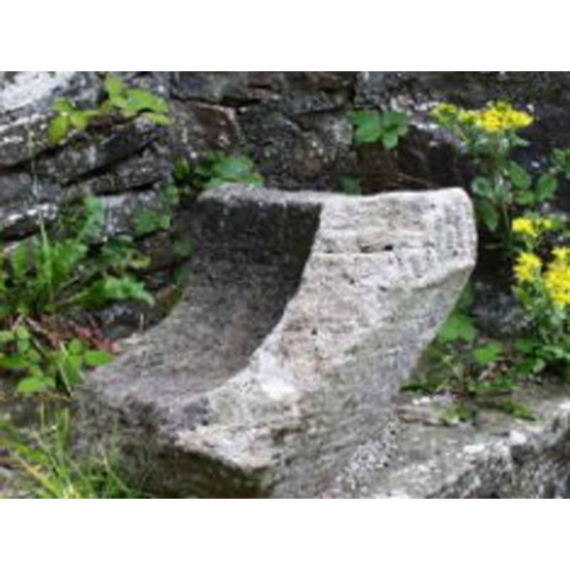
Image copyright © Heritage Project, Diocese of Limerick, 2004
Permision received (e-mail from Charlie Healy, webmaster,of 25/2/2004)
Results: 1 records
view of fragment
Copyright Statement: Image copyright © Heritage Project, Diocese of Limerick, 2004
Image Source: Heritage Project, Diocese of Limerick [www.limerickdioceseheritage.org/Dromcollogher/CRDromcollogher.htm]
Copyright Instructions: Permision received (e-mail from Charlie Healy, webmaster,of 25/2/2004)
INFORMATION
Font ID: 09265KIL
Object Type: Stoup, fragment
Font Century and Period/Style: Medieval
Church / Chapel Name: Parish Church of St. Bartholomew, Killagholehane [in ruins]
Font Location in Church: In the ruins of the church
Church Patron Saint(s): St. Bartholomew
Church Notes: 15thC church built on the site of an earlier church
Church Address: Killagholehane, Lacka Lower, Broadford, County Limerick, Ireland
Site Location: Limerick, Munster, Republic of Ireland, Europe
Directions to Site: Ruins site of this church located across the road from the new parish church of Dromcollogher, off the R579, 2 km S of Broadford
Additional Comments: abandoned stoup: now in the ruins of the abandoned church -- care of the OPW
Font Notes:
Click to view
Reported as a fragment of a "holy water font" in the web site of the Heritage Project, Diocese of Limerick [www.limerickdioceseheritage.org/Dromcollogher/CRDromcollogher.htm] [We are grateful to Charlie Healey and to the Heritage Project, Diocese of Limerick, for the image of this stoup]
Credit and Acknowledgements: We are grateful to Charlie Healey and to the Heritage Project, Diocese of Limerick, for the image of this stoup.
COORDINATES
UTM: 29U 501558 5797945
Latitude & Longitude (Decimal): 52.331812, -8.977135
Latitude & Longitude (DMS): 52° 19′ 54.52″ N, 8° 58′ 37.69″ W
MEDIUM AND MEASUREMENTS
Material: stone
Number of Pieces: fragment