Barrington / Barintone
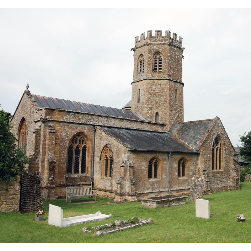
Image copyright © Bill Harrison, 2016
CC-BY-SA-2.0
Results: 2 records
view of church exterior - southwest view
Scene Description: Source caption: "St Mary's Church, Barrington. View from the south-west: Perp windows in the nave but EE lancet windows in the lower stages of the octagonal tower."
Copyright Statement: Image copyright © Bill Harrison, 2016
Image Source: digital photograph taken 6 July 2016 by Bill Harrison [www.geograph.org.uk/photo/5084963] [accessed 14 February 2018]
Copyright Instructions: CC-BY-SA-2.0
view of stoup
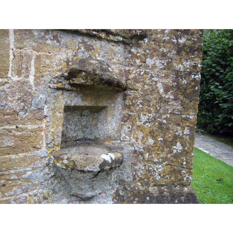
Scene Description: Source caption: "Church of St Mary the Virgin. Those entering the church would sign themselves with holy water as an act of self-consecration."
Copyright Statement: Image copyright © Anthony Vosper, 2016
Image Source: digital photograph taken 7 October 2016 by Anthony Vosper [www.geograph.org.uk/photo/5167954] [accessed 14 February 2018]
Copyright Instructions: CC-BY-SA-2.0
INFORMATION
Font ID: 09229BAR
Object Type: Baptismal Font1?
Font Century and Period/Style: 13th century, Medieval
Church / Chapel Name: Parish Church of St. Mary the Virgin
Church Patron Saint(s): St. Mary the Virgin
Church Address: 4 Manor Cottages, Barrington, Ilminster TA19 0JB, UK -- Tel.: +44 1460 240228
Site Location: Somerset, South West, England, United Kingdom
Directions to Site: Located off (N) the B3168, 6 km NE of Ilminster, 16 km W of Yeovil, 16 km E of Taunton
Ecclesiastic Region: Diocese of Bath & Wells
Historical Region: Hundred of South Petherton
Additional Comments: disappeared font? (removed from the church ca. 1860)
Font Notes:
Click to view
There is an entry for this Barrington [variant spelling] in the Domesday survey [http://opendomesday.org/place/ST3918/barrington/] [accessed 14 February 2018], but it mentions neither cleric nor church in it. The entry for this parish in the Victoria County History (Somerset, vol. 4, 1978) notes: "Part of a capital found embedded in the tower is evidence of a building of the earlier 13th century, though the earliest reference to a church occurs as late as 1240–1 [...] The crossing with its short octagonal tower, the chancel and transepts were built in the late 13th century and retain many of their original features including window tracery and, in the south transept and chancel, piscinas", and mentions that a new font was provided in the 1860s restoration of this church. The West Gallery Churches site [www.westgallerychurches.com/gallery.html] notes: "West gallery removed in 1860 (along with communion table, rails, pulpit, reading desk, font, pews, chancel and transepts!)". The National Monuments Record, English Heritage [http://www.imagesofengland.org.uk/details/default.aspx?id=264319] [accessed 16 September 2009] notes: "Octagonal Perpendicular style font, though probably a C19 copy". Not mentioned in Pevsner (1958).
COORDINATES
UTM: 30U 509052 5645323
Latitude & Longitude (Decimal): 50.959444, -2.871111
Latitude & Longitude (DMS): 50° 57′ 34″ N, 2° 52′ 16″ W
MEDIUM AND MEASUREMENTS
Material: stone
Font Shape: octagonal, mounted
Basin Interior Shape: round
Basin Exterior Shape: octagonal
REFERENCES
- Victoria County History [online], University of London, 1993-. URL: https://www.british-history.ac.uk.