London No. 22 / Stepney / Stebenhed / Stibenhede
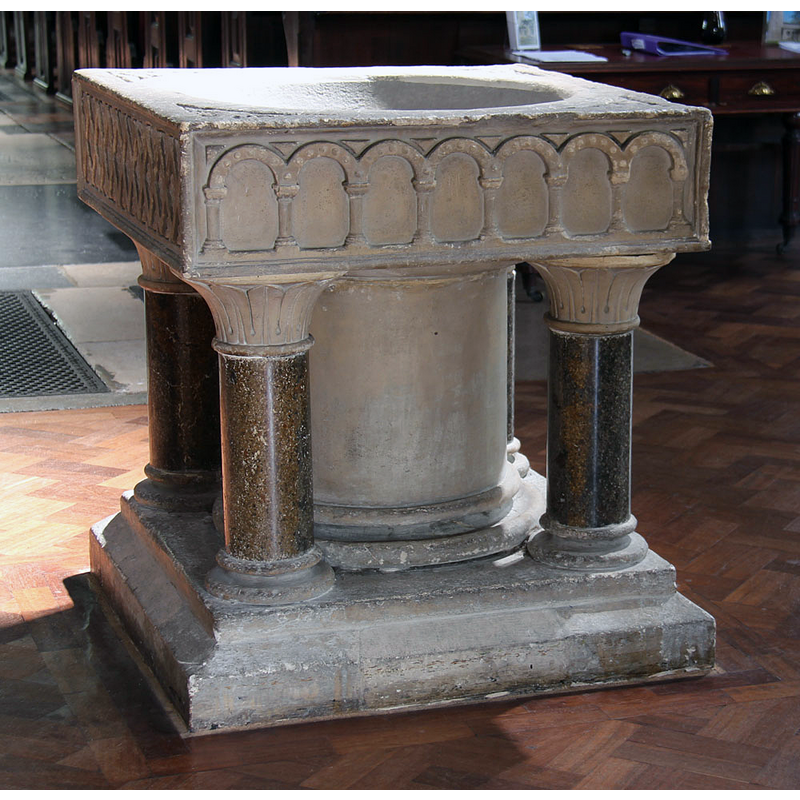
Image copyright © John Salmon, 2013
CC-BY-SA-2.0
Results: 6 records
view of font
Scene Description: the modern font [cf. FontNotes]
Copyright Statement: Image copyright © John Salmon, 2013
Image Source: digital photograph taken 16 May 2013 by John Salmon [www.geograph.org.uk/photo/3477060] [accessed 26 June 2019]
Copyright Instructions: CC-BY-SA-2.0
view of church exterior - southwest view
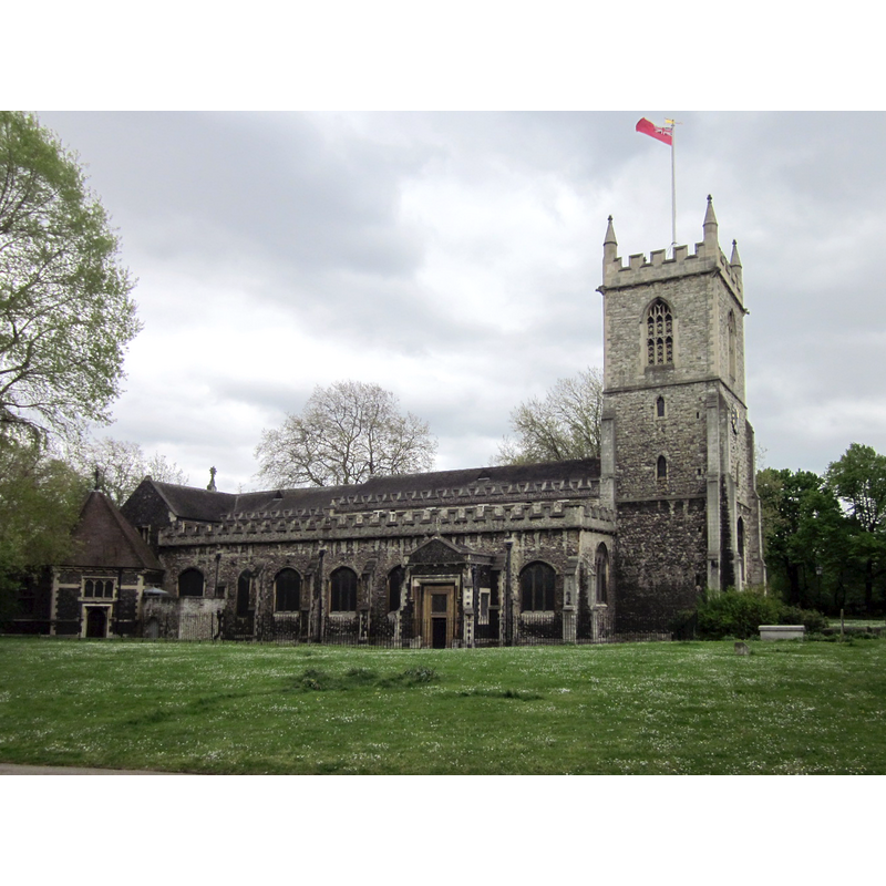
Copyright Statement: Image copyright © Zeisterre, 2013
Image Source: edited detail of a digital photograph taken 11 May 2013 by Zeisterre [https://commons.wikimedia.org/wiki/File:Stepney_St._Dunstan's_04.jpeg] [accessed 26 June 2019]
Copyright Instructions: CC-BY-SA-3.0
view of church exterior - west view
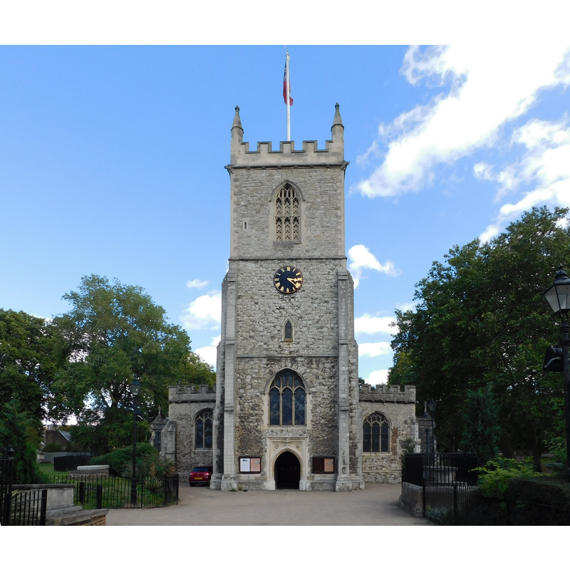
Copyright Statement: Image copyright © Paul the Archivist, 2018
Image Source: digital photograoph taken 7 September 2018 by Paul the Archivist [https://commons.wikimedia.org/wiki/File:St_Dunstan's_Church,_Stepney_11.jpg] [accessed 26 June 2019]
Copyright Instructions: CC-BY-SA-4.0
view of church interior - crucifix
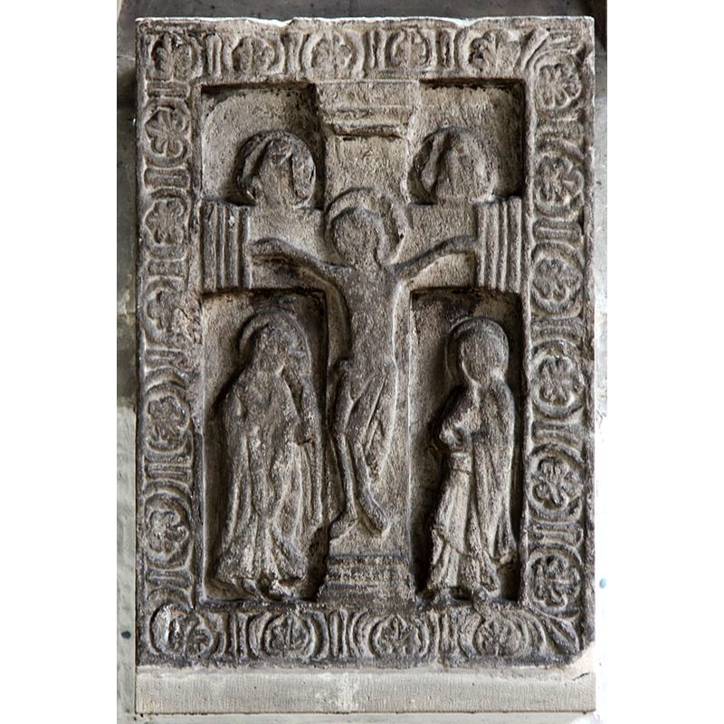
Scene Description: a medieval Crucifixion scene
Copyright Statement: Image copyright © John Salmon, 2013
Image Source: digital photograph taken 16 May 2013 by John Salmon [www.geograph.org.uk/photo/3477043] [accessed 26 June 2019]
Copyright Instructions: CC-BY-SA-2.0
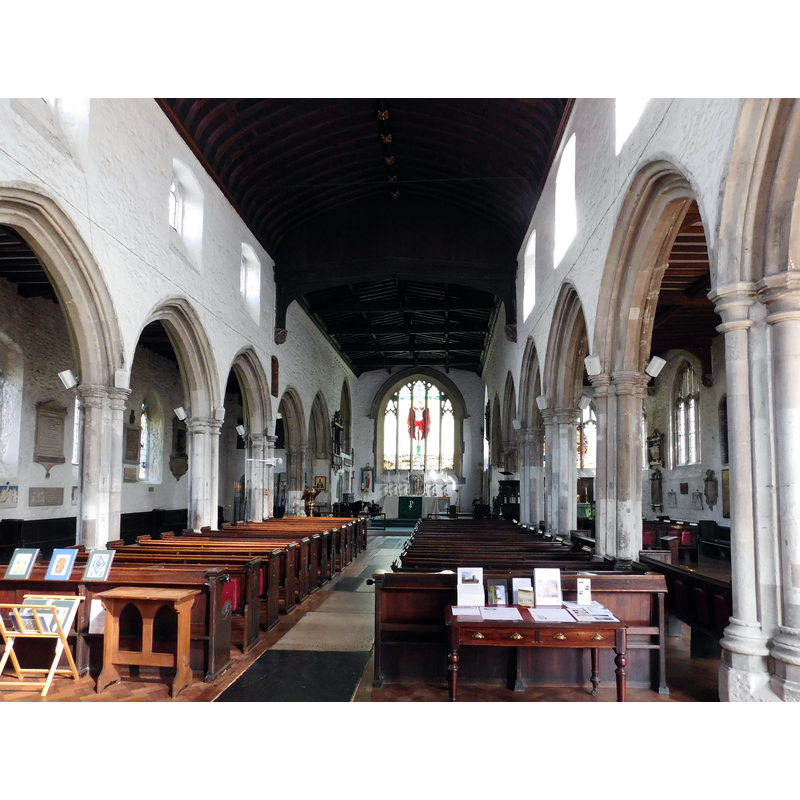
view of church interior - looking west
Copyright Statement: Image copyright © Paul the Archivist, 2018
Image Source: digital photograoph taken 7 September 2018 by Paul the Archivist [https://commons.wikimedia.org/wiki/File:St_Dunstan's_Church,_Stepney_07.jpg] [accessed 26 June 2019]
Copyright Instructions: CC-BY-SA-4.0
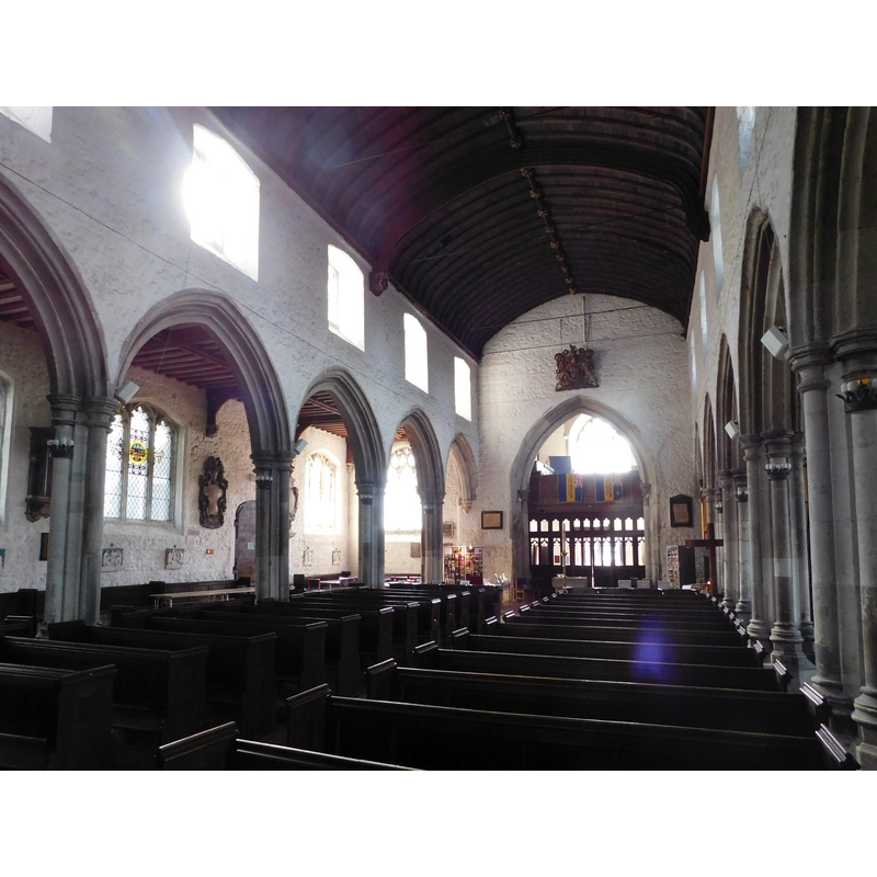
view of church interior - looking east
Copyright Statement: Image copyright © Paul the Archivist, 2018
Image Source: digital photograoph taken 7 September 2018 by Paul the Archivist [https://commons.wikimedia.org/wiki/File:St_Dunstan's_Church,_Stepney_03.jpg] [accessed 26 June 2019]
Copyright Instructions: CC-BY-SA-4.0
INFORMATION
Font ID: 09204LON
Object Type: Baptismal Font1?
Font Century and Period/Style: 12th century (mid?), Late Norman
Church / Chapel Name: Parish Church of St. Dunstan and All Saints
Font Location in Church: [cf. FontNotes]
Church Patron Saint(s): St. Dunstan & All Saints
Church Notes: The original church said to have been built in 952, in stone, to replace an earlier wooden structure, by St Dunstan bishop of London -- the present church is ca. 1400. A stone rood above the altar table is Saxon, according to Blatch's guide to London churches (1995)
Church Address: Stepney High St, London E1 0NR, UK
Site Location: Greater London, South East, England, United Kingdom
Directions to Site: Located SE of the B121-B140 crossroads, just W of Mile End Park, E of the City
Ecclesiastic Region: Diocese of London
Historical Region: Hundred of Ossulstone -- formerly Middlesex
Additional Comments: disappeared font? (the one from the 12thC church here? perhaps other font(s) from the earlier churches?)
Font Notes:
Click to view
There are thirteen entries for Stepney [variant spellings] in the Domesday survey [https://opendomesday.org/place/TQ3581/stepney/] [accessed 26 June 2019], none of which mentions cleric or church in it. The entry for this parish in the Victoria County History (Middlesex, vol. 11, 1998) notes: "The church of Stepney, which existed by 1154, [...] served the whole parish until the foundation of chapels of ease and private chapels from the 12th century and of independent parishes from the 14th [...] The suggestion in 1708 of an additional dedication led writers to assume the church was a Saxon foundation, rededicated to St. Dunstan after his canonization in 1029. [...] A groundless statement that Matthew Paris attributed the foundation to Dunstan [...] has often been repeated, [...] but the dedication to him may date from the Church's revived interest in him after 1093. [...] existing church, mostly 15th-century but much restored [...] Alterations in 1967-8 included the formation of a priest's vestry in the organ loft of 1872, a parish room in the hexagonal vestry, and of a baptistery by moving the font from the west end of the nave to the north aisle." The present font, claimed by some to be medieval, possibly Norman, consists of a square basin mounted on a a central broad shaft and four slender colonnettes, the whole raised on a square lower base or plinth of about the same height as the basin itself; one of the sides of the basin shows a row of five Maltese crosses inscribed in circles, another a blind arcade of round arches,... but the font appears, sight unseen, modern, a Victorian attempt at a table-top Norman font design, unless a part of the basin is original and has been totally recarved. The font is not mentioned in Blatch's guide to London churches of 1995.
A 3-D model of this font made by artfletch may be seen in Sketchfab [https://sketchfab.com/3d-models/st-dunstan-and-all-saints-font-afb9aff201534c148f7a721a44f157c9] [accessed 25 July 2025]; its caption reads: "The font in St Dunstan and All Saints, Stepney, London."
A 3-D model of this font made by artfletch may be seen in Sketchfab [https://sketchfab.com/3d-models/st-dunstan-and-all-saints-font-afb9aff201534c148f7a721a44f157c9] [accessed 25 July 2025]; its caption reads: "The font in St Dunstan and All Saints, Stepney, London."
COORDINATES
UTM: 30U 705249 5711463
Latitude & Longitude (Decimal): 51.516944, -0.041667
Latitude & Longitude (DMS): 51° 31′ 1″ N, 0° 2′ 30″ W
MEDIUM AND MEASUREMENTS
Material: stone
Font Shape: square, mounted
Basin Interior Shape: round
Basin Exterior Shape: square
REFERENCES
- Victoria County History [online], University of London, 1993-. URL: https://www.british-history.ac.uk.