Barton-on-the-Heath No. 1 / Barton on the Heath / Bertone
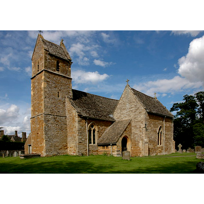
Image copyright © Philip Halling, 2007
CC-BY-SA-2.0
Results: 2 records
view of church exterior - southwest view
Copyright Statement: Image copyright © Philip Halling, 2007
Image Source: digital photograph taken 28 July 2007 by Philip Halling [www.geograph.org.uk/photo/512013] [accessed 19 December 2014]
Copyright Instructions: CC-BY-SA-2.0
view of church exterior - southeast view
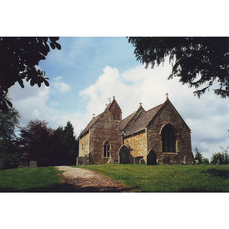
Copyright Statement: Image copyright © Nick Macneill, 2002
Image Source: digital photograph taken 27 April 2002 by Nick Macneill [www.geograph.org.uk/photo/1664561] [accessed 19 December 2014]
Copyright Instructions: CC-BY-SA-2.0
INFORMATION
Font ID: 08803BAR
Object Type: Stoup
Font Century and Period/Style: 12th century / 15th century, Norman? / Perpendicular?
Church / Chapel Name: Parish Church of St. Lawrence
Font Location in Church: E of the S doorway [cf. FontNotes]
Church Patron Saint(s): St. Lawrence [aka Laurence]
Church Address: Barton-on-the-Heath, Warwickshire GL56 0PH
Site Location: Warwickshire, West Midlands, England, United Kingdom
Directions to Site: Located off (N) the A44, about 10 km NW of Chipping Norton, about 40 km S of Stratford upon Avon
Ecclesiastic Region: Diocese of Coventry
Historical Region: Hundred of Barcheston [in Domesday] -- Hundred of Kington
Font Notes:
Click to view
There is an entry for Barton[-on-the-Heath] [variant spelling] in the Domesday survey [http://domesdaymap.co.uk/place/SP2532/barton-on-the-heath/] [accessed 19 December 2014], but it mentions neither cleric nor church in it. A stoup of the Norman period is noted in Parker (1850). Listed in Cox & Harvey (1907) as a holy-water stoup of the Norman period at the entrance of this church. The Victoria County History (Warwick, vol. 5, 1949) notes: "The chancel and nave are of early-12th-century date [...] The chancel arch, only 11 ft. wide, is of early-12th-century date but was probably partly rebuilt about the end of the same century [...] east of the south doorway is a stoup in a 15th-century four-centred head" [NB: it is not clear whether or not the same stoup is referred by the two sources. The CRSBI (2014) does not mention any early stoup, though it does mention that some early stones may have been re-carved. English Heritage [Listing NGR: SP2560632523] (1966) notes: "Church. Perhaps Anglo-Danish origins. Early and late C12, and C14 with some C15 alterations. C17 and C19 restorations. [...] C15 octagonal carved font." [cf. Index entry for Barton-on-the-Heath No. 2 for the 15th-century font in this church]
COORDINATES
UTM: 30U 594186 5760845
Latitude & Longitude (Decimal): 51.990276, -1.628307
Latitude & Longitude (DMS): 51° 59′ 25″ N, 1° 37′ 41.9″ W
MEDIUM AND MEASUREMENTS
Material: stone
REFERENCES
- Victoria County History [online], University of London, 1993-. URL: https://www.british-history.ac.uk.
- Corpus of Romanesque Sculpture in Britain and Ireland, The Corpus of Romanesque Sculpture in Britain and Ireland, The Corpus of Romanesque Sculpture in Britain and Ireland. URL: http://www.crsbi.ac.uk.
- Cox, John Charles, English Church Furniture, New York: E.P. Dutton & Co., 1907, p. 236
- Parker, John Henry, A Glossary of Terms used in Grecian, Roman, Italian and Gothic Architecture, Oxford: J. H. Parker, 1850, p. 448