Boisney / Boenai / Boenay / Boenei / Boeneium / Boisnay / Bouesnay / Bouesney
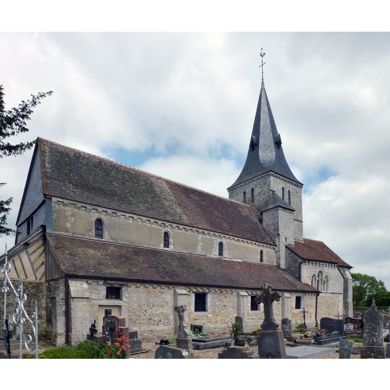
Image copyright © [in the public domain]
PD-self
Results: 2 records
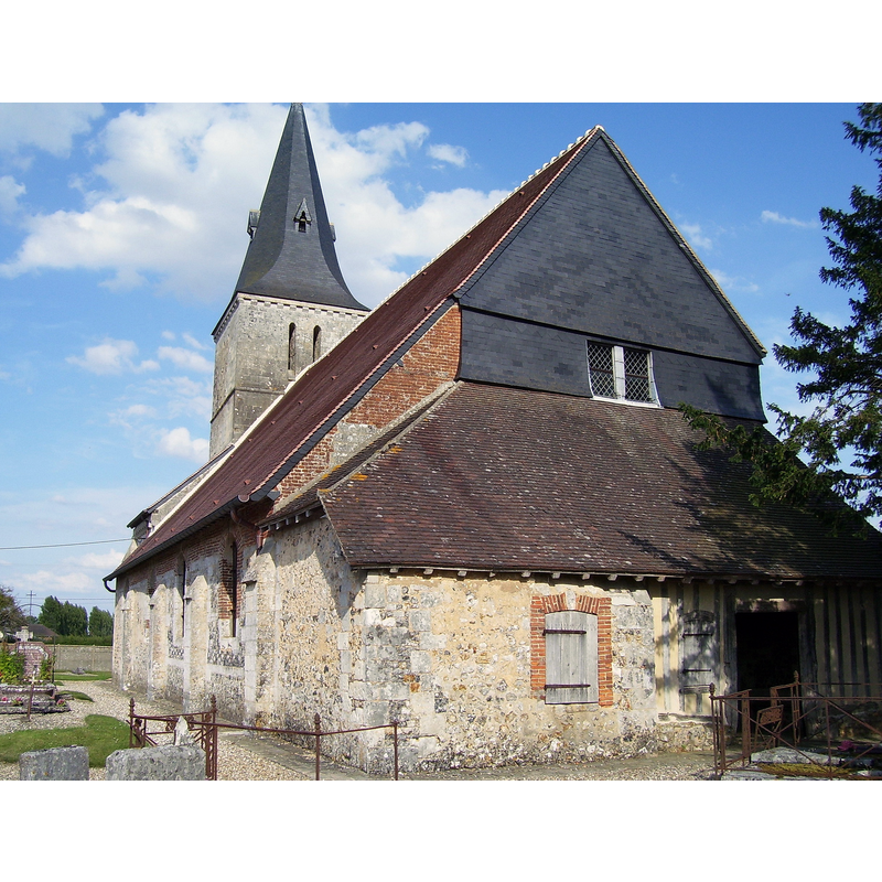
view of church exterior - northeast view
Scene Description: Source caption: "Boisney (Eure, Fr) église Saint-Aubin"
Copyright Statement: Image copyright © [in the public domain]
Image Source: edited detail of a digital photograph 3 June 2013 by Havang(nl) [https://commons.wikimedia.org/wiki/File:Boisney_(Eure,_Fr)_église_Saint-Aubin.JPG] [accessed 2 October 2023]
Copyright Instructions: PD-self
view of church exterior - southeast view
Copyright Statement: Image copyright © [in the public domain]
Image Source: digital photograph 16 July 2009 by Stanzilla [https://commons.wikimedia.org/wiki/File:Église_Saint-Aubin_Boisney.jpg] [accessed 2 October 2023]
Copyright Instructions: PD-self
INFORMATION
Font ID: 08567BOI
Object Type: Baptismal Font1?
Font Century and Period/Style: 12th century (mid?), Romanesque
Church / Chapel Name: Église paroissiale Saint-Aubin
Church Patron Saint(s): St. Aubin [aka Albinus of Angers]
Church Notes: 12th original church -- listed in Mérimée [ref.: PA00099346]
Church Address: 2 La Grande Rue, 27800 Boisney, France
Site Location: Eure, Normandie, France, Europe
Directions to Site: Located off the D31-D613 crossroads, S of the A28, roughly equidistant between Bernay (SW) and Brionne (NE)
Ecclesiastic Region: Diocèse d'Évreux
Historical Region: Haute-Normandie
Additional Comments: disappeared font? (the one from the mid-12thC church here)
Font Notes:
Click to view
[NB: we have no information on the medieval font of this church]. The entry for Boisney in Arthur Kingsley Porter's Medieval Architecture, vol. 1 (New York: Baker and Taylor, 1909) p. 306, reads: "BOISNEY, Eure. Eglise, which assigned to c. 1150 by Ruprich-Robert,' consists of three aisles, a square choir, and a central tower which is adjoined to the north and south by two little chapels too small to deserve the name of transept. Beneath the central tower is a rib vault with pointed arches; the rest of the church is roofed in wood. The exterior is notable chiefly for the fa9ade of the XVI century, for the decoration in arched corbel-tables, and for certain pointed windows. (RuprichRobert; De la Balle.)" [it mentions no font in it]. [NB: we found a single uncorroborated reference to an ancient baptistery here [source: http://members.aol.com/canteure/brionne.html]]
COORDINATES
UTM: 31U 329024 5447221
Latitude & Longitude (Decimal): 49.153982, 0.655099
Latitude & Longitude (DMS): 49° 9′ 14.33″ N, 0° 39′ 18.35″ E