San Feliu de Guixols, Torre del Fum / Sant Feliu de Guíxols
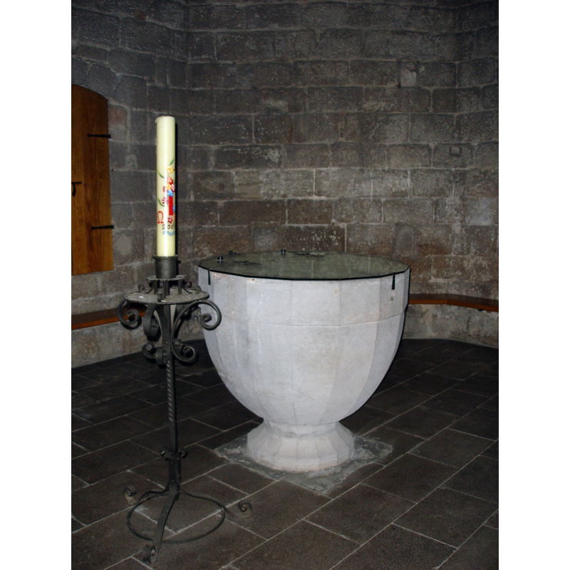
Image copyright © [in the public domain]
[released to the public domain by the author]
Results: 1 records
view of font and cover
Scene Description: the modern font in the baptistery chapel
Copyright Statement: Image copyright © [in the public domain]
Image Source: digital photograph taken 26 August 2007 by Mutari [http://commons.wikimedia.org/wiki/File:Monestir_de_Sant_Feliu_de_Gu%C3%ADxols_-_009.jpg] [accessed 15 March 2010]
Copyright Instructions: [released to the public domain by the author]
INFORMATION
Font ID: 07598FEL
Object Type: Baptistery?
Font Century and Period/Style: 5th - 6th century, Early Christian
Church / Chapel Name: In the old Benedictine Monastery
Church Address: Plaça del Monestir, 17220 Sant Feliu de Guíxols, Girona, Spain
Site Location: Gerona / Girona, Cataluña / Catalunya, Spain, Europe
Directions to Site: Located off the GI-682, S of the C-65, 27 km SE of Gerona capital
Ecclesiastic Region: Diócesis de Gerona
Historical Region: Baix Empordà
Font Notes:
Click to view
Reported and illustrated in Palol (1967: 155-156) as a possible baptistery building found under the Torre del Fum in the Benedictine monastery at San Feliu; Palol describes it as either a baptismal or a funerary site, of the Oriental type and probably dating to the 5th or 6th century; no font or piscina was discovered at the time [to be completed: see Khatchatrian's Les Baptist... (Paris, 1962)]. The baptistery chapel houses now a polygonal baptismal font that is either a modified late-Gothic font or a modern one; it is a large basin that appears to have sixteen sides, a vertical upper portion with a tall underbowl, raised on a squat base of the same shape. It has a modern glass cover hinged at the back, and is plain except for the arrises at the angles [NB: not listed separately as it appears to be a modern work].
COORDINATES
UTM: 31T 502224 4625373
Latitude & Longitude (Decimal): 41.7802, 3.02676
Latitude & Longitude (DMS): 41° 46′ 48.72″ N, 3° 1′ 36.34″ E
REFERENCES
- Fontaine, Jacques, Art pré-roman hispanique, La Pierre-qui-vire, Yonne: Zodiaque, 1973-1977, t. 1: 49
- Palol, Pedro de, Arqueología cristiana de la España romana: siglos IV a VI, Madrid, Valladolid: Consejo Superior de Investigaciones Científicas, Instituto Enrique Flórez, 1967, p. 155-156