Monkton Deverill / East Monkton / Moulton Deverel
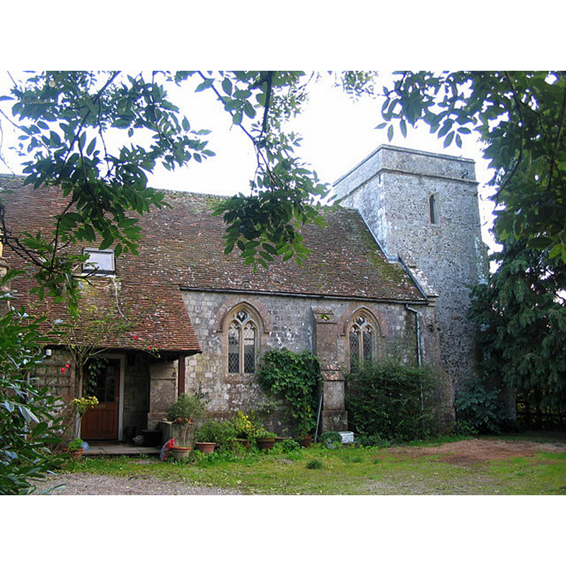
Image copyright © Phil Williams, 2006
CC-BY-SA-2.5
Results: 1 records
view of church exterior - north view
Scene Description: Source caption: "The old church at Monkton Deverill. A view looking south from the public footpath skirting the old church at Monkton Deverill. The building has been a private dwelling for over 20 years."
Copyright Statement: Image copyright © Phil Williams, 2006
Image Source: digital photograph 13 October 2006 by Phil Williams [https://www.geograph.org.uk/photo/261102] [accessed 28 July 2022]
Copyright Instructions: CC-BY-SA-2.5
INFORMATION
Font ID: 07317MON
Object Type: Baptismal Font1
Font Century and Period/Style: 12th - 13th century, Transitional / Early English
Cognate Fonts: [cf. FontNotes]
Church / Chapel Name: Parish Church of King Alfred the Great [redundant in 1971; became a private dwelling]
Font Location in Church: [cf. FontNotes]
Church Patron Saint(s): St. Alfred
Church Notes: originally a chapel of the church at Longbridge Deverill; 14thC tower; moct of the church demolished mid-19thC
Church Address: [NB: address & coordinates are given for the former church]
Site Location: Wiltshire, South West, England, United Kingdom
Directions to Site: Monkton Deverill is located off the B3095, 8 km S of Warminster
Font Notes:
Click to view
No entry found for Monkton Deverill in the Domesday survey. Listed in Cox & Harvey (1907) as a baptismal font of the Norman period. [NB: C&H list this entry as "Moulton Deverel", in Wiltshire -- the Deverills (Longbridge, Hill, Brixton and Monkton) are all clustered just S of Warminster. C&H must have referred to the medieval font at Monkton Deverill]. Noted as a Norman font in Edward Hutton's Highways and Byways in Wiltshire (1928): 235. The entry for this former church in Historic England [Listing NGR: ST8558337354] notes: "Anglican parish church, now redundant. C14 tower, rest rebuilt 1845 by T. H. Wyatt [...] Church declared redundant 1970, empty at time of survey (July 1985)"; It does not mention the font. [cf. BSI entry for Stourton for the moved font].
COORDINATES
UTM: 30U 555413 5665058
Latitude & Longitude (Decimal): 51.1343, -2.208
Latitude & Longitude (DMS): 51° 8′ 3.48″ N, 2° 12′ 28.8″ W
MEDIUM AND MEASUREMENTS
Material: stone
Font Shape: round
Basin Interior Shape: round
Basin Exterior Shape: round
REFERENCES
- Buck, A.G. Randle, "Some Wiltshire fonts. Part II", LIV, CXCIV (June 1951), The Wiltshire Archaeological and Natural History Magazine, 1951, pp. 19-35; p. 32
- Cox, John Charles, English Church Furniture, New York: E.P. Dutton & Co., 1907, p. 227