Cherington nr. Stroud / Cerintone
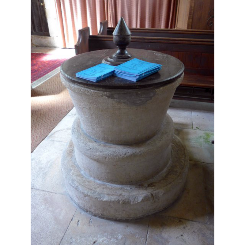
Image copyright © Basher Eyre, 2014
CC-BY-SA-3.0
Results: 6 records
view of font and cover - east side
Copyright Statement: Image copyright © Basher Eyre, 2014
Image Source: digital photograph taken 20 July 2014 by Basher Eyre [www.geograph.org.uk/photo/4094501] [accessed 19 February 2019]
Copyright Instructions: CC-BY-SA-3.0
view of font and cover - west side
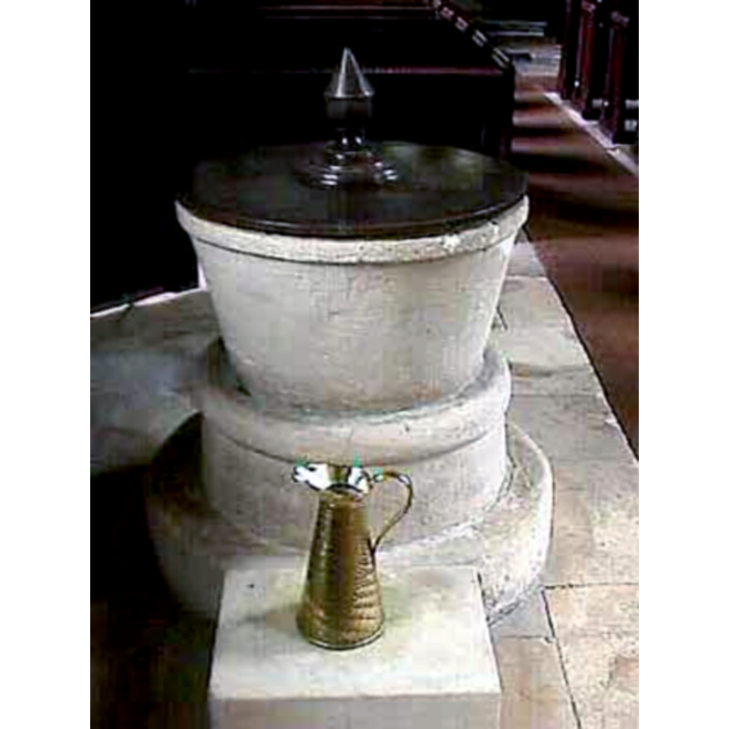
Copyright Statement: Image copyright © John Wilkes, 2007
Image Source: digital photograph by John Wilkes April 2007
Copyright Instructions: Standing permission
view of church exterior - northeast view
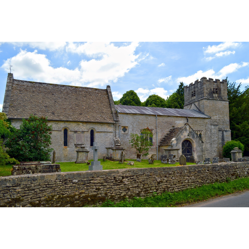
Copyright Statement: Image copyright © Philip Pankhurst, 2014
Image Source: digital photograph taken 17 June 2014 by Philip Pankhurst [www.geograph.org.uk/photo/4040401] [accessed 19 February 2019]
Copyright Instructions: CC-BY-SA-2.0
view of church exterior - northwest view
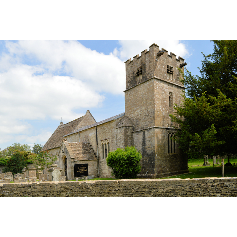
Copyright Statement: Image copyright © Philip Pankhurst, 2014
Image Source: edited detail of a digital photograph taken 17 June 2014 by Philip Pankhurst [www.geograph.org.uk/photo/4038946] [accessed 19 February 2019]
Copyright Instructions: CC-BY-SA-2.0
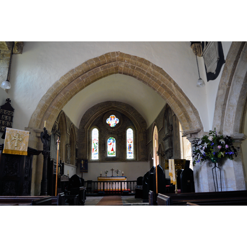
view of church interior - looking west
Scene Description: the top of the font is visible on the right, by the north doorway
Copyright Statement: Image copyright © Philip Pankhurst, 2014
Image Source: digital photograph taken 25 June 2014 by Philip Pankhurst [www.geograph.org.uk/photo/4042132] [accessed 19 February 2019]
Copyright Instructions: CC-BY-SA-3.0
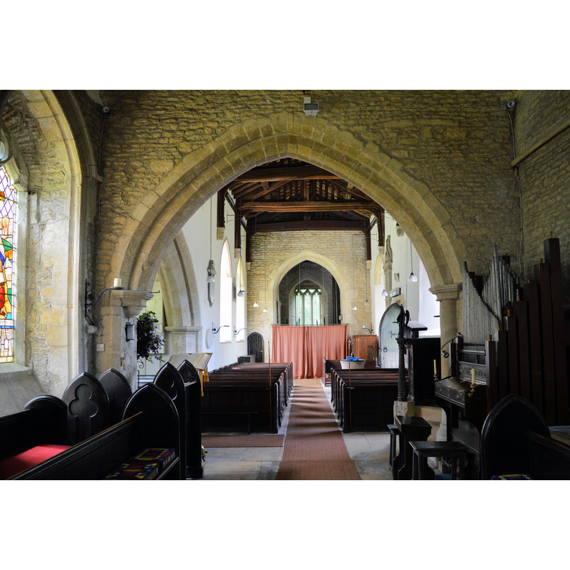
view of church interior - looking east
Copyright Statement: Image copyright © Philip Pankhurst, 2014
Image Source: digital photograph taken 25 June 2014 by Philip Pankhurst [www.geograph.org.uk/photo/4042091] [accessed 19 February 2019]
Copyright Instructions: CC-BY-SA-3.0
INFORMATION
Font ID: 07305CHE
Object Type: Baptismal Font1
Font Century and Period/Style: 12th century, Late Norman
Cognate Fonts: Avebury
Church / Chapel Name: Parish Church of St. Nicholas
Font Location in Church: Inside the church, in the W end of the nave, N side
Church Patron Saint(s): St. Nicholas of Myra
Church Address: Cherington, Tetbury GL8 8SN, UK -- Tel.: 01453 834884
Site Location: Gloucestershire, South West, England, United Kingdom
Directions to Site: Located 8-10 km SE of Stroud (access is easiest from Nailsworth or Minchinhampton)
Ecclesiastic Region: Diocese of Gloucester
Historical Region: Hundred of Longtree [formerly Wiltshire?]
Font Notes:
Click to view
There is an entry for Cherington [variant spelling] in the Domesday survey [http://domesdaymap.co.uk/place/ST9098/cherington/] [accessed 5 January 2015], but it mentions neither cleric nor church in it. The font here is described in Cox & Harvey (1907) as a "great specimen of late Norman. It is circular, and the bowl is arcaded with twelve semicircular arches containing the Twelve Apostles. One of these, St. Peter, holds a book in the left hand and a key in the right; the remainder all have a book, but held in different fashions. It resembles the font at Avebury, and is illustrated in the Wilts. Archaeological Magazine (vol. xxv)." The entry for this parish in the Victoria County History (Gloucestershire, vol. 11, 1976) notes: "The earliest record of the name of the parish suggests that Cherington had a church by the time of the Norman Conquest. [...] The font and a capital inverted and inset in a chancel-arch respond are additional remnants of the 12th-century church." Noted in Verey & Brooks (1999-2002): "Font. Norman tub-shaped bowl with a low pedestal only 12 in. (30 cm.) high on a massive circular base 10 ft (3 metres) in circumference". The entry for this church in the CRSBI (2019) reports a 12th-century font here: "The font has a plain, tapering bowl, with a plain, rounded band running along the top. The bowl is lined with lead. It is set on a plain cylindrical base with a large angle roll at the top. The tooling on the bowl and the base is similar. The plain, circular plinth may not be original."
[NB: ***there is Cherington/Chirton/Churton/Cherrington in Wiltshire -- is this the problem with the above discrepancy?]
[NB: ***there is Cherington/Chirton/Churton/Cherrington in Wiltshire -- is this the problem with the above discrepancy?]
Credit and Acknowledgements: We are grateful to John Wilkes, of www.allthecotswolds.com, for his photographs of church and font.
COORDINATES
UTM: 30U 559343 5726462
Latitude & Longitude (Decimal): 51.685983, -2.141566
Latitude & Longitude (DMS): 51° 41′ 9.54″ N, 2° 8′ 29.64″ W
MEDIUM AND MEASUREMENTS
Material: stone
Font Shape: bucket-shaped, mounted
Basin Interior Shape: round
Basin Exterior Shape: round
Rim Thickness: 8.5 cm [calculated]
Diameter (inside rim): 61 cm*
Diameter (includes rim): 78 cm*
Basin Total Height: 41 cm*
Notes on Measurements: * CRSBI (2019)
LID INFORMATION
Material: wood
Apparatus: no
Notes: round and flat, with cone finial/handle
REFERENCES
- Victoria County History [online], University of London, 1993-. URL: https://www.british-history.ac.uk.
- Corpus of Romanesque Sculpture in Britain and Ireland, The Corpus of Romanesque Sculpture in Britain and Ireland, The Corpus of Romanesque Sculpture in Britain and Ireland. URL: http://www.crsbi.ac.uk.
- Cox, John Charles, English Church Furniture, New York: E.P. Dutton & Co., 1907, p. 225, 226
- Verey, David, Gloucestershire, London: Penguin Books, 1999-2002, vol. 1: 226