Horley nr. Redhil / Horle / Horlee / Horlie
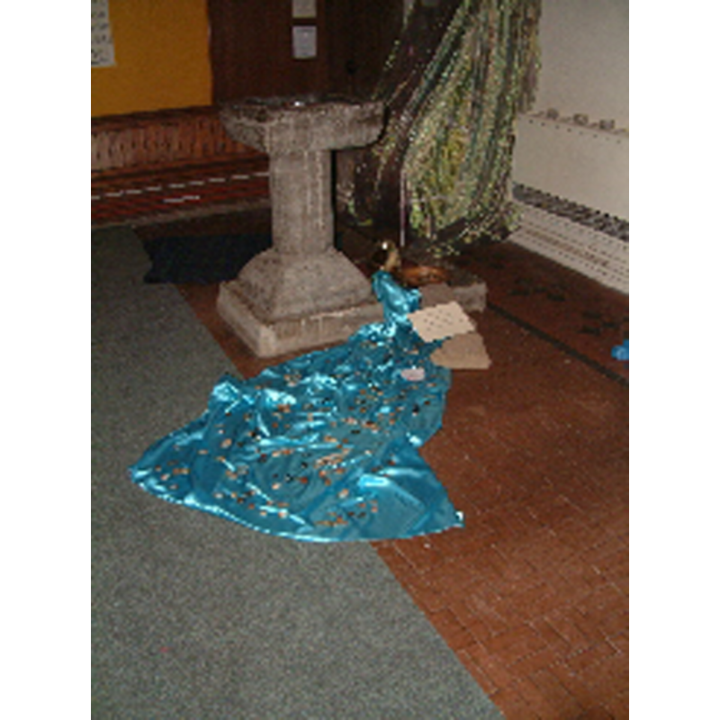
Image copyright © St. Bartholomew's Church, 2010
No known copyright restriction / Fair Dealing
Results: 2 records
view of font
Copyright Statement: Image copyright © St. Bartholomew's Church, 2010
Image Source: photograph in the Parish website [http://www.stbartshorley.org/God_at_Work/god_at_work.html] [accessed 12 August 2010]
Copyright Instructions: No known copyright restriction / Fair Dealing
view of church exterior - southwest view
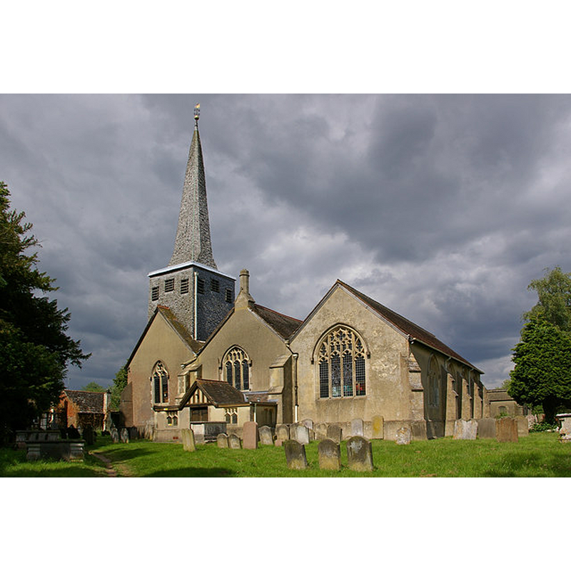
Scene Description: Source caption: "St Bartholomew's Church, Horley. Grade I listed church, much of which dates from the 14th century, although a church has probably been on this site since around 1150. The church saw a major restoration in 1881, and the south aisle (the right hand aisle in this photo) was added in 1900."
Copyright Statement: Image copyright © Ian Capper, 2010
Image Source: digital photograph taken 19 June 2010 by Ian Capper [www.geograph.org.uk/photo/2119302] [accessed 7 November 2017]
Copyright Instructions: CC-BY-SA-2.0
INFORMATION
Font ID: 07221HOR
Object Type: Baptismal Font1
Font Century and Period/Style: 12th - 13th century, Norman / Early English?
Cognate Fonts: Frensham, Beddington, etc. in the same area
Church / Chapel Name: Parish Church of St. Bartholomew
Font Location in Church: Inside the church
Church Patron Saint(s): St. Bartholomew
Church Address: Church Road, Horley, Surrey, RH6 8AB, UK -- Tel.: +44 1293 782218
Site Location: Surrey, South East, England, United Kingdom
Directions to Site: Located on the A23, 8 km S of Redhill, just NE of Gatwick airport
Ecclesiastic Region: Diocese of Southwark
Additional Comments: altered font
Font Notes:
Click to view
No entry found for this Horley in the Domesday survey. Brayley (1850) writes: "The font, on the left of the entrance from the north, is a square shallow basin of Sussex marble, supported by a circular pedestal, and quite plain." Described in Cox & Harvey (1907) as a square-bowled baptismal font of the Norman period made of dark Petworth marble from Sussex. The entry for this parish in the Victoria County History (Surrey, vol. 3, 1911) notes: "Although there is no mention of a church in Domesday there is practical certainty of the existence of one on this site by the middle of the 12th century, but it was probably of timber [...] The font, of Sussex marble, small and square in form, on a circular stem and plinth, may be of 13th-century date, but it has lost its angle shafts, and has been otherwise mutilated." The entry for this church in the Bristish Listed Buildings [Listing NGR: TQ2762742759], however, reports: "Early C20 marble font; square bowl on centre stem."
COORDINATES
UTM: 30U 697432 5672499
Latitude & Longitude (Decimal): 51.1698, -0.1758
Latitude & Longitude (DMS): 51° 10′ 11.28″ N, 0° 10′ 32.88″ W
MEDIUM AND MEASUREMENTS
Material: stone, marble (dark Petworth marble from Sussex)
Font Shape: square, mounted
Basin Interior Shape: round
Basin Exterior Shape: square
REFERENCES
- Victoria County History [online], University of London, 1993-. URL: https://www.british-history.ac.uk.
- Brayley, Edward Wedlake, A topographical history of Surrey, London: G. Willis, 1850, vol. 4: 278
- Cox, John Charles, English Church Furniture, New York: E.P. Dutton & Co., 1907, p. 221