Salt / Selte
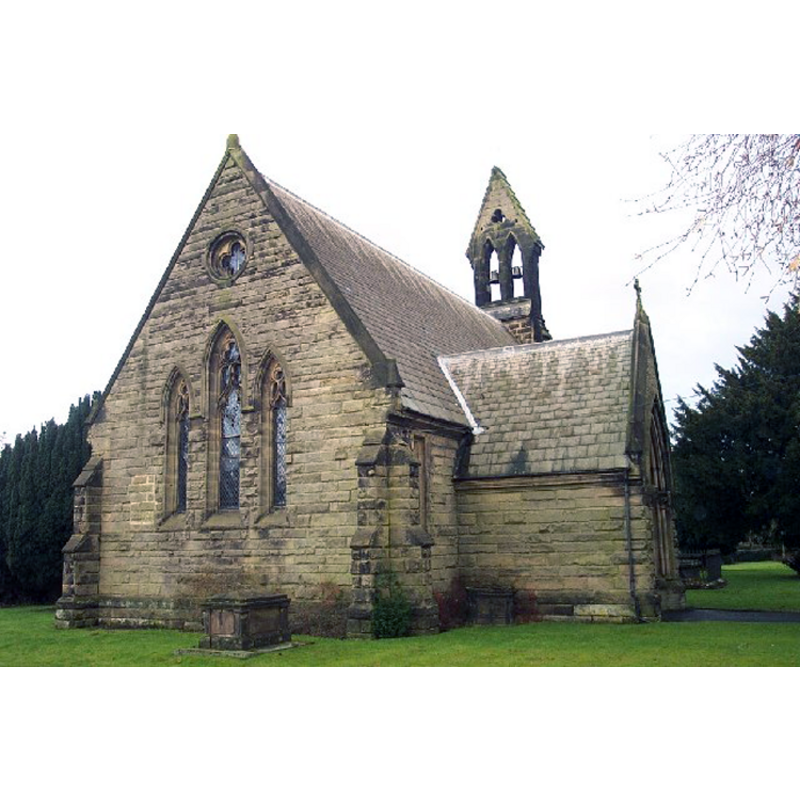
Image copyright © Geoff Pick, 2006
CC-BY-SA-3.0
Results: 2 records
view of church exterior - northeast view
Copyright Statement: Image copyright © Geoff Pick, 2006
Image Source: digital photograph taken 14 January 2006 by Geoff Pick [www.geograph.org.uk/photo/119880] [accessed 3 September 2013]
Copyright Instructions: CC-BY-SA-3.0
view of church exterior - west view
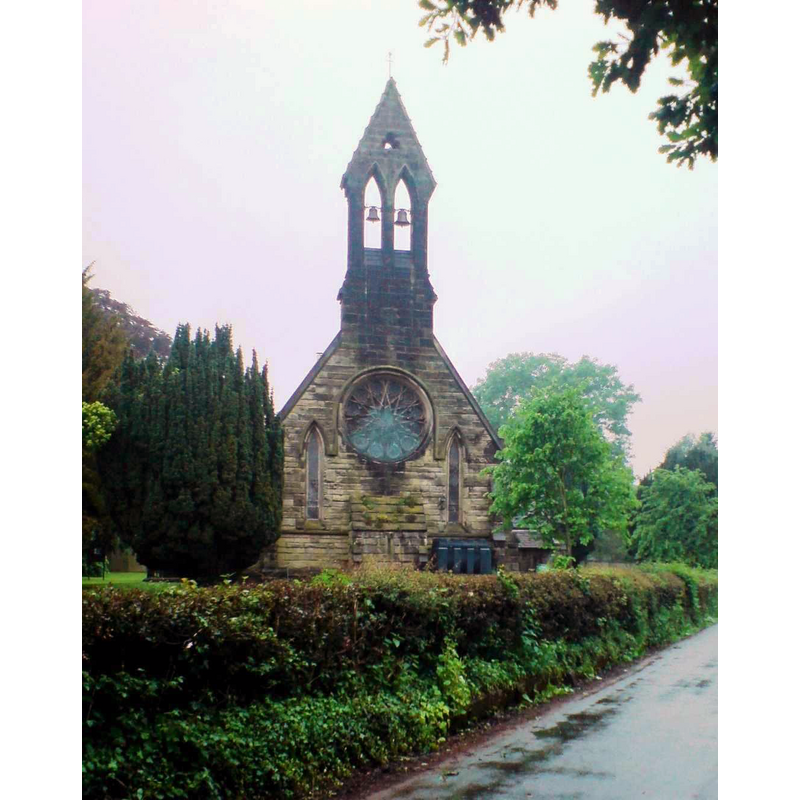
Copyright Statement: Image copyright © [in the public domain]
Image Source: digital photograph taken 29 May 2008 by Peter Morrell [http://en.wikipedia.org/wiki/File:Salt_church_st_james.JPG] [accessed 3 September 2013]
Copyright Instructions: Released by its author into the public domain
INFORMATION
Font ID: 07188SAL
Object Type: Baptismal Font1
Font Century and Period/Style: 11th - 12th century [basin only], Medieval / composite
Church / Chapel Name: Parish Church of St. James the Great
Font Location in Church: Inside the church [cf. FontNotes]
Church Patron Saint(s): St. James the Greater [aka James the Great, James the Elder]
Church Notes: there appear to have been no earlier church here [cf. FontNotes]
Church Address: Trentfield Lane, Salt, Staffordshire, ST18 0BW
Site Location: Staffordshire, West Midlands, England, United Kingdom
Directions to Site: Located just off the A51, 2 km SE of Enson, 5-6 km NE of Stafford
Ecclesiastic Region: Diocese of Lichfield
Historical Region: Hundred of Pirehill
Additional Comments: moved font? [cf. FontNotes]
Font Notes:
Click to view
Calvert (1886) reports visiting Salt and its "very pretty church in which is an ancient font curiously noted as having been utilised by the early Britons for the sharpening of their arrows". Listed in Cox & Harvey (1907) as a baptismal font of the Norman period. The present font consists of a round basin raised on a quatrefoil pedestal base; is the basin the claimed Norman font? [NB: we have found no mention of an earlier church here -- the said Norman font was reported at one point in the churchyard -- where was it from? -- White's Directory of Satffordshire for the year 1834 (p. 142) lists Salt together with Enson].
COORDINATES
UTM: 30U 562753 5855433
Latitude & Longitude (Decimal): 52.844986, -2.068255
Latitude & Longitude (DMS): 52° 50′ 41.95″ N, 2° 4′ 5.72″ W
MEDIUM AND MEASUREMENTS
Material: stone
Font Shape: round, mounted
Basin Exterior Shape: round
REFERENCES
- Calvert, Charles, History of Stafford and guide to the neighbourhood, Stafford: Printed and published by J. Halden & Son, 1886, p. 116
- Cox, John Charles, English Church Furniture, New York: E.P. Dutton & Co., 1907, p. 218