Orpington / Orpedingetune / Orpington in Bromley / Orpinton / Orpintvn
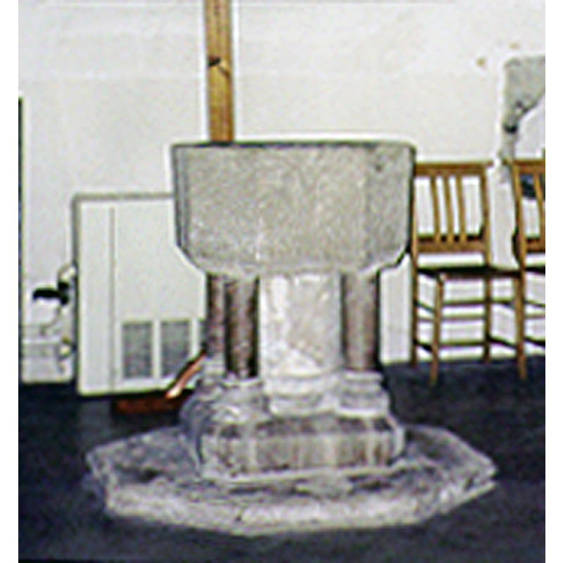
Image copyright © Alexander Volokh, 1999
Permission received (e-mail of 6 September 2006)
Results: 5 records
view of font
Copyright Statement: Image copyright © Alexander Volokh, 1999
Image Source: detail of a photograph by Alexander Volokh
Copyright Instructions: Permission received (e-mail of 6 September 2006)
view of church exterior - northwest view
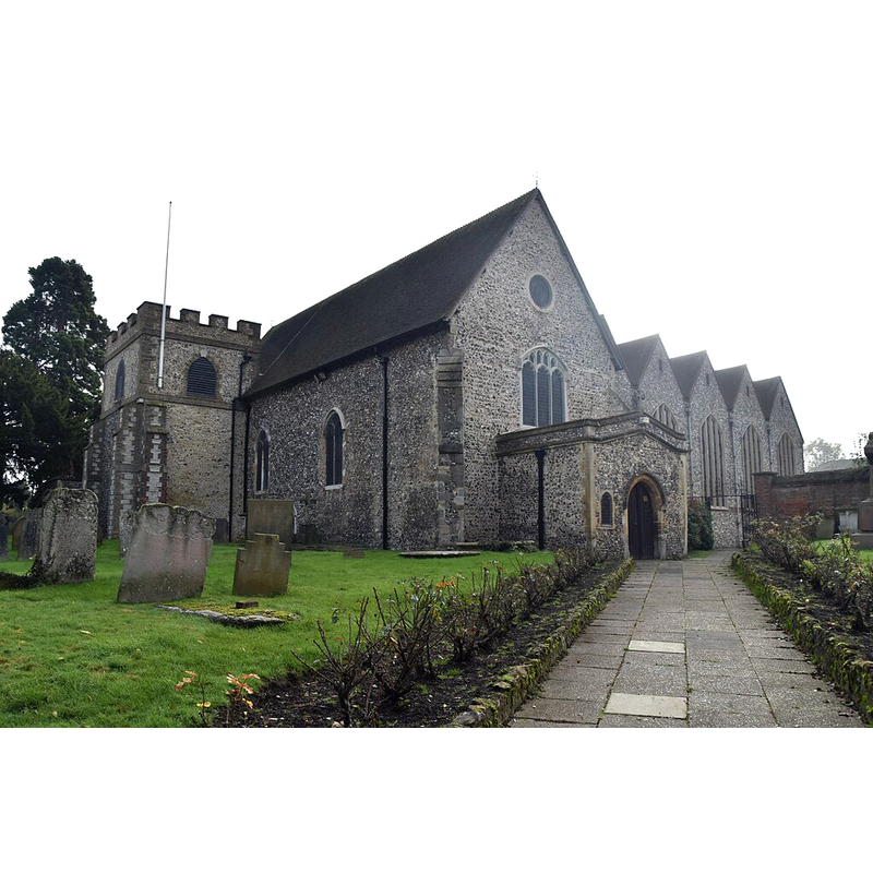
Scene Description: Source caption: "Church of All Saints"
Copyright Statement: Image copyright © N Chadwick, 2020
Image Source: digital photograph 8 December 2020 by N Chadwick [https://www.geograph.org.uk/photo/6699471] [accessed 30 March 2024]
Copyright Instructions: CC-BY-SA-2.5
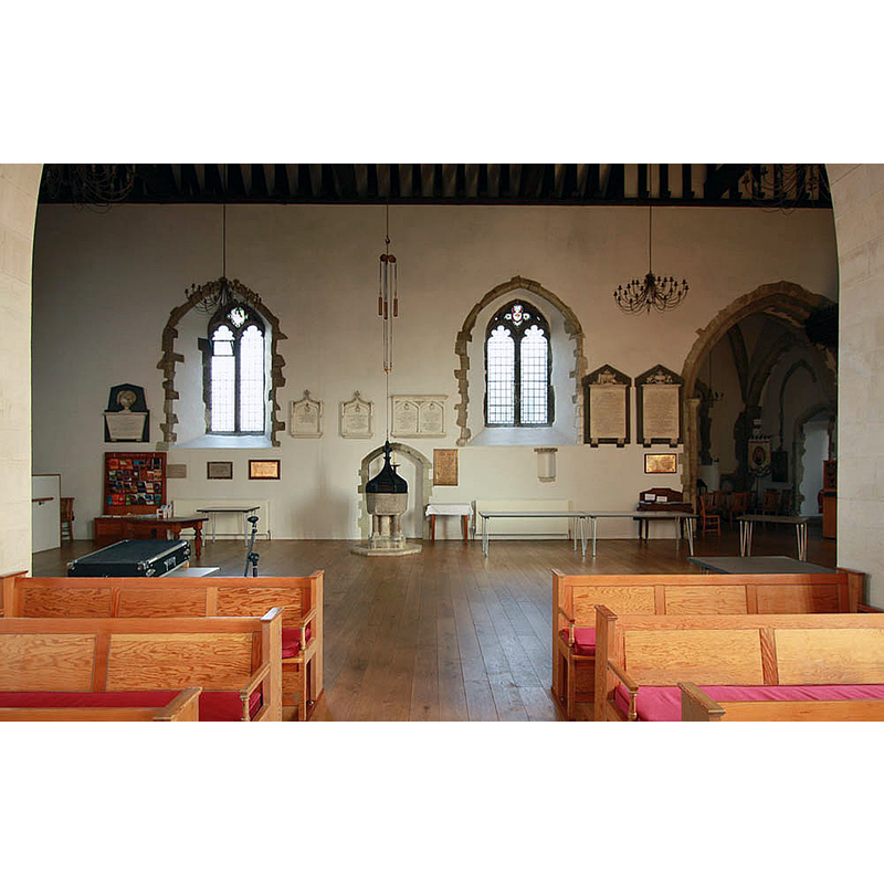
view of church interior - looking west
![Source caption: "All Saints, Bark Hart Road - West end" -- showing the font and cover at the far [west] end](/static-50478a99ec6f36a15d6234548c59f63da52304e5/compressed/1240330007_compressed.png)
Scene Description: Source caption: "All Saints, Bark Hart Road - West end" -- showing the font and cover at the far [west] end
Copyright Statement: Image copyright © John Salmon, 2011
Image Source: digital photograph 25 March 2011 by John Salmon [https://www.geograph.org.uk/photo/2340762] [accessed 30 March 2024]
Copyright Instructions: CC-BY-SA-2.5
view of font and cover in context
Scene Description: Source caption: "All Saints, Bark Hart Road - West end"
Copyright Statement: Image copyright © John Salmon, 2011
Image Source: digital photograph 25 March 2011 by John Salmon [https://www.geograph.org.uk/photo/2340763] [accessed 30 March 2024]
Copyright Instructions: CC-BY-SA-2.5
view of font and cover in context
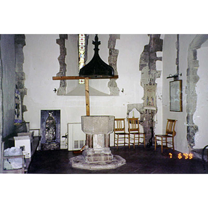
Copyright Statement: Image copyright © Alexander Volokh, 1999
Image Source: photograph by Alexander Volokh
Copyright Instructions: Permission received (e-mail of 6 September 2006)
INFORMATION
Font ID: 06921ORP
Object Type: Baptismal Font1
Font Century and Period/Style: 12th - 13th century, Early English
Church / Chapel Name: Parish Church of All Saints
Font Location in Church: Inside the church
Church Patron Saint(s): All Saints
Church Address: 44 Bark Hart Rd, Orpington, BR6 0QD, United Kingdom
Site Location: Greater London, South East, England, United Kingdom
Directions to Site: Located off (W) the A224, in the SW of the City, 22 km SE of Charing Cross, in the borough of, and near Bromley
Ecclesiastic Region: Diocese of Rochester
Historical Region: Hundred of Helmestrei [in Domesday] -- formerly in Kent (in Gt London since 1965)
Additional Comments: disappeared font? (the one from the original 11thC church here)
Font Notes:
Click to view
There are two entries for Orpington [variant spelling] in the Domesday survey [https://opendomesday.org/place/TQ4666/orpington/] [accessed 30 April 2024], the second of which reports two church in it [the other one probably in nearby Keston]. Listed in Cox & Harvey (1907) as a baptismal font of the Early English period. Listed in Leach (1975) as a font made of Purbeck marble. Newman (1980) notes the "Font cover. C15. Plain ribs and a finial", but not the font itself. The entry for this church in Historic England [List Entry Number 1083559] notes: "The original nave is C11 in origin and has a late C12 W door. The chancel and NE tower are early C13. Some late C14 work including the addition of the W porch with the tomb of Nicholas de Ystele. NE Rufford chapel added in the C15. The NE vestry is also medieval in origin. Upper part of the tower rebuilt in the 1770s and again in 1809. Restored in 1874 when the NE vestry was added, and there was some refurnishing in the early C20 [...] Octagonal late C12 or early C13 font, standing on four marble shafts with moulded bases around a central core. C15 cover with ogee ribs and a foliate finial." The same entry (ibid.) adds: "There was a church at Orpington in the early C11, when Eadsige, a priest and royal chaplain, gave land to Christ Church cathedral, Canterbury. By the time of the Domesday book, there were two churches in Orpington, almost certainly All Saints and the church at Hayes. In the C19, Anglo-Saxon long and short work was said to have been visible in the SE corner of the nave before the restoration, and a Saxon sundial was found during the work in 1957."
Credit and Acknowledgements: We are grateful to Alexander Volokh for his photograph of this font.
COORDINATES
UTM: 31U 298595 5695815
Latitude & Longitude (Decimal): 51.3778, 0.105909
Latitude & Longitude (DMS): 51° 22′ 40.08″ N, 0° 6′ 21.27″ E
MEDIUM AND MEASUREMENTS
Material: stone, limestone (Purbeck marble)
Font Shape: octagonal, mounted
Basin Interior Shape: round
Basin Exterior Shape: octagonal
LID INFORMATION
Date: 15th century?
Material: wood
Apparatus: yes, counterweight
Notes: [cf. FontNotes]
REFERENCES
- Cox, John Charles, English Church Furniture, New York: E.P. Dutton & Co., 1907, p. 204
- Leach, Rosemary, A Investigation into the use of Purbeck Marble in Medieval England, Hartlepool: E.W. Harrisons & Sons, 1975, p. 77
- Newman, John, West Kent and the Weald, Harmondsworth: Penguin Books, 1980, p. 443