Templecombe / Temple Combe / Abbas Combe / Combe Templariorum / Cumbe
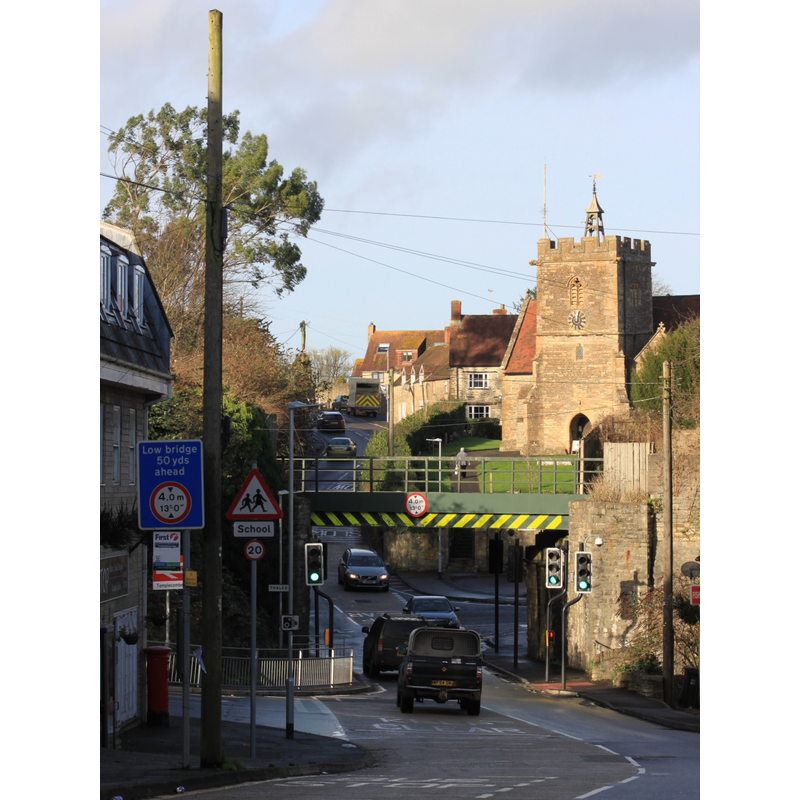
Image copyright © Geof Sheppard, 2015
CC-BY-SA-2.0
Results: 2 records
view of church exterior in context
Scene Description: Source caption: "Looking north towards St Mary's church in Templecombe, Somerset. The bridge carries the Exeter to Salisbury railway line; the railway station is immediately to the left of this."
Copyright Statement: Image copyright © Geof Sheppard, 2015
Image Source: digital photograph taken 29 December 2015 by Geof Sheppard [https://commons.wikimedia.org/wiki/File:2015_at_Templecombe_station_-_Wincanton_Road_bridge_and_church.JPG] [accessed 12 April 2018]
Copyright Instructions: CC-BY-SA-2.0
design element - architectural - arcade - blind - round arches - 16


INFORMATION
Font ID: 06684TEM
Object Type: Baptismal Font1
Font Century and Period/Style: 12th - 13th century, Late Norman / Transitional?
Church / Chapel Name: Parish Church of St. Mary
Font Location in Church: Inside the church
Church Patron Saint(s): St. Mary the Virgin
Church Address: Church Hill (A357), Templecombe, Somerset, BA8 0HQ, United Kingdom -- Tel.: +44 1963 362266
Site Location: Somerset, South West, England, United Kingdom
Directions to Site: Located off (W) the A357, just SE of Horsington, 8 km S of Wincanton, about 20 km ENE of Yeovil, 30 km W of Salisbury
Ecclesiastic Region: Diocese of Bath & Wells
Historical Region: Hundred of Horethorne
Additional Comments: altered font ("he late 12th-century Purbeck marble font had wooden corner pillars which were replaced with marble in 1864" [cf. FontNotes]
Font Notes:
Click to view
There is an entry for [Abbas] Combe [variant spelling] in the Domesday survey [http://opendomesday.org/place/ST7022/abbas-combe/] [accessed 12 April 2018], but it mentions neither cleric nor church in it. Phelps (1836) writes: "The font is square, and supported by four small pillars, and very ancient." Wade & Wade (1929) report "a curious E[arly] E[nglish] font" in this church. Described in Pevsner (1958): "Square, of the Purbeck type, with four shallow blank arches on each side, C12 or early C13. The bowl stands on five supports" [NB: did the font have only four pillars at Phelps' time?]. The entry for this parish in the Victoria County History (Somerset, vol. 7, 1999) notes: "Part of the church appears to date from the late 12th century [...] The tower, which was originally unbuttressed, is of the 13th century and was built against an earlier nave which may have been contemporary with the late 12th-century font [...] The late 12th-century Purbeck marble font had wooden corner pillars which were replaced with marble in 1864".
COORDINATES
UTM: 30U 540930 5650296
Latitude & Longitude (Decimal): 51.002778, -2.416667
Latitude & Longitude (DMS): 51° 0′ 10″ N, 2° 25′ 0″ W
MEDIUM AND MEASUREMENTS
Material: stone, limestone (Purbeck marble)
Font Shape: square, mounted
Basin Interior Shape: round
Basin Exterior Shape: square
REFERENCES
- Victoria County History [online], University of London, 1993-. URL: https://www.british-history.ac.uk.
- Pevsner, Nikolaus, South and West Somerset, Harmondsworth: Penguin Books, 1958, p. 320
- Wade, G.H., Somerset, London: Methurn & Co., 1929, [http://www.gutenberg.org/files/12287/12287-h/12287-h.htm] [accessed 6 April 2008]