Culcheth / Culchet / Culchith / Kilchiche / Kulchit / Kylchiz
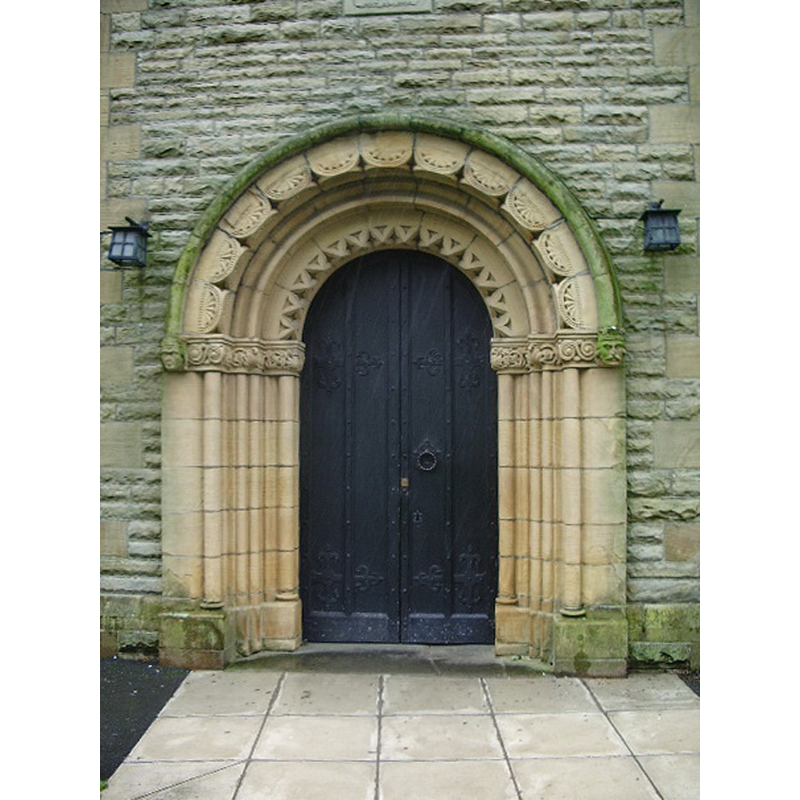
Image copyright © Alexander P Kapp, 2008
CC-BY-SA-3.0
Results: 2 records
view of church exterior - west portal
Scene Description: neo-Norman west portal of the early-20thC church
Copyright Statement: Image copyright © Alexander P Kapp, 2008
Image Source: digital photograph taken 6 August 2008 by Alexander P Knapp [www.geograph.org.uk/photo/910950] [accessed 17 July 2014]
Copyright Instructions: CC-BY-SA-3.0
view of church exterior - southwest view
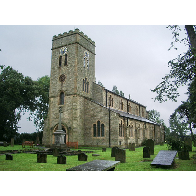
Copyright Statement: Image copyright © Alexander P Kapp, 2008
Image Source: digital photograph taken 6 August 2008 by Alexander P Knapp [www.geograph.org.uk/photo/910954] [accessed 17 July 2014]
Copyright Instructions: CC-BY-SA-3.0
INFORMATION
Font ID: 06671CRA
Object Type: Baptismal Font1?
Font Century and Period/Style: 16th century
Church / Chapel Name: Chapel or Church [destroyed]
Font Location in Church: [cf. FontNotes]
Church Notes: coordinates given are for the new church at Newchurch
Church Address: [new church] Church Lane, Warrington WA3 5ET, United Kingdom -- Tel.: +44 1925 766300
Site Location: Cheshire, North West, England, United Kingdom
Directions to Site: Located 10 km NE of Warrington
Ecclesiastic Region: Diocese of Liverpool
Historical Region: Hundred of West Derby -- formerly Lancashire
Font Notes:
Click to view
The Victoria County History (Lancaster, vol. 4, 1911) notes: "Before the Reformation there was at Culcheth a chapel of ease known as Trinity Church. [...] It was perhaps not then very old, and the name NEWCHURCH has remained attached to it till the present time. [...] Sir John Holcroft by his will of 1559 left his chain of gold or £10 towards the payment of a priest and clerk if the other inhabitants of the township could be induced to subscribe. [...] The Commonwealth Surveyors in 1650 recommended that Newchurch should be made into a parish [...] The church was rebuilt in 1743, a plain brick structure. This was burnt down in April 1903, and has been rebuilt in the Norman style.[...] The registers 1599–1812 have been printed by the Lancashire Parish Register Society, 1905." The Culcheth Local History web site [www.culcheth.org/history1.htm] [accessed 29 September 2010] notes: "The name 'Newchurch' which is found throughout the village, refers to the building of the village's first church in or about 1560, as a separate, new church, from the mother-church of St. Oswalds in Winwick, some 5 km away. The original New Church burned to the ground in 1903 and had to be rebuilt from scratch". [NB;: the early register include baptisms; we have no information on the early font of the destroyed church]
COORDINATES
UTM: 30U 532414 5922416
Latitude & Longitude (Decimal): 53.449763, -2.511912
Latitude & Longitude (DMS): 53° 26′ 59.15″ N, 2° 30′ 42.88″ W
REFERENCES
- Victoria County History [online], University of London, 1993-. URL: https://www.british-history.ac.uk.