Washington nr. Worthing
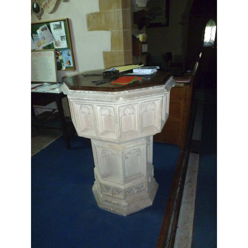
Image copyright © Basher Eyre, 2011
CC-BY-SA-3.0
Results: 4 records
design element - architectural - arcade - blind - trefoiled arches - 16 arches
Copyright Statement: Image copyright © Basher Eyre, 2011
Image Source: digital photograph taken 29 September 2011 by Basher Eyre [www.geograph.org.uk/photo/2627204] [accessed 24 October 2012]
Copyright Instructions: CC-BY-SA-3.0
design element - architectural - arch or window - cinquefoiled - 8
Copyright Statement: Image copyright © Basher Eyre, 2011
Image Source: digital photograph taken 29 September 2011 by Basher Eyre [www.geograph.org.uk/photo/2627204] [accessed 24 October 2012]
Copyright Instructions: CC-BY-SA-3.0
view of church exterior - northwest end
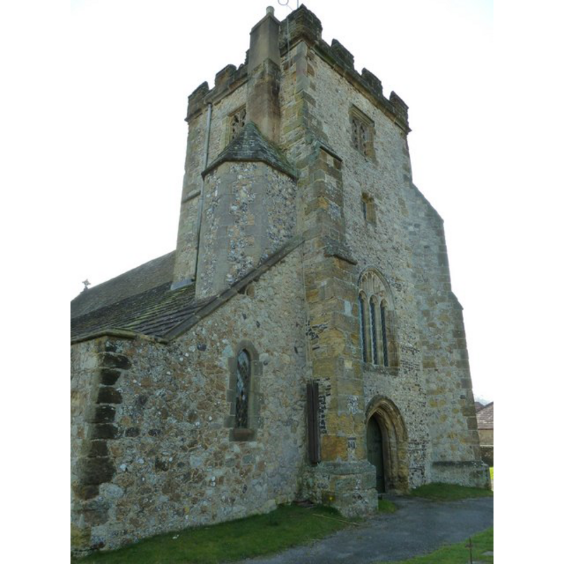
Copyright Statement: Image copyright © Basher Eyre, 2011
Image Source: digital photograph taken 29 September 2011 by Basher Eyre [www.geograph.org.uk/photo/2627393] [accessed 24 October 2012]
Copyright Instructions: CC-BY-SA-3.0
view of church exterior - southeast view
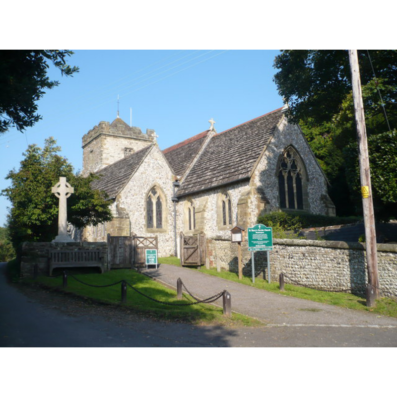
Copyright Statement: Image copyright © Pam Fray, 2008
Image Source: digital photograph taken 18 September 2008 by Pam Fry [www.geograph.org.uk/photo/970171] [accessed 24 October 2012]
Copyright Instructions: CC-BY-SA-3.0
INFORMATION
Font ID: 06568WAS
Object Type: Baptismal Font1
Font Century and Period/Style: 15th century [re-tooled?], Perpendicular [altered?]
Church / Chapel Name: Parish Church of St. Mary
Font Location in Church: Inside the church
Church Patron Saint(s): St. Mary the Virgin
Church Notes: "church of St. Mary (the dedication is recorded as early as 1146) " [cf. VCH entry in FontNotes]
Church Address: The Street, Washington, West Sussex, RH20 4AS
Site Location: West Sussex, South East, England, United Kingdom
Directions to Site: Located just off the A24 (Worthing-to-London road), 7 km from Steyning, 11 km NNW of Worthing
Ecclesiastic Region: Diocese of Chichester
Historical Region: Hundred of Steyning -- Rape of Bramber -- Sussex
Additional Comments: disappeared font? (the one from the 11thC church here) -- altered font?: re-tooled? (the present font)
Font Notes:
Click to view
The Victoria County History (Sussex, vol. 6, pt. 1, 1980) notes: "Philip de Braose granted Washington church to Sele priory c. 1096 [...] in exchange for Shipley church, the grant being confirmed in 1126 and later. [...] The early history of the fabric has been largely obscured by the rebuilding of everything except the tower and the north arcade in the 19th century. [...] The octagonal font is 15th-century". Described in Whiteman (1994): "The typical Perpendicular font is octagonal with panels of pointed arches having trefoil and cinquefoil heads". [NB: we have no information on the font from the 11th-century church here].
COORDINATES
UTM: 30U 682104 5642407
Latitude & Longitude (Decimal): 50.904559, -0.409931
Latitude & Longitude (DMS): 50° 54′ 16.41″ N, 0° 24′ 35.75″ W
MEDIUM AND MEASUREMENTS
Material: stone
Font Shape: octagonal, mounted
Basin Interior Shape: round
Basin Exterior Shape: octagonal
REFERENCES
- Victoria County History [online], University of London, 1993-. URL: https://www.british-history.ac.uk.
- Whiteman, Ken, Ancient Churches of Suffolk, Seaford, East Sussex: S.B. Publications, 1998, p. 167