Fittleworth / Fetilworth / Fitelworthe / Fitelwurda / Fyteleworth
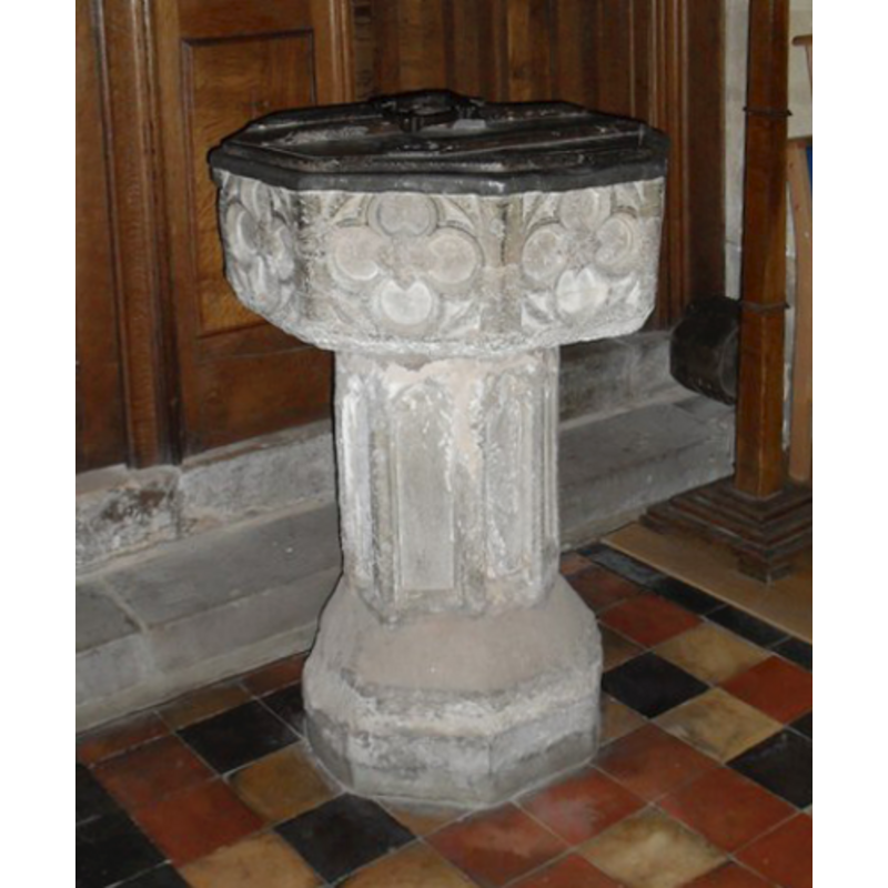
Image copyright © Basher Eyre, 2010
CC-BY-SA-3.0
Results: 5 records
view of font and cover - southeast side
Copyright Statement: Image copyright © Basher Eyre, 2010
Image Source: digital photograph taken 20 March 2010 by Basher Eyre [www.geograph.org.uk/photo/1778497] [accessed 15 January 2013]
Copyright Instructions: CC-BY-SA-3.0
design element - motifs - floral - rosette - in a quatrefoil - in a circle - in a square - 8
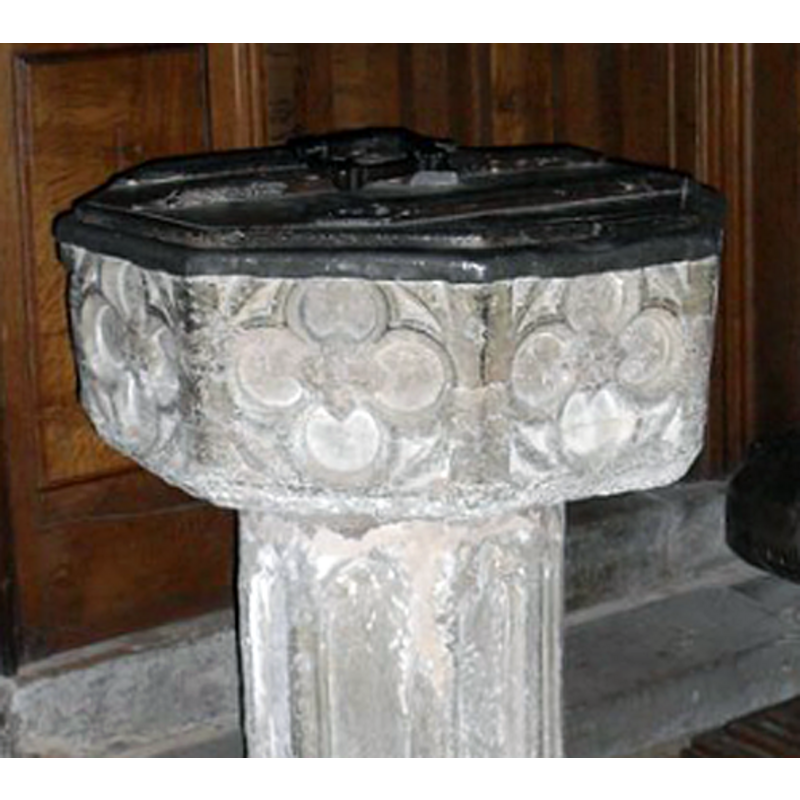
Copyright Statement: Image copyright © Basher Eyre, 2010
Image Source: detail of a digital photograph taken 20 March 2010 by Basher Eyre [www.geograph.org.uk/photo/1778497] [accessed 15 January 2013]
Copyright Instructions: CC-BY-SA-3.0
view of church exterior - north view
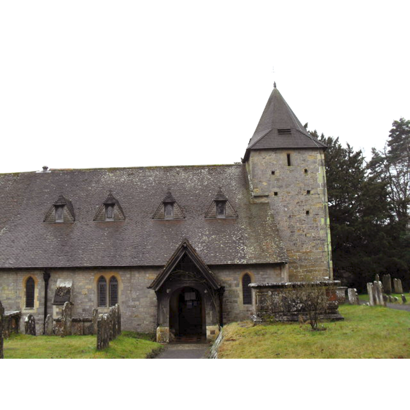
Copyright Statement: Image copyright © Basher Eyre, 2010
Image Source: digital photograph taken 20 March 2010 by Basher Eyre [www.geograph.org.uk/photo/1778418] [accessed 15 January 2013]
Copyright Instructions: CC-BY-SA-3.0
view of church exterior - south view
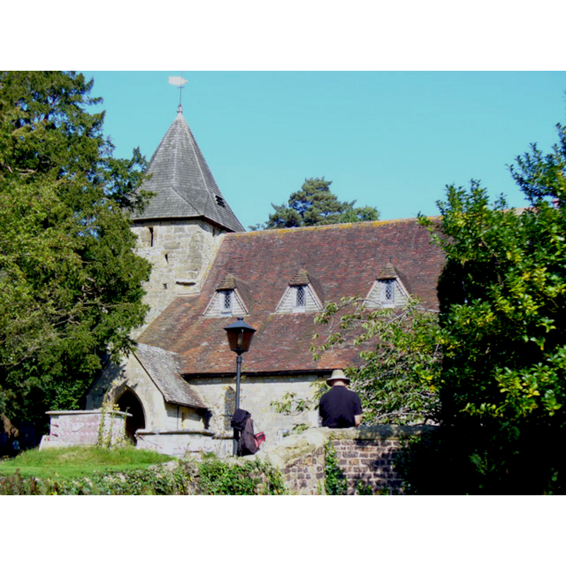
Copyright Statement: Image copyright © Colin Smith, 2008
Image Source: digital photograph taken 26 September 2008 by Colin Smith [www.geograph.org.uk/photo/980947] [accessed 15 January 2013]
Copyright Instructions: Standing permission
design element - motifs - panel - trefoiled - 8
Copyright Statement: Image copyright © Basher Eyre, 2010
Image Source: digital photograph taken 20 March 2010 by Basher Eyre [www.geograph.org.uk/photo/1778497] [accessed 15 January 2013]
Copyright Instructions: CC-BY-SA-3.0
INFORMATION
Font ID: 06508FIT
Object Type: Baptismal Font1
Font Century and Period/Style: 14th - 15th century, Decorated? / Perpendicular?
Church / Chapel Name: Parish Church of St. Mary
Font Location in Church: Inside the church
Church Patron Saint(s): St. Mary the Virgin
Church Address: Church Lane, Fittleworth, West Sussex, RH20 1HL
Site Location: West Sussex, South East, England, United Kingdom
Directions to Site: Located at the junction of the A283 and the B2138, just 4-5 km W of Pulborough, 5 km SE of Petworth
Ecclesiastic Region: Diocese of Chichester
Historical Region: Hundred of Bury -- Rape of Arundel -- Sussex
Font Notes:
Click to view
Harrison (1920) reports a Perpendicular font in this church. Described in Whiteman (1994): "The font, probably 14th-century, has an octagonal bowl decorated with rosettes". The basin is too shallow for a font of this period, and the motifs on the sides, rosettes inscribed in a quatrefoil-in-a-circle-in-a-square, appear to have been truncated at the top, the upper rim covered by the flap of the lead lining; raised on an octagonal stem with trefoiled panels on the sides, and a splaying lower base, also octagonal. The wooden cover is octagonal and flat, and appears old, perhaps 17th- or 18th-century.
COORDINATES
UTM: 30U 671056 5648639
Latitude & Longitude (Decimal): 50.96393, -0.563984
Latitude & Longitude (DMS): 50° 57′ 50.15″ N, 0° 33′ 50.34″ W
MEDIUM AND MEASUREMENTS
Material: stone
Font Shape: octagonal, mounted
Basin Interior Shape: round
Basin Exterior Shape: octagonal
Drainage Notes: lead-lined
LID INFORMATION
Date: 17th - 18th century?
Material: wood, oak?
Apparatus: no
Notes: [cf. FontNotes]
REFERENCES
- Harrison, Frederick, Notes on Sussex churches, Hove: Combridges, 1920, p. 111
- Whiteman, Ken, Ancient Churches of Suffolk, Seaford, East Sussex: S.B. Publications, 1998, p. 70