Murston / Muston
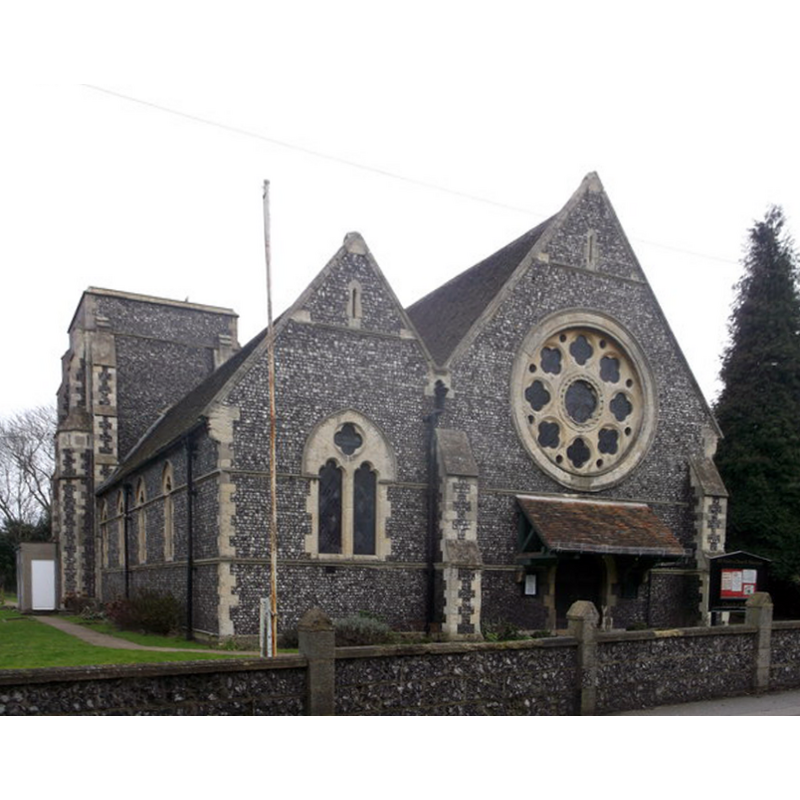
Image copyright © David Anstiss, 2013
CC-BY-SA-3.0
Results: 3 records
view of church exterior - southeast view
Scene Description: the modern church [cf. FontNotes]
Copyright Statement: Image copyright © David Anstiss, 2013
Image Source: digital photograph taken 16 February 2013 by David Anstiss [www.geograph.org.uk/photo/3338613] [accessed 8 September 2013]
Copyright Instructions: CC-BY-SA-3.0
view of church exterior - southwest view
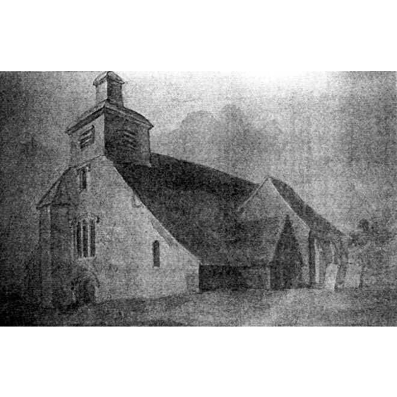
Scene Description: the old church ca. 1807
Copyright Statement: Image copyright © [in the public domain]
Image Source: ca. 1807? -- reproduced in http://kent.lovesguide.com/murston.htm [accessed 8 September 2013]
Copyright Instructions: PD
view of church exterior

Scene Description: the remains of the old church; photographed in 2010
Copyright Statement: Image copyright © Sioux Peto, 2011
Image Source: digital photograph taken 10 January 2011 by Sioux Peto [www.flickr.com/photos/50646987@N06/5512039629/] [accessed 8 September 2013]
Copyright Instructions: PERMISSION NOT AVAILABLE -- IMAGE NOT FOR PUBLIC USE
INFORMATION
Font ID: 06374MUR
Object Type: Baptismal Font1
Font Century and Period/Style: 12th century, Medieval
Church / Chapel Name: Parish Church of All Saints [old church]
Church Patron Saint(s): All Saints
Church Notes: the later church said to incorporate fragments of the earlier 12thC building
Church Address: Church Road, Murston, Kent, ME103RE
Site Location: Kent, South East, England, United Kingdom
Directions to Site: Located 1-2 km NE of Sittingbourne
Ecclesiastic Region: Diocese of Canterbury
Historical Region: Hundred of Milton [aka Middleton] -- Lath of Sherwinhope [aka Scray, Wiwarlet]
Additional Comments: disappeared font (the one from the old parish church)
Font Notes:
Click to view
No entry for Muston found in the Domesday survey. Halsted (1798) writes: "The church, dedicated to All Saints, is a large building, of three isles and three chancels, having a square tower, with a wooden turret, in which are three bells." The old church was described in Glynne (1877), his visit to it having taken place earlier in the decade. That medieval building [12th-13th century?] was mostly demolished in the 1870s, with only a chancel remains as a mortuary chapel that still stands [www.youtube.com/watch?v=Q-jVE_j2rW8] [accessed 8 September 2013]. The present font in this church is noted in Newman (1976) as modern, by William Burges [i.e., William Burges (1827-1881) High Victorian English architect] from the date of the new parish church, 1873-1874 [NB: we have no information on the whereabouts of the font from the old church].
COORDINATES
UTM: 31U 343501 5690310
Latitude & Longitude (Decimal): 51.3425, 0.753
Latitude & Longitude (DMS): 51° 20′ 33″ N, 0° 45′ 10.8″ E
REFERENCES
- Glynne, Steven Richard, Sir, Notes on the churches of Kent, London: John Murray, 1877
- Hasted, Edward, The History and topographical survey of the County of Kent [...], Canterbury: Printed for the author, by Simmons and Kirkby, 1778-, vol. 6: 153-150 / [www.british-history.ac.uk/report.aspx?compid=62955] [accessed 8 September 2013]
- Newman, John, North East and East Kent, Harmondsworth: Penguin Books, 1976, p. 395