Carbrooke / Cherebroc / Great Carbrook
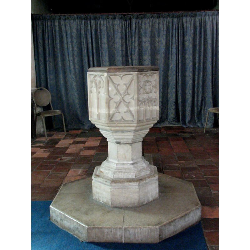
Image copyright © Evelyn Simak, 2008
CC-BY-SA-3.0
Results: 8 records
view of font and cover
Copyright Statement: Image copyright © Evelyn Simak, 2008
Image Source: digital photograph taken 1 March 2008 by Evelyn Simak [www.geograph.org.uk/photo/710309] [accessed 14 March 2013]
Copyright Instructions: CC-BY-SA-3.0
design element - patterns - tracery - varied
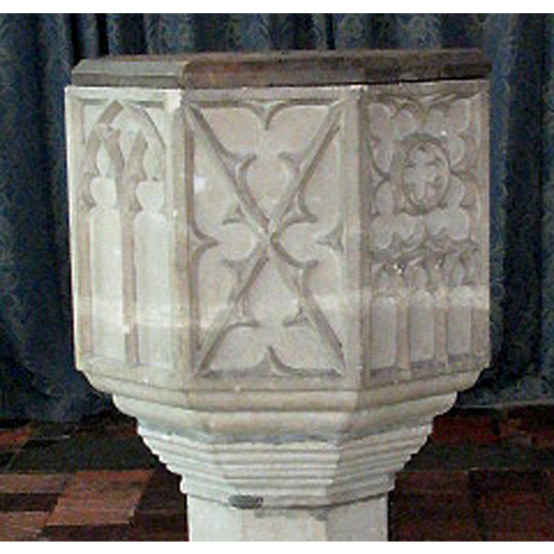
Copyright Statement: Image copyright © Evelyn Simak, 2008
Image Source: detail of a digital photograph taken 1 March 2008 by Evelyn Simak [www.geograph.org.uk/photo/710309] [accessed 14 March 2013]
Copyright Instructions: CC-BY-SA-3.0
design element - motifs - moulding - graded
Copyright Statement: Image copyright © Evelyn Simak, 2008
Image Source: detail of a digital photograph taken 1 March 2008 by Evelyn Simak [www.geograph.org.uk/photo/710309] [accessed 14 March 2013]
Copyright Instructions: CC-BY-SA-3.0
view of church exterior - southeast view
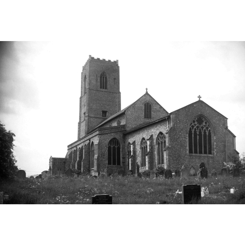
Copyright Statement: Image copyright © George Plunkett, 2014
Image Source: B&W photograph taken 31 May 1976 by George Plunkett [www.georgeplunkett.co.uk/Norfolk/C/Carbrooke Ss Peter and Paul church from SE [5536] 1976-05-31.jpg] [accessed 24 June 2014]
Copyright Instructions: Standing permission by Jonathan Plunkett
view of church exterior - southeast view
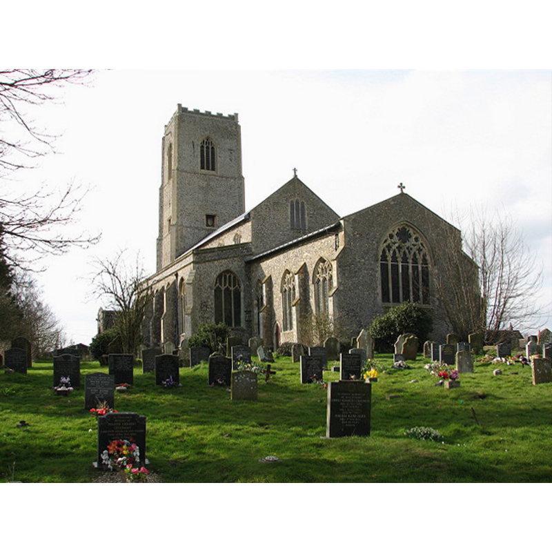
Copyright Statement: Image copyright © Evelyn Simak, 2008
Image Source: digital photograph taken 1 March 2008 by Evelyn Simak [www.geograph.org.uk/photo/710266] [accessed 14 March 2013]
Copyright Instructions: CC-BY-SA-3.0
view of church interior - nave - looking east
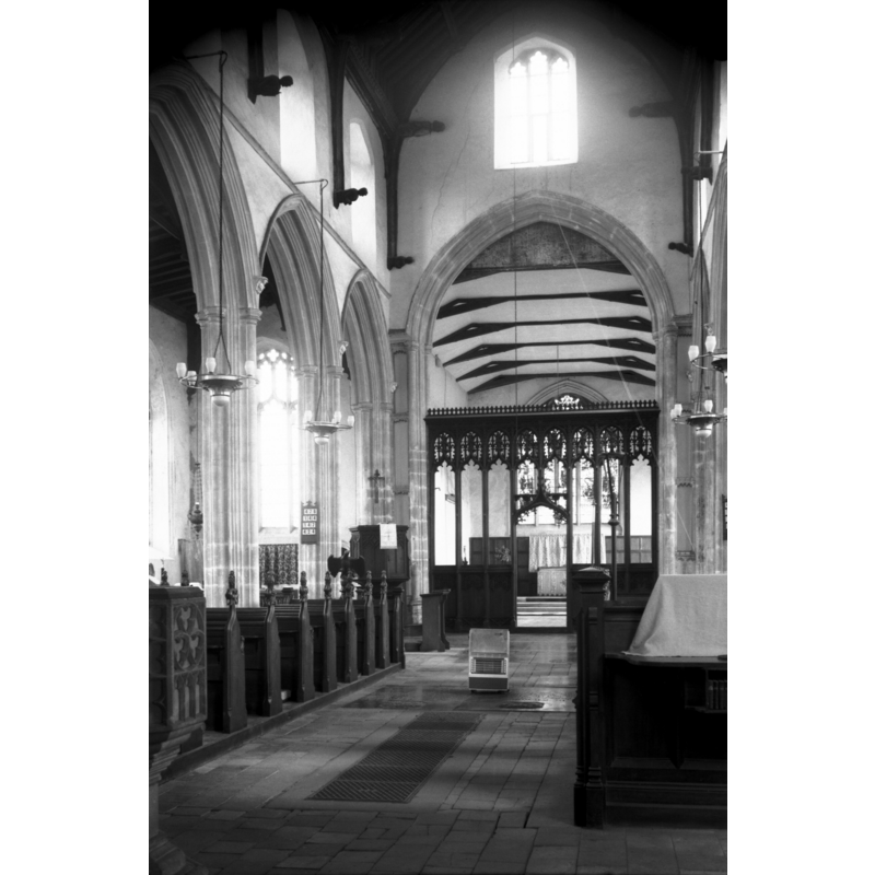
Scene Description: Photo caption: "15c arcade and screen"
Copyright Statement: Image copyright © George Plunkett, 2014
Image Source: B&W photograph taken 31 May 1976 by George Plunkett [www.georgeplunkett.co.uk/Norfolk/C/Carbrooke Ss Peter and Paul church int east [5535] 1976-05-31.jpg] [accessed 24 June 2014]
Copyright Instructions: Standing permission by Jonathan Plunkett
view of church interior - nave - looking west
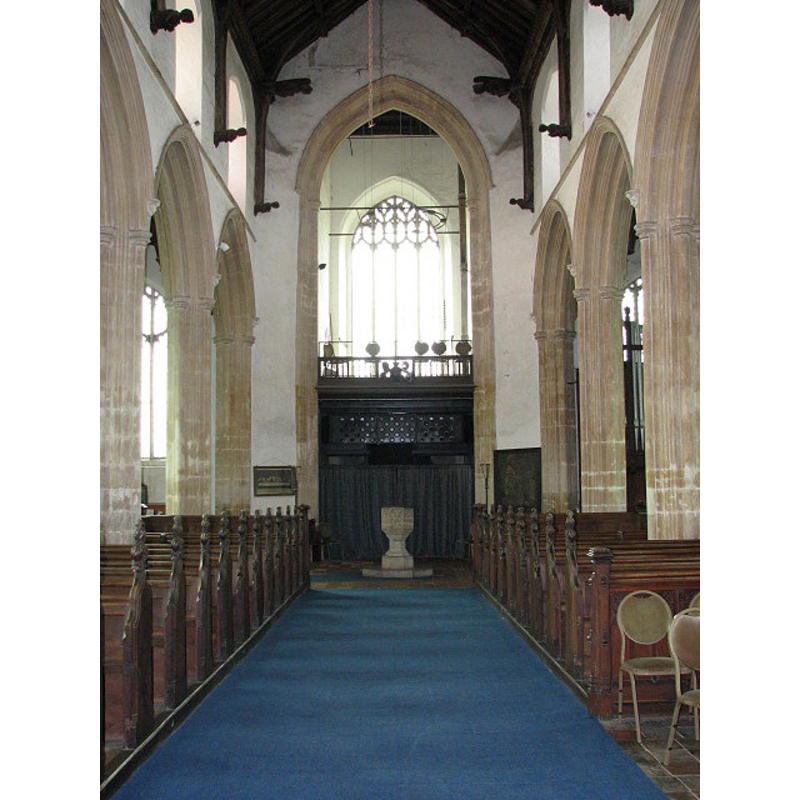
Scene Description: the font beneath the tower arch
Copyright Statement: Image copyright © Evelyn Simak, 2008
Image Source: digital photograph taken 1 March 2008 by Evelyn Simak [www.geograph.org.uk/photo/710305] [accessed 14 March 2013]
Copyright Instructions: CC-BY-SA-3.0
view of church interior - nave - looking east
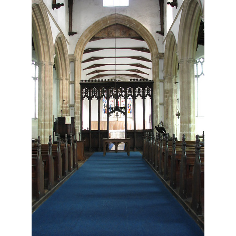
Copyright Statement: Image copyright © Evelyn Simak, 2008
Image Source: digital photograph taken 1 March 2008 by Evelyn Simak [www.geograph.org.uk/photo/710287] [accessed 14 March 2013]
Copyright Instructions: CC-BY-SA-3.0
INFORMATION
Font ID: 06352CAR
Object Type: Baptismal Font1, base only
Font Century and Period/Style: 14th century, Decorated
Church / Chapel Name: Parish Church of St. Peter and St. Paul
Font Location in Church: Inside the church, at the W end of the nave
Church Patron Saint(s): St. Peter & St. Paul
Church Address: Church Street, Carbrooke, Norfolk IP25 6SW
Site Location: Norfolk, East Anglia, England, United Kingdom
Directions to Site: Located about 4 km NE of Watton
Ecclesiastic Region: Diocese of Norwich
Historical Region: Hundred of Wayland
Additional Comments: lost or missing font?: only the base remains -- Knott's image of the font in context (at the W end of the nave) is too small and dark for detail
Font Notes:
Click to view
Blomefield (1805-1810) writes: "The church itself is dedicated to St. Peter and Paul, and so was the high altar [...] The Church is a regular pile, rebuilt about the beginning of Henry the Sixth's reign; it consists of a nave, two isles, two porches, and chancel, which are all covered with lead; there is a lofty square tower at the west-end, and in it are five good bells." Blomefield (ibid.) names "Peter Drury, brother" as first recorded rector, in 1332. Blomefield (ibid.) cites the Domesday entry for 'Cherebroc', with mention of a church with twentythree acres of land in it [="i. ecclesia, xxiiii. acr."] A font here is described in Tyrrell-Green (1928) as the surviving base of an old baptismal font from this church. Pevsner & Wilson (1999) note: Octagonal, with a variety of C14 tracery patterns." [NB: no mention of its composite nature? Or, was Tyrrell-Green writing of an earlier font's base? -- the present church goes back to the 13th century, and there was a church here by 1086].
COORDINATES
UTM: 31U 356085 5827971
Latitude & Longitude (Decimal): 52.58271, 0.87584
Latitude & Longitude (DMS): 52° 34′ 57.76″ N, 0° 52′ 33.02″ E
MEDIUM AND MEASUREMENTS
Material: stone
Number of Pieces: [basin missing]
Font Shape: octagonal, mounted
Basin Interior Shape: round
Basin Exterior Shape: octagonal
REFERENCES
- Blomefield, Francis, An essay towards a topographical history of Norfolk, 1805-1810, vol. 2: 334-343 / [www.british-history.ac.uk/report.aspx?compid=78076] [accessed 14 March 2013]
- Pevsner, Nikolaus, Norfolk 2: North-West and South (2nd ed.), London: Penguin, 1999, p. 239
- Tyrrell-Green, E., Baptismal Fonts Classified and Illustrated, London: Society for Promoting Christian Knowledge: The Macmillan Co., 1928, p. 40