Ysbyty Ystwyth / Y Spytty Ystwyth / Yspytty Ystwyth [disappeared?]
![Main image for Ysbyty Ystwyth / Y Spytty Ystwyth / Yspytty Ystwyth [disappeared?]](/static-50478a99ec6f36a15d6234548c59f63da52304e5/compressed/1200122012_compressed.png)
Image copyright © Llywelyn2000, 2017
CC-BY-SA-4.0
Results: 2 records
view of church exterior - north view
Scene Description: "The new church was constructed in 1872-1876 [...] Fittings include a High Victorian circular font" [COFLEIN [cf. FontNotes]
Copyright Statement: Image copyright © Llywelyn2000, 2017
Image Source: digital photograph taken 12 August 2017 by Llywelyn2000 [https://commons.wikimedia.org/wiki/File:Eglwys_Fach_Sant_Ioan_Fedyddiwr,_St_John_the_Baptist_Church,_Ysbyty_Ystwyth,_Wales_26.jpg] [accessed 22 January 2020]
Copyright Instructions: CC-BY-SA-4.0
view of church exterior in context - southwest view
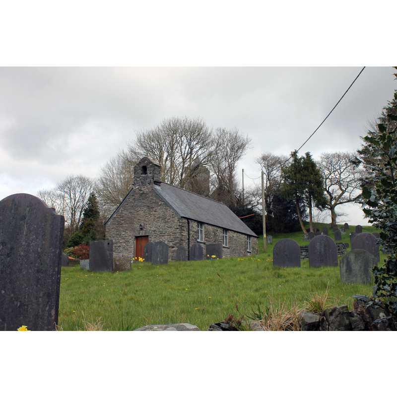
Scene Description: the old church in the centre of the image; the new church can be partially seen behind it
Copyright Statement: Image copyright © Llywelyn2000, 2017
Image Source: digital photograph taken 12 August 2017 by Llywelyn2000 [https://commons.wikimedia.org/wiki/File:Eglwys_Fach_Sant_Ioan_Fedyddiwr,_St_John_the_Baptist_Church,_Ysbyty_Ystwyth,_Wales_01.jpg] [accessed 22 January 2020]
Copyright Instructions: CC-BY-SA-4.0
INFORMATION
Font ID: 06342YSB
Object Type: Baptismal Font1?
Font Century and Period/Style: Medieval
Church / Chapel Name: Old Church of St. John the Baptist / Eglwys Fach Sant Ioan Fedyddiwr [now a church hall]
Font Location in Church: [cf. FontNotes]
Church Patron Saint(s): St. John the Baptist
Church Address: Ysbyty Ystwyth, Ystrad Meurig SY25 6DY, UK -- Tel.: +44 1974 262623
Site Location: Ceredigion, Wales, United Kingdom
Directions to Site: Located off (E) the B4343, 10-12 km NE of Tregaron, 20-22 km ESE of Aberystwyth
Ecclesiastic Region: Diocese of St Davids
Historical Region: Hundred og Ilar -- formerly Cardiganshire
Additional Comments: missing / lost font: only the stem remains (not clear whether the 'column' was originally meant to be part of a font; its inscription was probably a later addition) -- disappeared font? (the one from the medieval church here)
Font Notes:
Click to view
Meyrick (1808) reports: "The font, which is an octangular pillar excavated, and probably once the support of a bason, has inscribed on it, D.C. 1747". Lewis' Dictionary 1833 does not mention the possible font base noted in Tyrrell-Green (1928) but records one other baptismal (?) object in this church: "the church is supported by octagonal pillars, in one of which is a cavity for the purpose of a font" [NB: Lewis' dictionary editions usually distinguish between fonts and stoups]. The entry for this church in Evans (1914) mentions no font in it. Tyrrell-Green (1928) reports the surviving stem of the base of an old baptismal font from this church. The entry for Old St. John's church in COFLEIN [https://www.coflein.gov.uk/en/site/306344/details/st-john-the-baptists-church-ysbyty-ystwyth] [accessed 22 January 2020] notes: "St John the Baptist's Church (now used as a church hall) [...] was not a parish church during the medieval period, but an upland chapelry belonging to the Deanery of Ultra-Aeron. It is thought to have been a hospice chapel of Stata Florida Abbey. By 1833 Ysbyty Ystwyth was a parish. [...] In 1833 it was described as having a screen dividing the nave (probably a rood screen). At that time the roof was reportedly supported on octagonal pillars, in one of which there was a cavity for a font. The church was rebuilt in the early-mid-nineteenth century on the same site and in the same location as its predecesssor, but retaining little from its earlier fabric. In 1872-1876 a new church (NPRN 306347), also dedicated to St John the Baptist, was constructed on the same site, but some 50m to the south-west. The former church became derelict, but was repaired and used as a school room from the early 1920s to the 1990s. After that time it reverted to church use." The entry for New St. John's church in COFLEIN [https://www.coflein.gov.uk/en/site/306347/details/st-john-the-baptists-new-church-ysbyty-ystwyth] [accessed 22 January 2020] notes: "The new church was constructed in 1872-1876 [...] It consists of nave and chancel under a single roof, north-west porch-tower with slate pyramidal roof behind battlements, a lean-to vestry on the south-east, and lancet windows. [...] Fittings include a High Victorian circular font".
COORDINATES
UTM: 30U 441256 5797737
Latitude & Longitude (Decimal): 52.326774, -3.862006
Latitude & Longitude (DMS): 52° 19′ 36.48″ N, 3° 51′ 43.2″ W
REFERENCES
- Lewis, Samuel, A Topographical Dictionary of England, Comprising the Several Counties, Cities, Boroughs, Corporate and Market Towns, Parishes, Chapelries, and Townships, and the Islands of Guernsy, Jersey, and Man, with Historical and Statistical Descriptions [...], London: S. Lewis, 1831, [www.british-history.ac.uk/report.asp?compid=47892] [accessed 23 December 2006]
- Meyrick, Samuel Rush, The History and Antiquities of the County of Cardigan [...], London: Longman, Hurst, Rees, and Orme, 1808, p. 317
- Tyrrell-Green, E., Baptismal Fonts Classified and Illustrated, London: Society for Promoting Christian Knowledge: The Macmillan Co., 1928, p. 40