Stanton St. John / Stantone
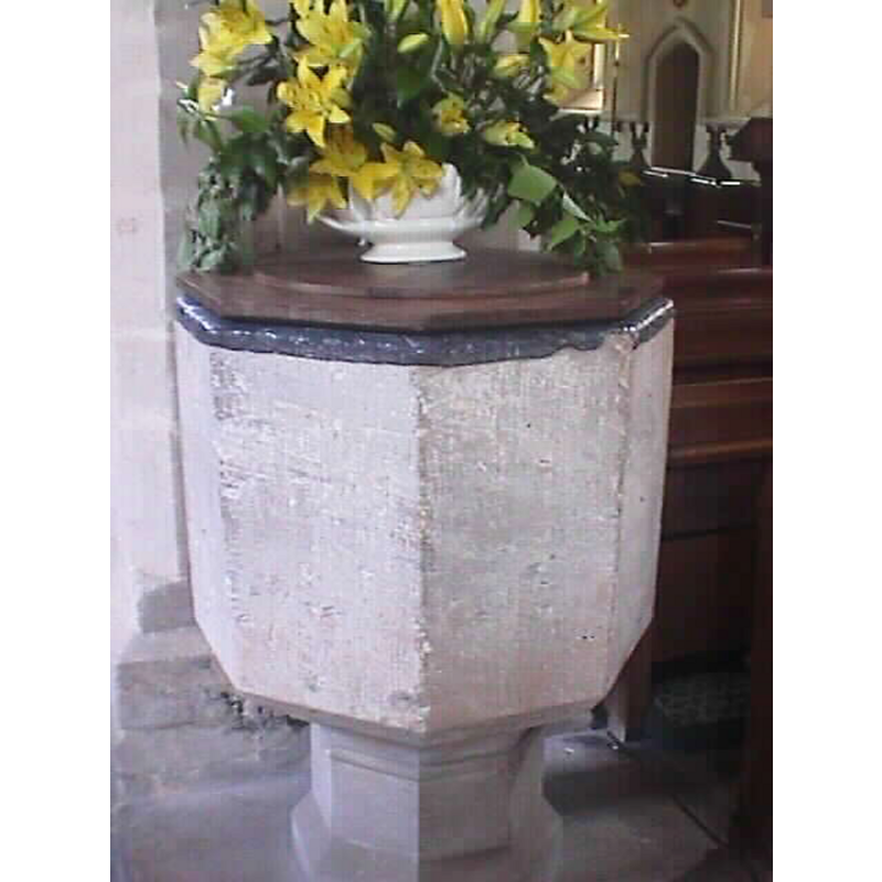
Image copyright © John Wilkes, 2006
Standing permission
Results: 2 records
view of font and cover
Copyright Statement: Image copyright © John Wilkes, 2006
Image Source: digital photograph taken by John Wilkes in June 2006
Copyright Instructions: Standing permission
view of church exterior - south view
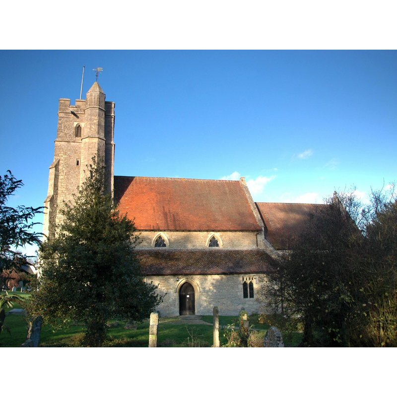
Copyright Statement: Image copyright © Motacilla, 2011
Image Source: digital photograph taken 7 December 2011 by Motacilla [http://en.wikipedia.org/wiki/File:StantonStJohn_StJonhBaptist_south.JPG] [accessed 14 June 2012]
Copyright Instructions: CC-BY-SA-3.0
INFORMATION
Font ID: 06316STA
Object Type: Baptismal Font1
Font Century and Period/Style: 14th century [basin only] [composite font], Medieval [composite]
Church / Chapel Name: Parish Church of St. John the Baptist
Font Location in Church: Inside the church, in the nave
Church Patron Saint(s): St. John the Baptist
Church Address: Middle Road, Stanton St. John, Oxfordshire, OX33 1HW
Site Location: Oxfordshire, South East, England, United Kingdom
Directions to Site: Located 7 km ENE of Oxford
Ecclesiastic Region: Diocese of Oxford
Historical Region: Hundred of Headington [in Domesday] -- Hundred of Bullingdon
Additional Comments: altered font (the present font: new base provided) -- disappeared font? (the one from the ca. 1135-1150 church here)
Font Notes:
Click to view
There are three entries for this Stanton [St John] [variant spelling] in the Domesday survey [http://opendomesday.org/place/SP5709/stanton-st-john/] [accessed 5 December 2016], none of which mention cleric or church in it. The Guide to the Architectural Antiquities in the Neighbourhood of Oxford (1846) notes: "The Font is octagonal, quite plain, and remarkably low, standing on the ground without any steps". This description no longer matches the font as, sometime after the mid-19th century an octagonal pedestal base was provided for the old basin. The Victoria County History (Oxford, vol. 5, 1957) notes: "Between 1135 and 1150 John de St. John, then lord of Stanton, granted the parish church to Eynsham Abbey. [...] Of the 12th- and 13th-century building only the north arcade has survived. [...] The font is of plain octagonal form"; the VCH plan of the church interior shows the font located on the west side of the second pillar of the north arcade. Noted in Sherwood & Pevsner (1974): "Font. Octagonal and plain. C14?" [NB: we have no information on the font from the earlier church here].
Credit and Acknowledgements: We are grateful to John Wilkes, of www.allthecotswolds.com, for his photograph of this font.
COORDINATES
UTM: 30U 626634 5738156
Latitude & Longitude (Decimal): 51.779934, -1.164302
Latitude & Longitude (DMS): 51° 46′ 47.76″ N, 1° 9′ 51.49″ W
MEDIUM AND MEASUREMENTS
Material: stone
Font Shape: octagonal, mounted
Basin Interior Shape: round
Basin Exterior Shape: octagonal
LID INFORMATION
Date: 19th-20th century?
Material: wood
Apparatus: no
Notes: wooden, octagonal and practically flat
REFERENCES
- Victoria County History [online], University of London, 1993-. URL: https://www.british-history.ac.uk.
- Oxford Society for Promoting the Study of Gothic Architecture, Guide to the Architectural Antiquities in the Neighbourhood of Oxford, A, Oxford: John Henry Parker [for the Society], 1846, p. 229
- Pevsner, Nikolaus, Oxfordshire, Harmondsworth: Penguin Books, 1974, p. 785